Old aerial photographs and today in Saga Prefecture
Select a marker on the map to check the old aerial photograph of that location right there.
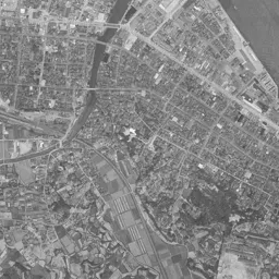
Photographs by era
- 1961-1969: Karatsu Station Area
- 1974-1978: Karatsu Station Area
Station areas in this prefecture that became most built up (top 10)
Ranked by how much the share of built-up area within 500 m of each station grew from 1976 to 2021. The national ranking is in Station areas that became most built up in 45 years.
Urban area share (top: 1976, bottom: 2021)
- 1 Watada StationJR Kyushu Chikuhi Line
- 2 Keyakidai StationJR Kyushu Kagoshima Line
- 2 Nabeshima StationJR Kyushu Nagasaki Line
- 4 Tateno StationAmagi Railway Amagi Line
- 5 Kiyama StationAmagi Railway Amagi Line / JR Kyushu Kagoshima Line
- 6 Yayoigaoka StationJR Kyushu Kagoshima Line
- 7 Hizen-Asahi StationJR Kyushu Kagoshima Line
- 8 Shin-Tosu StationJR Kyushu Nagasaki Line / JR Kyushu Kyushu Shinkansen
- 8 Nishi-Arita StationMatsuura Railway Nishi-Kyushu Line
- 10 Higashi-Karatsu StationJR Kyushu Chikuhi Line
Source: processed from National Land Numerical Information (Land Use Subdivision Mesh / Railway Data / Administrative Boundaries / Ministry of Land, Infrastructure, Transport and Tourism) / Photographs: GSI Tiles (aerial photographs by era / latest nationwide photographs)
See old and today's aerial photographs anywhere in Saga Prefecture on the map