Karatsu Station Area about 60 years ago and today
Then and now
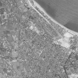
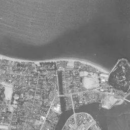
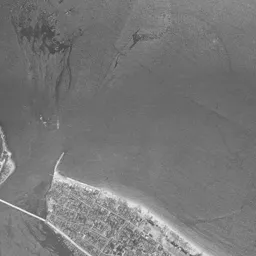
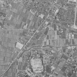
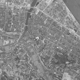
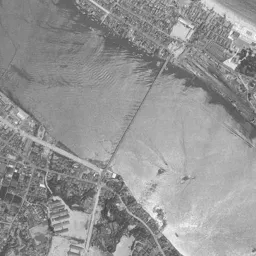
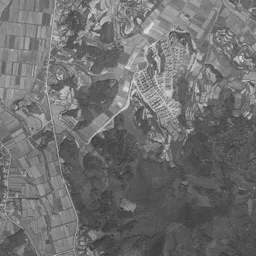
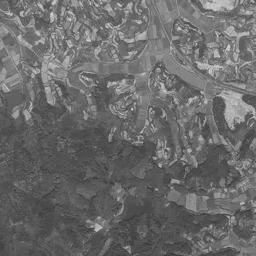
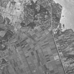
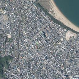
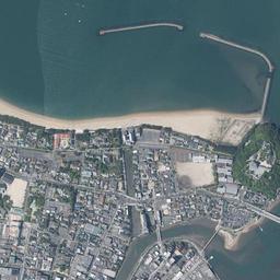
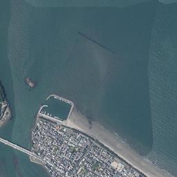
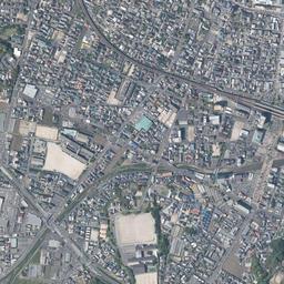
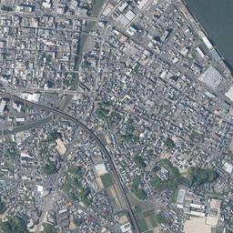
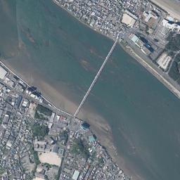
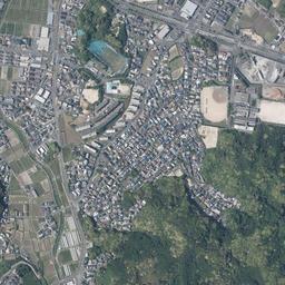
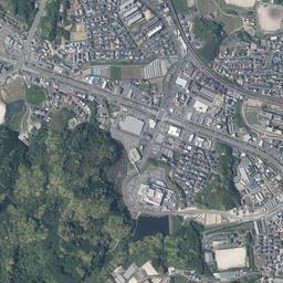
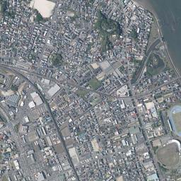
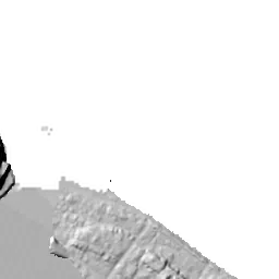


Center photograph taken: 1964-69
What to compare in this era: At the top of the frame, a black cape juts out into the river mouth, and a long, narrow bridge crosses to the east. In today's photograph too, the outline of the cape and the position of the bridge have hardly changed
Controls: drag to move / right-drag to rotate and tilt / scroll while holding ⌘ or Ctrl to zoomControls: slide with two fingers to move / pinch to zoom / drag two fingers up or down to tilt
Note: the 3D elevation data is based on current surveys, not on the terrain at the time of the photograph. Elevation tiles: processed from GSI Tiles
The 3D view could not be loaded. Check your connection and try again.
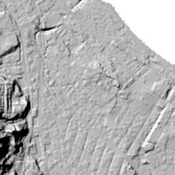
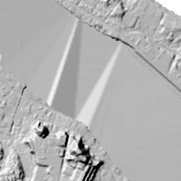
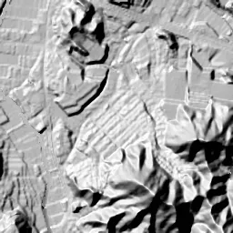
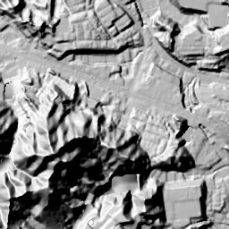
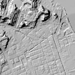
Note: the terrain shading is based on current surveys, not on the terrain at the time of the photograph. Hillshade map: processed from GSI Tiles
Note: the map is today's, not a map from the time of the photograph. Map: © OpenStreetMap contributors
Source: processed from GSI Tiles (aerial photographs by era / latest nationwide photographs / single photographs)
Explore this area on the mapMove the map to compare the surroundings then and now as well.
Overlay and compare the 1961-1969 aerial photograph and today's photograph of the Karatsu Station Area area, Saga Prefecture. All photographs are published by the Geospatial Information Authority of Japan (GSI).
Eras of photographs for this location
For the Karatsu Station Area area, aerial photographs from the following eras can be compared.
The old photographs of this location cover 2 eras from 1961-1969 to 1974-1978; as of 2026, the newest photograph, 1974-1978, is 48-52 years ago.There are no photographs of this location from after that until today. The differences between eras are summarized in the guide to aerial photograph eras.
Coverage for each era differs by region. Only the eras that actually have photographs of this location are listed here.
Elevation of this location
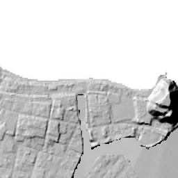
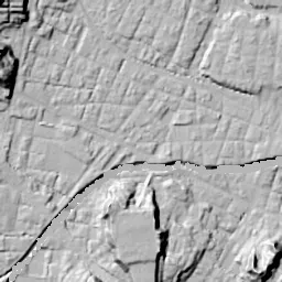
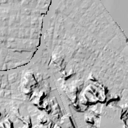
The elevation (above sea level) near Karatsu Station is 9.4 m (source: GSI elevation API). Elevation profiles running east-west and north-south through this location are also shown.
Profile positions (vertical green line = north-south / horizontal blue line = east-west)
Elevation is the value at the ground surface (even where a station is underground or elevated, the value is for the ground surface). Elevation is only one factor in disaster preparedness. Check actual risks such as flooding on the Hazard Map Portal Site and the hazard maps published by local governments.
Elevation tiles for the profiles: processed from GSI Tiles
Access by rail
Karatsu Station is served by the following lines.
- JR Kyushu Chikuhi Line
- JR Kyushu Karatsu Line
Source of line information: processed from National Land Numerical Information (Railway Data / Ministry of Land, Infrastructure, Transport and Tourism).
Change seen in the share of built-up area
This compares land use in 1976 and 2021. The share of built-up area within 500 m changed from 93% to 99%. Among the locations on this site, the spread of built-up area here is on the small side (bottom 20-40%). The bar below shows where this location falls in the distribution across the locations on this site.
Source: processed from National Land Numerical Information (Land Use Subdivision Mesh / 1976 and 2021 / Ministry of Land, Infrastructure, Transport and Tourism). The texture value (amount of fine detail) of the photographs changed from 12.5 to 35.9. This is a mechanical comparison between photographs and includes differences from the shooting season and from black and white versus color, so treat it only as a rough guide.
Official land prices over time
The official land price (Chika Koji) standard site nearest to this location is "4-570-108 Machida, Karatsu, Saga Prefecture" (about 741 m in a straight line; use: Residential). The official prices per square meter at this standard site from 1998 to 2026 are shown below. The 2026 official price is 51,700 yen.
View as a table
| Year | Official price |
|---|---|
| 1998 | 67,000 yen |
| 1999 | 67,500 yen |
| 2000 | 67,500 yen |
| 2001 | 67,500 yen |
| 2002 | 67,100 yen |
| 2003 | 66,600 yen |
| 2004 | 65,400 yen |
| 2005 | 64,100 yen |
| 2006 | 62,500 yen |
| 2007 | 61,400 yen |
| 2008 | 60,300 yen |
| 2009 | 59,000 yen |
| 2010 | 56,900 yen |
| 2011 | 54,300 yen |
| 2012 | 51,800 yen |
| 2013 | 49,900 yen |
| 2014 | 48,100 yen |
| 2015 | 47,100 yen |
| 2016 | 46,400 yen |
| 2017 | 46,200 yen |
| 2018 | 46,300 yen |
| 2019 | 46,300 yen |
| 2020 | 45,900 yen |
| 2021 | 46,000 yen |
| 2022 | 46,800 yen |
| 2023 | 47,700 yen |
| 2024 | 49,000 yen |
| 2025 | 50,300 yen |
| 2026 | 51,700 yen |
Source: processed from National Land Numerical Information (Land Price Publication Data / Ministry of Land, Infrastructure, Transport and Tourism). Official land prices are values published for standard sites as of January 1 each year and do not show the transaction price of any particular piece of land. The selection and location of standard sites may be reviewed from year to year.
Nearby locations
Sorted by distance from Karatsu Station Area. Comparing them together shows how the same area has changed over time.
Select a marker on the map to see the location name and a link to it.
Locations with the same origins
Towns in the same category as Karatsu Station Area (Redevelopment), chosen from other regions. You can compare what they share in land use and town layout.
Select a marker on the map to see the location name and a link to it.
Recently viewed towns
This history is saved only on your device and is not sent to any server. Depending on your browser settings, it may be deleted automatically if you do not visit for a while (it is less likely to be deleted if you use the site as an app).
Why not look at how another town has changed?
History of Karatsu Station Area
Karatsu Station stands at the southern edge of the castle town, about 1.2 km southwest of the cape at the river mouth where the castle stands. At the top of the aerial photograph, the white sandy beach of the Genkai Sea and a green cape jutting out at the mouth of the Matsuura River line up side by side, and that cape is the castle hill of Karatsu Castle. In the middle of the frame, rows of houses continuing from the castle town are packed together, and the station is at the southern end of those rows of houses. At the bottom, the urban area changes into hills and fields. From north to south, the uses of the land overlap like bands in the order castle, town, station, hills, and that is the framework of this picture.
A castle built on the cape at the river mouth
According to materials from the City of Karatsu, Karatsu Castle was built over seven years from 1602 by Terasawa Hirotaka, a retainer of Toyotomi Hideyoshi. Because the pine groves extending east and west look like a crane spreading both wings, it has the alternative name Maizuru Castle (the name means dancing crane). When the castle was first built there was no main keep, and in 1966 a main keep was built as a cultural and tourist facility. After the Terasawa clan, the lords of the castle were the Okubo, Matsudaira, Doi, Mizuno and Ogasawara clans in turn.
In the photograph, the cape faces both the sea to the north and the Matsuura River to the east, and to the west a sandy beach extends in an arc. From the opposite bank too, a long, narrow beach extends east, and with the cape at the center the two beaches take a shape opening to the left and right. The pine groves themselves continue beyond the frame, but the part at the base of the two wings that the name Maizuru refers to can be confirmed at the top of this frame. The rows of houses of the castle town spread south from the base of the cape and continue without a break up to just before the station. As the city notes that you can look out over the Matsuura River and the castle town from the castle's observation deck, the castle and the town are close enough to fit in a single view. Karatsu took city status in 1932.
Traces of the castle remain in place names as well. The city hall is located in Nishi-Jonai (jonai means inside the castle), and the names Kita-Jonai and Higashi-Jonai also appear in the histories of the city's facilities. The divisions from the time when the area at the base of the cape was the inside of the castle continue to be used as the names of addresses. Of the rows of houses spreading south from the cape toward the top of the photograph, the part near the cape corresponds to these Jonai districts.
Between the river mouth and the hills
In the black-and-white 1961-69 photograph, the cape juts out into the river mouth as a black mass covered in trees, and a single long, narrow bridge crosses to the opposite bank to the east. To the west of the cape, an arc of white sandy beach continues to the upper left of the frame, and behind the beach rows of houses line up in a band. The mouth of the Matsuura River is wide enough to take up the right half of the frame, and shallows show through white on the water. On the opposite bank too, a long, narrow urban area extends along the sea, and beyond it the sandy beach continues to the right edge. At the southern end of the urban area on the opposite bank, there is a corner where many thin lines run in parallel like tracks. In the middle of the river mouth, another long, narrow bridge crosses the water diagonally.
South of the castle, the middle of the frame is taken up by the urban area of the castle town, packed with small roofs with eaves touching. A narrow river flows north through it and empties into the river mouth at the base of the cape. The course of the river divides the urban area north and south as a line of black water. Buildings are packed around the station too, but square fields still remain to the west of the station, and an open space like a sports ground standing out white is conspicuous. South of the station, fields and woods intertwine as if threading along the foot of the hills, and most of the bottom of the frame is dark green mountains and terraced farmland. In the lower right, along the river mouth, fields with regular lots spread out flat.
In the 1974-78 photograph the sea appears pale green, and off the river mouth muddy brown water spreads in a band. The castle's cape, the bridge to the east and the arc of sandy beach to the west are in the same positions as in the previous era. The change is in the area south of the station: a corner of the hill just to the south has become white, flat graded land, and new buildings begin to line up around it. House roofs have also increased in the fields in the lower left, and the lots of fields that remained west of the station are gradually shrinking. Among this, the open space like a sports ground west of the station remains as a white square and serves as a marker for the changes around it. The flat fields in the lower right still keep their large lots in this era. The corner of parallel lines on the opposite bank appears reddish brown, and the two bridges crossing the river mouth are also seen in the same places as in the previous era.
Rows of houses continuing from the castle town to the station
The shape of the castle's cape and the river mouth and the arc of sandy beach to the west have hardly changed in today's photograph from the old eras. The white square open space facing the beach at the western base of the cape has also continued to appear in the same place since 1961-69. The differences are in the details at the water's edge. Several new breakwaters line up off the beach, and an enclosure like a small boat basin has been added at the tip of the opposite bank. South of the station, the graded land of 1974-78 has been filled with houses and roads, and the fields in the lower left have also been almost entirely replaced by rows of houses. Only the green of the mountains at the bottom of the frame keeps the same outline as in the old eras. The corner of parallel lines at the southern end of the opposite bank has disappeared, and large buildings and parking lots line up in its place.
The tracks through the station enter it in an arc from the upper left of the frame, exit to the southeast and descend between the hills. As of 2026 Karatsu Station is an elevated station, and the tracks pass through the urban area lifted above the ground. The buildings around the station line up long and narrow along the tracks, and the station building and the buildings on both sides of it look like a single band.
There are also differences in how the town is built north and south of the station. On the castle town side, small roofs are finely packed, and narrow streets cross densely. On the former graded land south of the station, buildings on large lots and squares that look like school sports grounds are mixed in. The town to the north, whose shape was fixed in the age of the castle, and the town that appeared as graded land on the hill southeast of the station in the 1970s photograph sit side by side in one frame with the station between them.
In Machida 4-chome, about 741 m from the station, there is an observation point for official land prices (Chika Koji) of residential land. The highest value in the record up to the 2026 publication is 67,500 yen per square meter in 1999, 2000 and 2001. From there, years of decline continued, and the lowest value up to the 2026 publication was 45,900 yen in 2020. After that, up to the 2026 publication, a movement of slight increases every year continued.
Within this area, the flat land at the river mouth and along the sea is low in elevation. For expected flooding and storm surges, the material for judgment is not the photographs but the City of Karatsu's hazard map.