Iwakuni Station Area about 60 years ago and today
Then and now
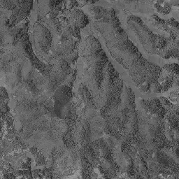
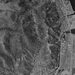
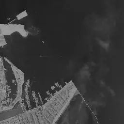
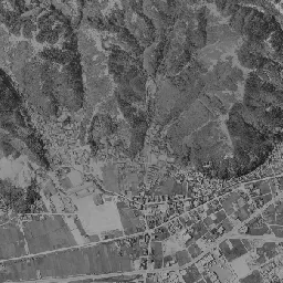
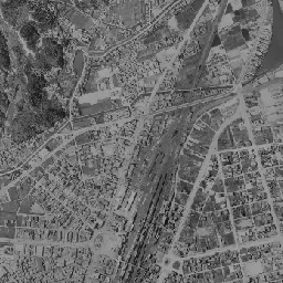
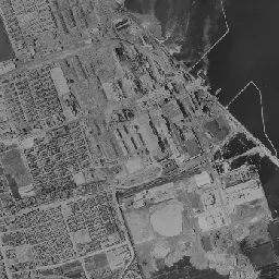
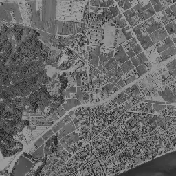
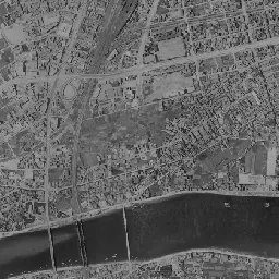
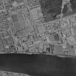
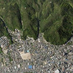
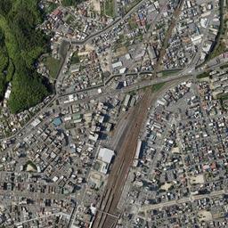
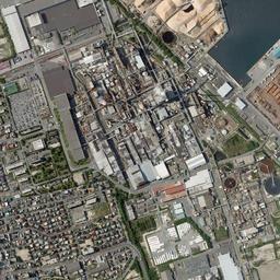
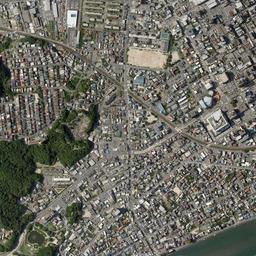
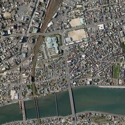
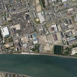


Center photograph taken: 1961-67
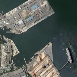
What to compare in this era: At the port at the upper right of the frame, small boats line up inside the breakwaters. The place where orange and white mounds are later piled is still water
Controls: drag to move / right-drag to rotate and tilt / scroll while holding ⌘ or Ctrl to zoomControls: slide with two fingers to move / pinch to zoom / drag two fingers up or down to tilt
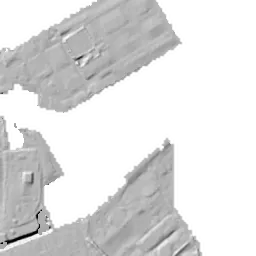
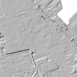
Note: the 3D elevation data is based on current surveys, not on the terrain at the time of the photograph. Elevation tiles: processed from GSI Tiles
The 3D view could not be loaded. Check your connection and try again.
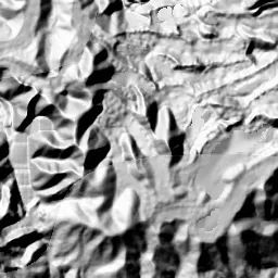
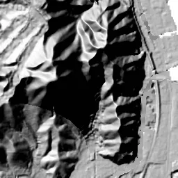
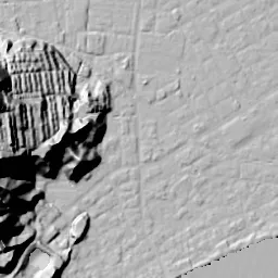
Note: the terrain shading is based on current surveys, not on the terrain at the time of the photograph. Hillshade map: processed from GSI Tiles
Note: the map is today's, not a map from the time of the photograph. Map: © OpenStreetMap contributors
Source: processed from GSI Tiles (aerial photographs by era / latest nationwide photographs / single photographs)
Explore this area on the mapMove the map to compare the surroundings then and now as well.
Overlay and compare the 1961-1969 aerial photograph and today's photograph of the Iwakuni Station Area area, Yamaguchi Prefecture. All photographs are published by the Geospatial Information Authority of Japan (GSI).
Eras of photographs for this location
For the Iwakuni Station Area area, aerial photographs from the following eras can be compared.
The old photographs of this location cover 3 eras from 1961-1969 to 1979-1983; as of 2026, the newest photograph, 1979-1983, is 45 years ago.There are no photographs of this location from after that until today. The differences between eras are summarized in the guide to aerial photograph eras.
Coverage for each era differs by region. Only the eras that actually have photographs of this location are listed here.
Elevation of this location
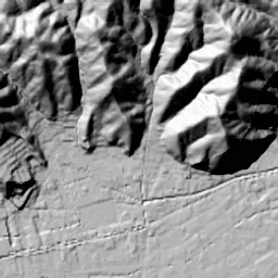
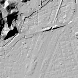
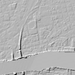
The elevation (above sea level) near Iwakuni Station is 1.1 m (source: GSI elevation API). Elevation profiles running east-west and north-south through this location are also shown.
Profile positions (vertical green line = north-south / horizontal blue line = east-west)
Elevation is the value at the ground surface (even where a station is underground or elevated, the value is for the ground surface). Elevation is only one factor in disaster preparedness. Check actual risks such as flooding on the Hazard Map Portal Site and the hazard maps published by local governments.
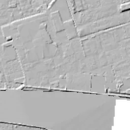
Elevation tiles for the profiles: processed from GSI Tiles
Access by rail
Iwakuni Station is served by the following lines.
- JR West Gantoku Line
- JR West Sanyo Line
Source of line information: processed from National Land Numerical Information (Railway Data / Ministry of Land, Infrastructure, Transport and Tourism).
Change seen in the share of built-up area
This compares land use in 1976 and 2021. The share of built-up area within 500 m changed from 79% to 97%. Among the locations on this site, the spread of built-up area here is in the middle. The bar below shows where this location falls in the distribution across the locations on this site.
Source: processed from National Land Numerical Information (Land Use Subdivision Mesh / 1976 and 2021 / Ministry of Land, Infrastructure, Transport and Tourism). The texture value (amount of fine detail) of the photographs changed from 15 to 42.1. This is a mechanical comparison between photographs and includes differences from the shooting season and from black and white versus color, so treat it only as a rough guide.
Official land prices over time
The official land price (Chika Koji) standard site nearest to this location is "2-15-12 Showa-machi, Iwakuni, Yamaguchi Prefecture" (about 610 m in a straight line; use: Residential). The official prices per square meter at this standard site from 2015 to 2026 are shown below. The 2026 official price is 62,200 yen.
View as a table
| Year | Official price |
|---|---|
| 2015 | 53,300 yen |
| 2016 | 53,300 yen |
| 2017 | 53,300 yen |
| 2018 | 53,600 yen |
| 2019 | 54,200 yen |
| 2020 | 55,000 yen |
| 2021 | 55,700 yen |
| 2022 | 56,800 yen |
| 2023 | 58,100 yen |
| 2024 | 59,400 yen |
| 2025 | 60,800 yen |
| 2026 | 62,200 yen |
Source: processed from National Land Numerical Information (Land Price Publication Data / Ministry of Land, Infrastructure, Transport and Tourism). Official land prices are values published for standard sites as of January 1 each year and do not show the transaction price of any particular piece of land. The selection and location of standard sites may be reviewed from year to year.
Nearby locations
Sorted by distance from Iwakuni Station Area. Comparing them together shows how the same area has changed over time.
Select a marker on the map to see the location name and a link to it.
Locations with the same origins
Towns in the same category as Iwakuni Station Area (Redevelopment), chosen from other regions. You can compare what they share in land use and town layout.
Select a marker on the map to see the location name and a link to it.
Recently viewed towns
This history is saved only on your device and is not sent to any server. Depending on your browser settings, it may be deleted automatically if you do not visit for a while (it is less likely to be deleted if you use the site as an app).
Why not look at how another town has changed?
History of Iwakuni Station Area
Iwakuni Station on the Sanyo Line is set on the plain spreading at the mouth of the Nishiki River. Mountains press close west of the station, and going east you soon come out on the shore of the Seto Inland Sea. The center of the aerial photographs is the station; the fan of tracks runs through the frame from north to south, east of it is the grid of the downtown, and farther on, by the sea, a port and a group of factories appear. The composition in which the station, the town and the factories are packed in order onto the narrow flat land between the mountains and the sea barely breaks down as the eras advance.
A reclaimed plain and the name of the station
According to the publications of the City of Iwakuni, the Iwakuni Domain of the Edo period put generations of effort into land reclamation by drainage, and by around the time of the Meiji Restoration it had built reclaimed land reaching 15 square kilometers across the whole river mouth. From the Meiji era on, various factories were placed in the waterfront area, and the town's character as a town of industry grew stronger. The district around the station is called Marifu, and the city's materials position it as the central urban area. There was a time when this place name was also carved into the name of the station. According to the cultural property commentary of the Iwakuni City Board of Education, in 1942 Marifu Station was renamed Iwakuni Station, and the station on the Gantoku Line that had until then been called Iwakuni Station became Nishi-Iwakuni Station. This means that the name Iwakuni moved to the Marifu station at that time.
The ground around the station is at a height barely different from sea level in whichever direction you go, north, south, east or west. Including the western edge where the foot of the mountains begins, the flat land in the photographs is one continuous stretch of low land. If you open the City of Iwakuni's hazard map, you can see how far water is assumed to reach on the plain made by reclamation.
The fan of tracks and the grid
In the 1961-69 photograph, the station yard runs diagonally through the center of the frame from north-northeast to south-southwest, and many tracks bundle together and swell into a spindle shape. A downtown divided into squares by straight streets spreads east of the yard, with the grain of roofs finely packed. At the northern end of the yard, the tracks gather into one and pass north through the narrow gap between the mountains and the sea. The west side has thin rows of houses, and lots that look like paddy fields remain in the middle left. The upper left of the frame is mountains carved by valleys, with many ridge lines extending toward the plain. A port surrounded by breakwaters lies in the sea at the upper right, with small boats lined up along the shore. The frame from the middle right downward is an area mixing the large roofs of factories, wide ground showing as a white oval, and black rectangular lots. A river lies along the bottom edge of the frame, crossed by several bridges.
The shore at the upper right has greatly changed its form by 1974-78. New square reclaimed land juts out, and several orange and white mounds are piled on it. A long, narrow landing pier sticks out into the sea. You cannot tell from the photographs alone what is in the piles, but from the arrangement, with colors divided lot by lot, it can be read as a storage place for raw materials or products. In the factory lots, buildings with red roofs line up, and at the lower right a corner of rectangles with fine stripes appears. On the mountainside in the middle left, a slope with brown bare earth exposed stands out. In the downtown east of the station vacant land has decreased, and every corner of the grid has filled with buildings. West of the station, several white square vacant lots that look like school sports grounds are dotted about, and rows of houses are beginning to fill in around them.
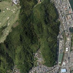
In the 1979-83 photograph, the tracks in the station yard appear reddish brown, and the shape of the fan becomes even clearer. The mounds on the port's reclaimed land have spread further, and the border between the orange and white colors is sharply divided. Off the landing pier, several white dots of small boats float. The striped corner at the lower right and the arrangement of the factories' large roofs have barely changed since 1974-78. The brown of the mountainside on the left is beginning to return to green, and the rows of houses west of the station reach the foot of the mountains.
The waterfront factories and the new station
The City of Iwakuni's materials name Teijin, Nippon Paper Industries, Union Oil Industry, Mitsui Chemicals and others as this waterfront group of factories. The group of large roofs lining the right side of the frame and the piles at the port appear to be a corner of that waterfront factory zone. The city's statement that factories were placed in the waterfront area from the Meiji era on matches the large roofs already lined up on the right side of the 1961-69 photograph.
The station itself was used for a long time as an old building. According to the mayor's press conference, the old station building was built in 1948, and besides its aging, the tracks dividing the east and west of the station and hindering passage between them were seen as problems. The city concluded a construction agreement with JR West in March 2014, began construction in November 2015, and from the first train on November 26, 2017, an east-west free passage crossing over the tracks and a station building above the tracks came into use. The free passage is 6 m wide, with elevators and escalators on both the east and west sides. According to the city's explanation, the project cost of the free passage and the station building above the tracks combined is about 6.44 billion yen. In place of the station building used since 1948, it became a station that links passage between east and west above the tracks.
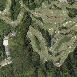
It is only in today's photograph that a large white roof is added around the station. Even so, the shape of the fan of tracks has barely changed since 1961-69. The downtown east of the station keeps the same grid of streets, with buildings with large roofs and vacant lots lined with cars slipping in here and there. At the foot of the mountains to the west, rows of houses reach the bottom of the slopes, and almost no open space remains on the flat land. At the port at the upper right, color-coded mounds line up regularly on the reclaimed land, and a large ship is moored alongside the end of the landing pier. On the ridges of the mountains at the upper left, in places that were forest up to 1979-83, several long, narrow strips of bright green turf wind in rows; the land has been prepared with ponds and looks like a golf course. The bridges over the river at the bottom edge of the frame look more numerous than in 1961-69.
At the residential land in Showa-machi 2-chome, where the official standard site is, the cheapest price per square meter up to the 2026 official land prices (Chika Koji) is 53,300 yen in 2015, 2016 and 2017, and the highest is 62,200 yen in 2026. From 2018 on, the value has risen little by little every year.