Sendai Station East Exit about 60 years ago and today
Then and now
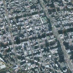
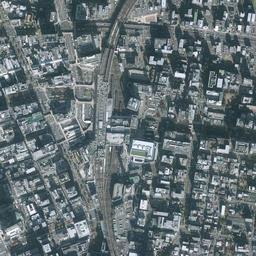
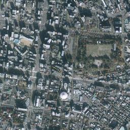
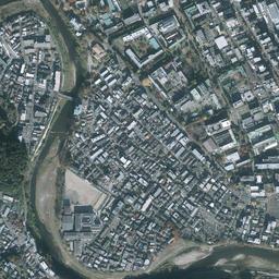
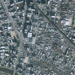


Center photograph taken: 1961-68
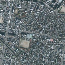
What to compare in this era: Look at the single street cutting diagonally through the right side of the tracks and the fine roofs around it. In today's photograph the same area has changed into a grid of straight lines
Controls: drag to move / right-drag to rotate and tilt / scroll while holding ⌘ or Ctrl to zoomControls: slide with two fingers to move / pinch to zoom / drag two fingers up or down to tilt
Note: the 3D elevation data is based on current surveys, not on the terrain at the time of the photograph. Elevation tiles: processed from GSI Tiles
The 3D view could not be loaded. Check your connection and try again.
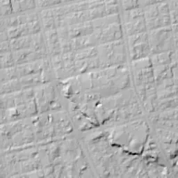
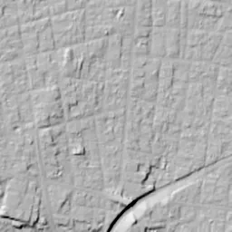
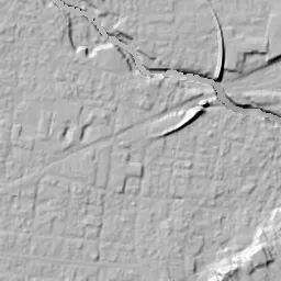
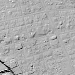
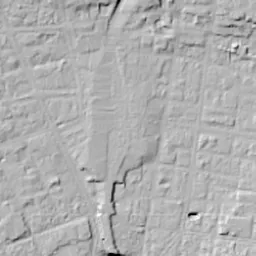
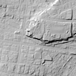
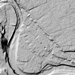
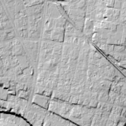
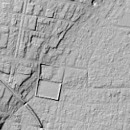
Note: the terrain shading is based on current surveys, not on the terrain at the time of the photograph. Hillshade map: processed from GSI Tiles
Note: the map is today's, not a map from the time of the photograph. Map: © OpenStreetMap contributors
Source: processed from GSI Tiles (aerial photographs by era / latest nationwide photographs / single photographs)
Explore this area on the mapMove the map to compare the surroundings then and now as well.
Overlay and compare the 1961-1969 aerial photograph and today's photograph of the Sendai Station East Exit area, Miyagi Prefecture. All photographs are published by the Geospatial Information Authority of Japan (GSI).
Eras of photographs for this location
For the Sendai Station East Exit area, aerial photographs from the following eras can be compared.
The old photographs of this location cover 4 eras from 1945-1950 to 1984-1986; as of 2026, the newest photograph, 1984-1986, is 42 years ago.There are no photographs of this location from after that until today. The differences between eras are summarized in the guide to aerial photograph eras.
Coverage for each era differs by region. Only the eras that actually have photographs of this location are listed here.
Elevation of this location
The elevation (above sea level) near Sendai Station is 35.5 m (source: GSI elevation API). Elevation profiles running east-west and north-south through this location are also shown.
Profile positions (vertical green line = north-south / horizontal blue line = east-west)
Elevation is the value at the ground surface (even where a station is underground or elevated, the value is for the ground surface). Elevation is only one factor in disaster preparedness. Check actual risks such as flooding on the Hazard Map Portal Site and the hazard maps published by local governments.
Elevation tiles for the profiles: processed from GSI Tiles
Access by rail
Sendai Station is served by the following lines.
- Sendai Subway Namboku Line
- JR East Senzan Line
- JR East Senseki Line
- JR East Tohoku Shinkansen
- JR East Tohoku Line
- Sendai Subway Tozai Line
Source of line information: processed from National Land Numerical Information (Railway Data / Ministry of Land, Infrastructure, Transport and Tourism).
Change seen in the share of built-up area
This compares land use in 1976 and 2021. The share of built-up area within 500 m changed from 92% to 99%. Among the locations on this site, the spread of built-up area here is on the small side (bottom 20-40%). The bar below shows where this location falls in the distribution across the locations on this site.
Source: processed from National Land Numerical Information (Land Use Subdivision Mesh / 1976 and 2021 / Ministry of Land, Infrastructure, Transport and Tourism). The texture value (amount of fine detail) of the photographs changed from 17 to 42.7. This is a mechanical comparison between photographs and includes differences from the shooting season and from black and white versus color, so treat it only as a rough guide.
Official land prices over time
The official land price (Chika Koji) standard site nearest to this location is "102-16 Odawara Yuminomachi, Miyagino Ward, Sendai, Miyagi Prefecture" (about 987 m in a straight line; use: Residential). The official prices per square meter at this standard site from 2017 to 2026 are shown below. The 2026 official price is 669,000 yen.
View as a table
| Year | Official price |
|---|---|
| 2017 | 280,000 yen |
| 2018 | 303,000 yen |
| 2019 | 348,000 yen |
| 2020 | 400,000 yen |
| 2021 | 410,000 yen |
| 2022 | 433,000 yen |
| 2023 | 475,000 yen |
| 2024 | 532,000 yen |
| 2025 | 597,000 yen |
| 2026 | 669,000 yen |
Source: processed from National Land Numerical Information (Land Price Publication Data / Ministry of Land, Infrastructure, Transport and Tourism). Official land prices are values published for standard sites as of January 1 each year and do not show the transaction price of any particular piece of land. The selection and location of standard sites may be reviewed from year to year.
Nearby locations
Sorted by distance from Sendai Station East Exit. Comparing them together shows how the same area has changed over time.
Select a marker on the map to see the location name and a link to it.
Locations with the same origins
Towns in the same category as Sendai Station East Exit (Redevelopment), chosen from other regions. You can compare what they share in land use and town layout.
Select a marker on the map to see the location name and a link to it.
Articles that feature this location
Recently viewed towns
This history is saved only on your device and is not sent to any server. Depending on your browser settings, it may be deleted automatically if you do not visit for a while (it is less likely to be deleted if you use the site as an app).
Why not look at how another town has changed?
History of Sendai Station East Exit
The east exit of Sendai Station, placed on the back side of the tracks while keeping the lot layout of the castle town, was rebuilt from its streets up by two land readjustment projects. The center west of the station burned in the air raid of 1945 and gained wide streets in the postwar reconstruction project. On the east side across the tracks, the long, narrow plots and narrow streets inherited from the lot layout of the castle town remained as they were. The difference in texture between east and west with the station as the boundary catches the eye first in the 1945-50 photograph, and in the later eras the fine pattern of roofs on the east side is replaced by large blocks.
East and west with the tracks as the boundary
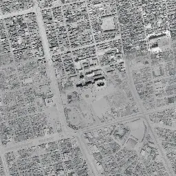
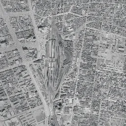
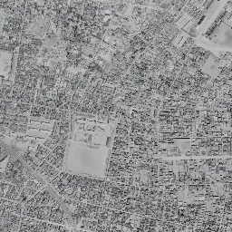
In the 1945-50 photograph, the tracks of the station yard run vertically through the center of the frame, opening like a fan. To their left, the middle of the west side is whitish overall, the shadows of buildings are sparse, and only the lines of the streets stand out. The records of the City of Sendai state that the center of the city burned down completely in the Sendai air raid of 1945 and that the damaged houses reached about 12,000. In one corner at the upper left, several large buildings remain, and grid streets run around them. On the right side of the tracks, by contrast, small roofs are packed without gaps and sink into gray, and the streets are narrow and bend. In the middle on the right there is a wide lot surrounded on all four sides by long, narrow buildings. In the lower left, the Hirose River shows a white riverbed and curves widely, and from the south of the station another line branches off diagonally toward the lower right. Toward the top of the frame, a bright haze, as if light had wrapped around, lies diagonally.
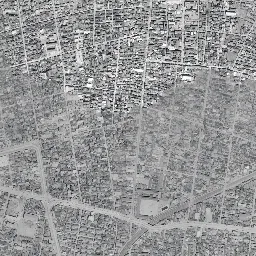
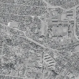
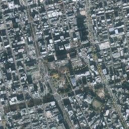
The rebuilding of the burned west side was fast. In 1947 the City of Sendai approved a war damage reconstruction land readjustment project, covering 291.1 hectares. In the 1961-69 photograph the west side is fully built up, and several wide, straight streets run vertically and horizontally. The area east of the tracks, on the other hand, is the same sea of fine roofs as in the previous era, and the narrowness of the streets has not changed either. A single street cuts diagonally through the middle of the east side from the upper left to the lower right, and beyond it, toward the lower right, there is a corner where long, narrow buildings line up in parallel. In the lot in the middle on the right, an oval sports ground and rows of buildings can be seen, and in the upper right a black pond peeks out. The reversal, in which the burned west side gained a new grid while the east of the tracks kept its old form, shows most clearly in this era.
Strip-shaped plots and narrow streets
The City of Sendai describes the district spreading northeast of the station, as it was before the project began, as follows. Commercial and business land was mixed with housing, there were many narrow, strip-shaped residential plots derived from the lot layout of the castle town, and there were also many back plots that did not face a street. There were two main streets running east-west through the district, but both were about 7 m wide and one-way. The share of the district's area taken by roads was only 9.32%.
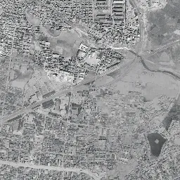
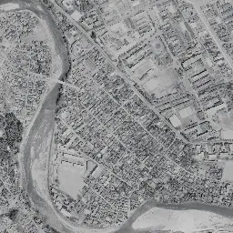
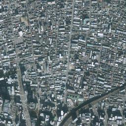
The rebuilding starts from the side closest to the station. In August 1973, the Sendai Station East No. 1 Land Readjustment Project was approved for 55.8 hectares on the east side of the station. The 1974-78 photograph is in color, and on the west side the rooftops of large buildings shine white, so the street grid looks even bolder. In the station yard the bundle of tracks is gathered narrowly, and the line heading to the upper right also extends diagonally as a wide band. The lot in the middle on the right keeps the expanse of its sports ground, surrounded by buildings with white roofs. In the lower left a green band continues along the bank of the Hirose River, with buildings packed on the inner side of the river. Even so, the fineness of the roofs on the east side is almost unchanged from 1961-69, and the traces of the project do not yet appear in the frame.
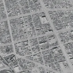
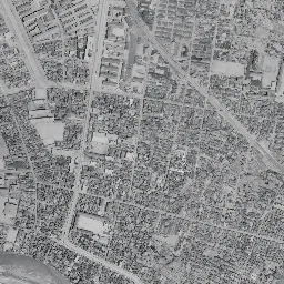
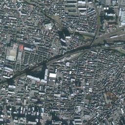
When the Tohoku Shinkansen opened between Morioka Station and Omiya Station in 1982, the composition of the photograph itself changed. The 1984-86 photograph shows a thick black arc of elevated structure passing from the upper right through the station to the lower right. Right beside the east side of the station a green square plaza and a building a size larger appear, and the center of the lot in the middle on the right has become pale-colored open ground. Large masses also begin to mix here and there into the pattern of roofs on the east side. The street grid on the west side keeps the same lines as in 1961-69, and the change is only above the tracks and on the east side.
Roads more than tripled
The 45.3 hectares northeast of the station received project approval as the Sendai Station East No. 2 Land Readjustment Project on April 1, 1988. The implementing body was the City of Sendai, and the area is bounded by National Route 45 on the north, Tsutsujigaoka Park on the east, the Tohoku Main Line on the west, and the already completed East No. 1 district on the south. The houses that had to be moved numbered 1,068. The East No. 1 district reached replotting disposition in 1991 and the East No. 2 district in 2015. In the land use after readjustment shown by the city, the roads of the East No. 2 district grew in length from 5,510 m to 10,147 m, and their share of the area became 31.96%. The share of roads more than tripled, and parks also increased from one to ten. The axis was the Motoderakoji-Fukumuro Line, which runs about 1 km through the district and is 40 m to 46.5 m wide. In a district that had been linked east-west by two one-way streets 7 m wide, a single road with the width of a main avenue was put through. The planned population was set at 4,980.
The rebuilding of the east exit is not a story closed within these two districts alone. On the Wakabayashi Ward side, the land readjustment of the Shinterakoji district, approved in 1960, went ahead and had completed its replotting disposition in 1984. As a purpose of East No. 2, the City of Sendai states that the "Sendai Station East area", taken together with East No. 1 and Shinterakoji, should have the functions of a single unified city. The town east of the tracks replaced the skeleton of its streets decades after the war damage reconstruction, by adding one project after another.
If you switch to today's photograph, the east side of the tracks is packed with large buildings just like the west side, and the streets align in straight vertical and horizontal lines. In the area that fine gray roofs filled in 1961-69, places that keep that pattern are hardly to be seen. The arc of the Shinkansen traces the same line as in 1984-86, and in the middle on the right a green square park spreads out. Its position suggests that it corresponds to Tsutsujigaoka Park, given as the eastern edge of the project area. The square sports ground in the lower right of the frame has been in the same place from 1945-50 to today. The Hirose River curving in the lower left has not changed its form either, apart from the whiteness of its riverbed. Only the east side of the station replaced the pattern of the ground through the four eras.