Rakusai New Town about 60 years ago and today
Then and now
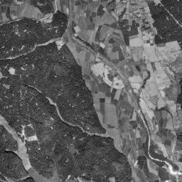
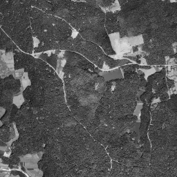
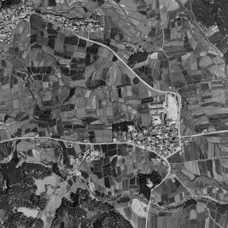
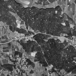
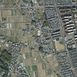
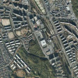
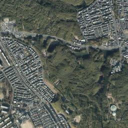
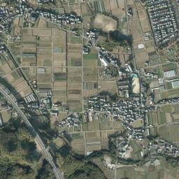
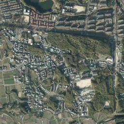
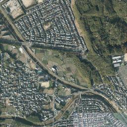


Center photograph taken:
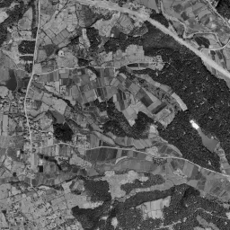
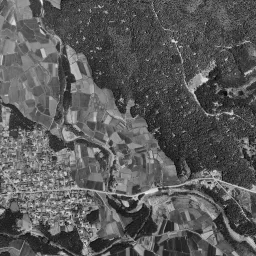
What to compare in this era: Follow the dense woods covering the right half of the frame and the valleys branching like limbs inside them. Bright, long, narrow farmland enters only the valley bottoms.
Controls: drag to move / right-drag to rotate and tilt / scroll while holding ⌘ or Ctrl to zoomControls: slide with two fingers to move / pinch to zoom / drag two fingers up or down to tilt
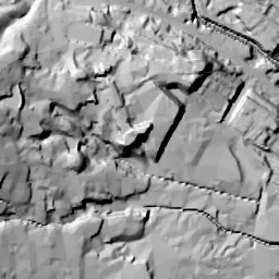
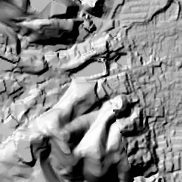
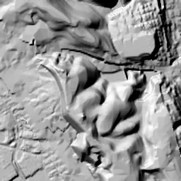
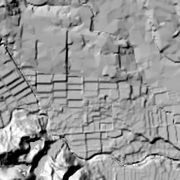
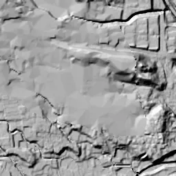
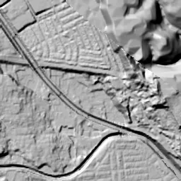
This 3D terrain is today's. The mismatch when you overlay an old photograph is the evidence of the land development that cut hills and filled valleys.
Note: the 3D elevation data is based on current surveys, not on the terrain at the time of the photograph. Elevation tiles: processed from GSI Tiles
The 3D view could not be loaded. Check your connection and try again.
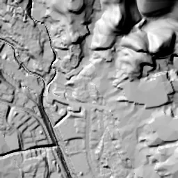
Note: the terrain shading is based on current surveys, not on the terrain at the time of the photograph. Hillshade map: processed from GSI Tiles
Note: the map is today's, not a map from the time of the photograph. Map: © OpenStreetMap contributors
Source: processed from GSI Tiles (aerial photographs by era / latest nationwide photographs / single photographs)
Explore this area on the mapMove the map to compare the surroundings then and now as well.
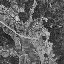
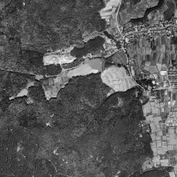
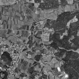
Overlay and compare the 1961-1969 aerial photograph and today's photograph of the Rakusai New Town area, Kyoto Prefecture. All photographs are published by the Geospatial Information Authority of Japan (GSI).
Eras of photographs for this location
For the Rakusai New Town area, aerial photographs from the following eras can be compared.
The old photographs of this location cover 3 eras from 1961-1969 to 1979-1983; as of 2026, the newest photograph, 1979-1983, is 44 years ago.There are no photographs of this location from after that until today. The differences between eras are summarized in the guide to aerial photograph eras.
Coverage for each era differs by region. Only the eras that actually have photographs of this location are listed here.
Elevation of this location
The elevation (above sea level) at the reference point of Rakusai New Town is 62.6 m (source: GSI elevation API). Elevation profiles running east-west and north-south through this location are also shown.
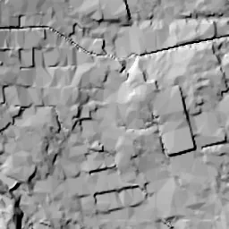
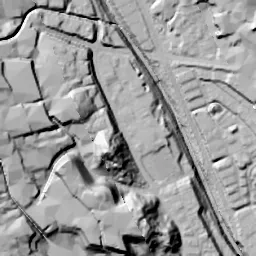
Profile positions (vertical green line = north-south / horizontal blue line = east-west)
Elevation is the value at the ground surface (even where a station is underground or elevated, the value is for the ground surface). Elevation is only one factor in disaster preparedness. Check actual risks such as flooding on the Hazard Map Portal Site and the hazard maps published by local governments.
Elevation tiles for the profiles: processed from GSI Tiles
Access by rail
One of the nearest stations to Rakusai New Town is Katsura Station, served by the following lines.
- Hankyu Kyoto Line
- Hankyu Arashiyama Line
Source of line information: processed from National Land Numerical Information (Railway Data / Ministry of Land, Infrastructure, Transport and Tourism).
Change seen in the share of built-up area
This compares land use in 1976 and 2021. The share of built-up area within 500 m changed from 1% to 58%. Among the locations on this site, the spread of built-up area here is among the largest (top 20%). The bar below shows where this location falls in the distribution across the locations on this site.
Source: processed from National Land Numerical Information (Land Use Subdivision Mesh / 1976 and 2021 / Ministry of Land, Infrastructure, Transport and Tourism). The texture value (amount of fine detail) of the photographs changed from 18.7 to 41. This is a mechanical comparison between photographs and includes differences from the shooting season and from black and white versus color, so treat it only as a rough guide.
Official land prices over time
The official land price (Chika Koji) standard site nearest to this location is "2-11-4 Oe Kitafukunishi-cho, Nishikyo Ward, Kyoto, Kyoto Prefecture" (about 639 m in a straight line; use: Residential). The official prices per square meter at this standard site from 2016 to 2026 are shown below. The 2026 official price is 148,000 yen.
View as a table
| Year | Official price |
|---|---|
| 2016 | 148,000 yen |
| 2017 | 147,000 yen |
| 2018 | 146,000 yen |
| 2019 | 145,000 yen |
| 2020 | 144,000 yen |
| 2021 | 143,000 yen |
| 2022 | 143,000 yen |
| 2023 | 143,000 yen |
| 2024 | 144,000 yen |
| 2025 | 146,000 yen |
| 2026 | 148,000 yen |
Source: processed from National Land Numerical Information (Land Price Publication Data / Ministry of Land, Infrastructure, Transport and Tourism). Official land prices are values published for standard sites as of January 1 each year and do not show the transaction price of any particular piece of land. The selection and location of standard sites may be reviewed from year to year.
Nearby locations
Sorted by distance from Rakusai New Town. Comparing them together shows how the same area has changed over time.
Select a marker on the map to see the location name and a link to it.
Locations with the same origins
Towns in the same category as Rakusai New Town (New town), chosen from other regions. You can compare what they share in land use and town layout.
Select a marker on the map to see the location name and a link to it.
Articles that feature this location
Recently viewed towns
This history is saved only on your device and is not sent to any server. Depending on your browser settings, it may be deleted automatically if you do not visit for a while (it is less likely to be deleted if you use the site as an app).
Why not look at how another town has changed?
History of Rakusai New Town
If you go west through the city area of Kyoto, the flat land suddenly breaks off and runs into the foot of the Nishiyama hills. It is the boundary where the low land made by the Katsura River meets the hills extending south from the mountains to the west. Rakusai New Town sits on the eastern shoulder of those hills. Rakusai is an old way of referring to the west of Kyoto, and the foot of the hills is also land long known for its bamboo groves. The blocks, lined with town names such as Takenosato and Sakaidani, are on platforms made by cutting the tops of the hills and filling the valleys. The railway station is outside the frame, and a wide road runs along the backbone of the town. The reason the city of Kyoto climbed up onto these hills is that no large open space remained on the low-land side. The hills waiting just to the west were the nearest room available.
A hill of woods and valley paddies
The appearance of the hills when they were still hills remains in the 1961-69 aerial photograph. The area from the right half of the frame to the center is almost completely painted over with dense woods, and valleys run through them, branching like limbs. Only the valley bottoms are bright, with farmland divided into long, narrow lots entering deeper and deeper. A little below the center, a long, narrow water surface shines white at the bottom of a valley. It is a pond that received and stored the rain falling on the hills. The valley splits in two in the center of the frame, and narrow farmland continues to the far end of each. No clusters of houses can be seen on the hills, and people's lives were drawn toward the valley bottoms and the foot of the hills. To the left and bottom of the frame, terraced fields and small settlements are scattered along the foot of the hills, and roads descend from there toward the low land. There is not a single straight road, and every road bends to match the direction of the valleys and ridges. The original system of the hills itself appears in this photograph, receiving water in the valleys and distributing it to the farmland at their foot.
Bare ground over the whole hill
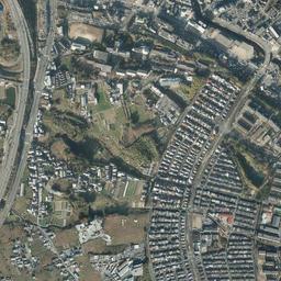
The 1974-78 photograph is so different that it is hard to believe it is the same hill. From the center of the frame to the upper left, the whole area of the hilltops has changed to the color of bright soil, and the hill has become a single sheet of bare ground. The outline of its edge meets the woods sharply, and inside only the lines of streets and the division of lots are drawn. There are still only a handful of buildings, with just a group of small white buildings clustered toward the north. A state in which the streets were drawn first can be seen from above just as it is. Several islands of dark green have been left in the bare ground, which can also be read as woods left uncut on their way to becoming the green of later slopes and parks. Small black water surfaces also remain here and there, and at the southern edge a larger greenish water surface touches the prepared land. The white band running east-west along the southern edge is probably a road laid along with the preparation. The color of the bare ground divides into lighter and darker shades from place to place, and it seems that the cut surfaces and the filled surfaces appear with different brightness. From these shades you can imagine that the work did not advance to the same stage across the whole hill at once. On the left of the frame, lots of paddies and fields and settlements continue unchanged, and in the woods on the right a separate group of houses stands out white.
A hill that became a town
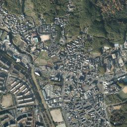
In the 1979-83 photograph, the brightness of the bare ground has disappeared and the blocks are filled in. Residents began moving in in 1976, which means the shape of the town was completed within a few years from then. From north-northwest to south-southeast a wide road runs through the center of the town, and on both sides slab-shaped residential buildings stand in rows. On the north side, detached houses and mid-rise residential buildings alternate along gently curving streets, and in the center a group of buildings with large roofs and a wide, leveled ground are gathered together. In the blocks on the south side, the way residential buildings facing the same direction line up at even intervals can be seen best from above. The water surface at the southern edge of the prepared land remained black. Once you step outside the blocks, woods and fields begin immediately, and you can read at a glance that the edge of the preparation became the boundary of the town. The framework of this town is not a railway but a road. There is no station within the frame, and the wide road running through the center also serves as the town's north-south axis. It is connected with the railway running on the low land below the hills through this road and the roads descending the slope.
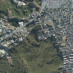
In today's photograph too, the framework is almost the same as in 1979-83, and the amount of green has changed greatly. Rows of trees have grown along the streets, and the spaces between the residential buildings have also been filled with dense green. The water surface at the southern edge is in the same position even as of 2026, and works as a landmark where the pond shows the position of a valley. At the upper left of the frame, the alignment and branches of a wide road have been added, and lots lined with white roofs have increased in the fields to the west. In the woods to the east, blocks of houses are scattered like islands. Outside the blocks, the contrast of fields to the west and woods to the east from 1961-69 remains, and only the inside of the prepared platform is filled with square lots.
A platform that rises to the west
The blocks look flat, but the hill as a whole is tilted. The western measuring point is the highest at 72.4 m, and the east drops to 56.9 m. The center is 62.6 m, and the north and south are almost equal in the 63 m range, so it is almost level in the north-south direction and is a platform tilting one way, descending a little over 15 m from west to east. If you switch to the east-west cross-section graph, this one-way tilt appears as a single line. The flatness of the blocks was made by the preparation, and the original ups and downs of the hill remain rather in the shape of the valleys in the 1961-69 photograph. On slopes that have been cut and filled, rainwater tends to gather along the valleys from before the cutting. The hazard map published by the City of Kyoto shows the assumptions for landslides and flooding, so it is worth checking on the map where the road you use overlaps with the old valleys.
In Oeda Kita-Fukunishi-cho 2-chome there is a residential area with land value records, about 640 m from the location. However, the record begins only in 2016, well after the period when the hill turned into a town. In the official land prices (Chika Koji) up to the 2026 publication, the highest is 148,000 yen per square meter, in both 2016 (the start) and 2026; the lowest is 143,000 yen from 2021 to 2023, and 2025 is 146,000 yen. The difference between the highest and lowest values is 5,000 yen, and the record of about ten years stays within a very narrow range. You cannot follow from this reference point how much value was set around the opening of the town.