Beppu Station Area about 60 years ago and today
Then and now
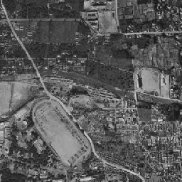
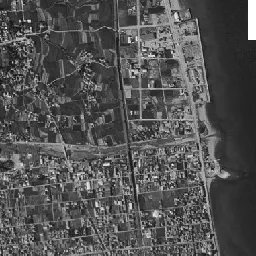

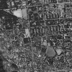
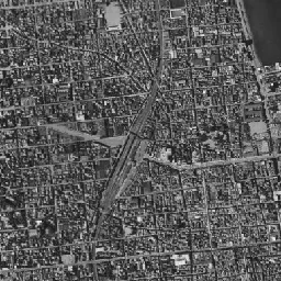
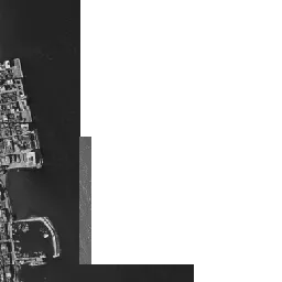
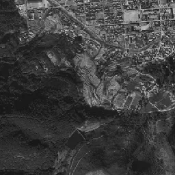
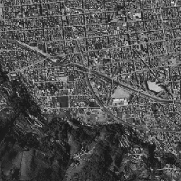
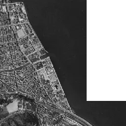
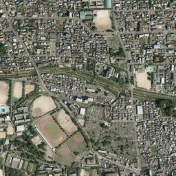
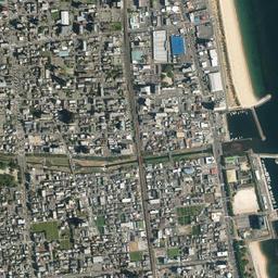

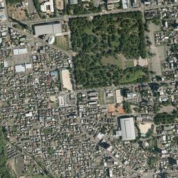
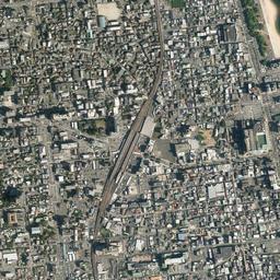
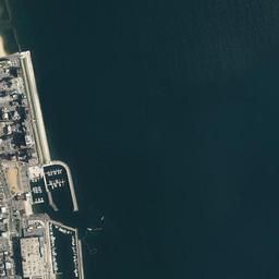
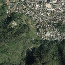
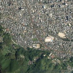
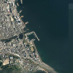
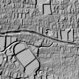
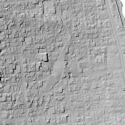


Center photograph taken: 1961-66
What to compare in this era: Around the station in the center, the tracks widen and split. In 1974-78 the tracks come together into a single thin band
Controls: drag to move / right-drag to rotate and tilt / scroll while holding ⌘ or Ctrl to zoomControls: slide with two fingers to move / pinch to zoom / drag two fingers up or down to tilt
Note: the 3D elevation data is based on current surveys, not on the terrain at the time of the photograph. Elevation tiles: processed from GSI Tiles
The 3D view could not be loaded. Check your connection and try again.
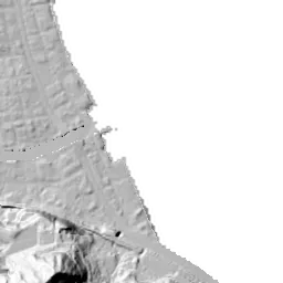
Note: the terrain shading is based on current surveys, not on the terrain at the time of the photograph. Hillshade map: processed from GSI Tiles
Note: the map is today's, not a map from the time of the photograph. Map: © OpenStreetMap contributors
Source: processed from GSI Tiles (aerial photographs by era / aerial photographs by fiscal year / latest nationwide photographs / single photographs / survey periods of the photographs)
Explore this area on the mapMove the map to compare the surroundings then and now as well.
Overlay and compare the 1961-1969 aerial photograph and today's photograph of the Beppu Station Area area, Oita Prefecture. All photographs are published by the Geospatial Information Authority of Japan (GSI).
Eras of photographs for this location
For the Beppu Station Area area, aerial photographs from the following eras can be compared.
The old photographs of this location cover 3 eras from 1961-1969 to FY2007; as of 2026, the newest photograph, FY2007, is 18-19 years ago.There are no photographs of this location from after that until today. The differences between eras are summarized in the guide to aerial photograph eras.
Coverage for each era differs by region. Only the eras that actually have photographs of this location are listed here.
Elevation of this location
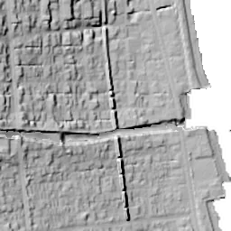
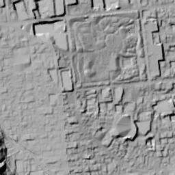
The elevation (above sea level) near Beppu Station is 10.1 m (source: GSI elevation API). Elevation profiles running east-west and north-south through this location are also shown.
Profile positions (vertical green line = north-south / horizontal blue line = east-west)
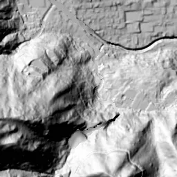
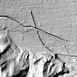
Where the line in a profile breaks off and leaves a gap, no elevation data is available (water surfaces such as the sea or rivers).
Elevation is the value at the ground surface (even where a station is underground or elevated, the value is for the ground surface). Elevation is only one factor in disaster preparedness. Check actual risks such as flooding on the Hazard Map Portal Site and the hazard maps published by local governments.
Elevation tiles for the profiles: processed from GSI Tiles
Access by rail
Beppu Station is served by the following lines.
- JR Kyushu Nippo Line
Source of line information: processed from National Land Numerical Information (Railway Data / Ministry of Land, Infrastructure, Transport and Tourism).
Change seen in the share of built-up area
This compares land use in 1976 and 2021. The share of built-up area within 500 m changed from 96% to 100%. Among the locations on this site, the spread of built-up area here is on the small side (bottom 20-40%). The bar below shows where this location falls in the distribution across the locations on this site.
Source: processed from National Land Numerical Information (Land Use Subdivision Mesh / 1976 and 2021 / Ministry of Land, Infrastructure, Transport and Tourism). The texture value (amount of fine detail) of the photographs changed from 19.4 to 45.6. This is a mechanical comparison between photographs and includes differences from the shooting season and from black and white versus color, so treat it only as a rough guide.
Official land prices over time
The official land price (Chika Koji) standard site nearest to this location is "1-3476-2 Asami, Beppu, Oita Prefecture" (about 980 m in a straight line; use: Residential). The official prices per square meter at this standard site from 1994 to 2026 are shown below. The 2026 official price is 33,600 yen.
View as a table
| Year | Official price |
|---|---|
| 1994 | 62,500 yen |
| 1995 | 62,500 yen |
| 1996 | 62,500 yen |
| 1997 | 62,500 yen |
| 1998 | 62,500 yen |
| 1999 | 62,500 yen |
| 2000 | 62,500 yen |
| 2001 | 62,500 yen |
| 2002 | 61,300 yen |
| 2003 | 60,000 yen |
| 2004 | 57,800 yen |
| 2005 | 52,300 yen |
| 2006 | 48,400 yen |
| 2007 | 43,500 yen |
| 2008 | 42,000 yen |
| 2009 | 40,500 yen |
| 2010 | 38,800 yen |
| 2011 | 37,400 yen |
| 2012 | 36,000 yen |
| 2013 | 34,900 yen |
| 2014 | 34,000 yen |
| 2015 | 33,100 yen |
| 2016 | 32,800 yen |
| 2017 | 32,500 yen |
| 2018 | 32,200 yen |
| 2019 | 32,200 yen |
| 2020 | 32,200 yen |
| 2021 | 32,200 yen |
| 2022 | 32,200 yen |
| 2023 | 32,200 yen |
| 2024 | 32,300 yen |
| 2025 | 32,500 yen |
| 2026 | 33,600 yen |
Source: processed from National Land Numerical Information (Land Price Publication Data / Ministry of Land, Infrastructure, Transport and Tourism). Official land prices are values published for standard sites as of January 1 each year and do not show the transaction price of any particular piece of land. The selection and location of standard sites may be reviewed from year to year.
Nearby locations
Sorted by distance from Beppu Station Area. Comparing them together shows how the same area has changed over time.
Select a marker on the map to see the location name and a link to it.
Locations with the same origins
Towns in the same category as Beppu Station Area (Redevelopment), chosen from other regions. You can compare what they share in land use and town layout.
Select a marker on the map to see the location name and a link to it.
Recently viewed towns
This history is saved only on your device and is not sent to any server. Depending on your browser settings, it may be deleted automatically if you do not visit for a while (it is less likely to be deleted if you use the site as an app).
Why not look at how another town has changed?
History of Beppu Station Area
At the foot of the slope descending from the western mountains to Beppu Bay, the area around Beppu Station opens out as the center of the hot spring town. The station is about halfway down the slope, and walking east for a few hundred meters brings you to Kitahama on the coast. The aerial photographs show the tracks running north-south through the center of the frame, the street heading straight east from the station to the sea, and a shoreline that changes shape from era to era. About the eastern third of the frame is sea; in the 1961-69 photograph the area further offshore is missing in gray, and in the 1974-78 photograph too the right edge is missing in black. This is because the coverage of the photographs ends there, not because there was anything on the sea. Since the ground descends from west to east, the left side toward the mountains and the right side toward the sea differ considerably in height within the same frame.
A spa resort opened by ships
The hot springs of Beppu had long been known, but it was the sea that set the shape of the town. The historical materials compiled by the City of Beppu record that many spa visitors from other provinces came to Beppu Village and Hamawaki Village, which were close to the coast and easy for ships to call at. In 1871 (Meiji 4) the port of Beppu was built and ship services to the Kansai region began, and in 1911 (Meiji 44) the railway's Kamegawa, Beppu and Hamawaki stations opened. It became a town that received both visitors arriving by sea and visitors arriving by land, and the town extended north from Hamawaki. Beppu became a city in 1924 (Taisho 13). After the war, in 1950, the Beppu International Tourist Hot Spring Culture City Construction Act was promulgated, and city building centered on hot springs and tourism gained the backing of law.
The grid-like streets between the station and the coast are the town that spread in this way, filling the space between the port and the station. The street extending east from the station crosses the center of the frame in every era of the photographs as the road connecting the coast where ships arrive with the railway station.
The station and the bowed shore
The 1961-69 photograph is black and white, and fine roofs are packed all over from the center of the frame to the lower half. The tracks run almost north-south from the top edge of the frame to the bottom edge and change direction gently around the center. Before and after the station the tracks widen and split into many lines, and just to the west a white, bright surface like a plaza juts out diagonally. From the east side of the station, a street running straight to the coast passes through as a line brighter than the surrounding roofs.
The coast where the street ends continues north and south in a gentle bow. Right of the center, a long, narrow landing pier juts offshore, and a cluster of buildings huddles at its base. A little to the south there is a small harbor enclosed by a curved breakwater, with dots that look like small boats lined up inside. The upper half of the frame looks different, and rectangles of fields still remain on the east side of the tracks. The northern coast still shines white as a sandy beach, and no straight lines that look like artificial seawalls can be found.
On the left side of the frame, in a corner a little way up the slope, long, narrow buildings of the same shape line up neatly with dark pine woods behind them. A wide surface with an outline close to a pentagon, shaped like a baseball field, lies below them. The lower left corner is darkly covered by mountain woods, and a river course runs diagonally from the foot of the mountains toward the sea. In the upper left, a large oval track and a white rectangular plaza can be seen.
Until the camp became a park again
The rows of buildings on the left were facilities on the grounds of Beppu Park. According to the City of Beppu's park chronology, this area began in 1907 (Meiji 40), when the city bought the land in time for a visit by the Crown Prince and laid it out as a place of recreation. In 1946 (Showa 21) US forces were stationed there, and even after it was returned to Japan in 1957 (Showa 32), it continued to be used as the Self-Defense Forces' Camp Beppu. The neatly lined buildings in the 1961-69 photograph are the camp in that era.
If you switch to the 1974-78 photograph, the rows of buildings on the left remain in almost the same arrangement, and the surface shaped like a baseball field looks pale reddish brown. In 1977 (Showa 52) it was designated a memorial park and was laid out again as Beppu Park. The rows of buildings eventually disappeared. In today's photograph the same place is covered by wide woods, with several buildings with large roofs along their edge. The chronology continues that B-Con Plaza was completed in 1995, Beppu Stadium was demolished in 2001, and the general gymnasium Beppu Arena was completed in 2003. Some of the pines planted around the time of the Meiji-era layout are said to be still alive at more than 100 years old. From rows of buildings to pine woods, the same land changed its use twice in about half a century.
The people's station and the coastal seawall
The station itself also changed form in the 1960s. According to materials of the JR Kyushu Group, Beppu Station was elevated in 1966 as a "people's station" (minshu eki), and commercial facilities were laid out under the elevated tracks for about 1 km. In the 1974-78 photograph, the tracks that had split into many lines before and after the station have come together into a single thin band, and the streets press directly against both sides of it.
The coast also changes greatly. In the 1974-78 photograph, at the position of the landing pier right of the center, a long, straight seawall parallel to the shoreline has been drawn, and a long, narrow strip of land has formed inside it. A straight edge and a small harbor also appear on the northern coast, and the sandy beach that shone white shrinks to a thin band. The fields in the upper half of the frame have almost all been replaced by houses.
In the lower half of the frame, the river course running from the foot of the mountains to the sea and the tracks heading south along the sea pass through the same positions in every era. The mountain woods in the lower left also hardly change their outline, and the filling in of rows of houses is limited to the slope between the foot of the mountains and the coast.
Buildings with large roofs surround the station, and tall buildings stand along the street to the east and on the coastal land; that is the scene in today's photograph. The street extending east from the station still keeps its width and reaches the coast. Outside the straight seawall many small landing piers jut out, and white dots that look like yachts are moored. On the northern coast there is a wide sandy beach drawing an arc, and beside the small harbor to the south a block of large buildings has formed. The coastal land includes parts made by reclamation and seawall work. The flooding maps of the official hazard map show how far water is expected to come in heavy rain or storm surges. The arrangement of the two lines, the street and the tracks, has hardly moved since 1961-69, and only the contents inside them have been replaced.