Hiratsuka (Former Naval Powder Arsenal) about 60 years ago and today
Then and now
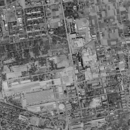
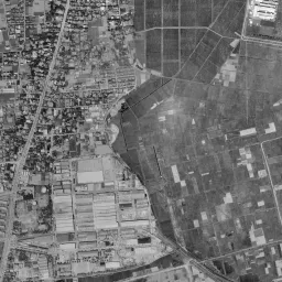
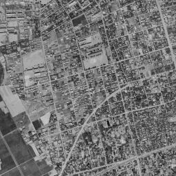
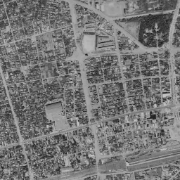
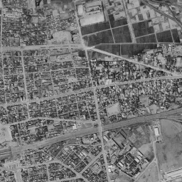
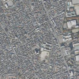
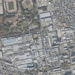
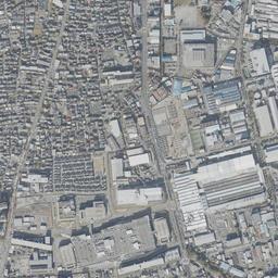
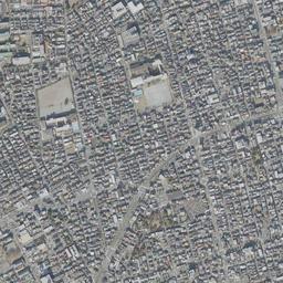


Center photograph taken:
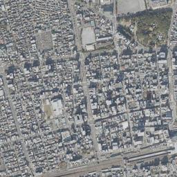
What to compare in this era: Rows of fruit trees that look like black dots lined up lie northwest of the center. In 1987-90, two stadiums have been built in this lot
Controls: drag to move / right-drag to rotate and tilt / scroll while holding ⌘ or Ctrl to zoomControls: slide with two fingers to move / pinch to zoom / drag two fingers up or down to tilt
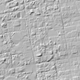
Note: the 3D elevation data is based on current surveys, not on the terrain at the time of the photograph. Elevation tiles: processed from GSI Tiles
The 3D view could not be loaded. Check your connection and try again.
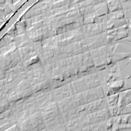
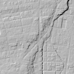
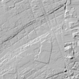
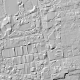
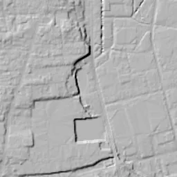
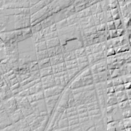
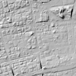
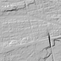
Note: the terrain shading is based on current surveys, not on the terrain at the time of the photograph. Hillshade map: processed from GSI Tiles
Note: the map is today's, not a map from the time of the photograph. Map: © OpenStreetMap contributors
Source: processed from GSI Tiles (aerial photographs by era / aerial photographs by fiscal year / latest nationwide photographs / single photographs / survey periods of the photographs)
Explore this area on the mapMove the map to compare the surroundings then and now as well.
Overlay and compare the 1961-1969 aerial photograph and today's photograph of the Hiratsuka (Former Naval Powder Arsenal) area, Kanagawa Prefecture. All photographs are published by the Geospatial Information Authority of Japan (GSI).
Eras of photographs for this location
For the Hiratsuka (Former Naval Powder Arsenal) area, aerial photographs from the following eras can be compared.
The old photographs of this location cover 5 eras from 1961-1969 to FY2007; as of 2026, the newest photograph, FY2007, is 18-19 years ago.There are no photographs of this location from after that until today. The differences between eras are summarized in the guide to aerial photograph eras.
Coverage for each era differs by region. Only the eras that actually have photographs of this location are listed here.
Elevation of this location
The elevation (above sea level) at the reference point of Hiratsuka (Former Naval Powder Arsenal) is 9.0 m (source: GSI elevation API). Elevation profiles running east-west and north-south through this location are also shown.
Profile positions (vertical green line = north-south / horizontal blue line = east-west)
Elevation is the value at the ground surface (even where a station is underground or elevated, the value is for the ground surface). Elevation is only one factor in disaster preparedness. Check actual risks such as flooding on the Hazard Map Portal Site and the hazard maps published by local governments.
Elevation tiles for the profiles: processed from GSI Tiles
Access by rail
One of the nearest stations to Hiratsuka (Former Naval Powder Arsenal) is Hiratsuka Station, served by the following lines.
- JR East Tokaido Line
Source of line information: processed from National Land Numerical Information (Railway Data / Ministry of Land, Infrastructure, Transport and Tourism).
Change seen in the share of built-up area
This compares land use in 1976 and 2021. The share of built-up area within 500 m changed from 71% to 75%. Among the locations on this site, the spread of built-up area here is on the small side (bottom 20-40%). The bar below shows where this location falls in the distribution across the locations on this site.
Source: processed from National Land Numerical Information (Land Use Subdivision Mesh / 1976 and 2021 / Ministry of Land, Infrastructure, Transport and Tourism). The texture value (amount of fine detail) of the photographs changed from 17 to 34.6. This is a mechanical comparison between photographs and includes differences from the shooting season and from black and white versus color, so treat it only as a rough guide.
Official land prices over time
The official land price (Chika Koji) standard site nearest to this location is "3-782 and adjacent lots, Nishi-Yawata, Hiratsuka, Kanagawa Prefecture" (about 787 m in a straight line; use: Residential). The official prices per square meter at this standard site from 2000 to 2026 are shown below. The 2026 official price is 183,000 yen.
View as a table
| Year | Official price |
|---|---|
| 2000 | 225,000 yen |
| 2001 | 217,000 yen |
| 2002 | 205,000 yen |
| 2003 | 196,000 yen |
| 2004 | 188,000 yen |
| 2005 | 181,000 yen |
| 2006 | 176,000 yen |
| 2007 | 173,000 yen |
| 2008 | 176,000 yen |
| 2009 | 173,000 yen |
| 2010 | 171,000 yen |
| 2011 | 169,000 yen |
| 2012 | 167,000 yen |
| 2013 | 166,000 yen |
| 2014 | 166,000 yen |
| 2015 | 166,000 yen |
| 2016 | 166,000 yen |
| 2017 | 166,000 yen |
| 2018 | 167,000 yen |
| 2019 | 167,000 yen |
| 2020 | 167,000 yen |
| 2021 | 166,000 yen |
| 2022 | 166,000 yen |
| 2023 | 169,000 yen |
| 2024 | 173,000 yen |
| 2025 | 177,000 yen |
| 2026 | 183,000 yen |
Source: processed from National Land Numerical Information (Land Price Publication Data / Ministry of Land, Infrastructure, Transport and Tourism). Official land prices are values published for standard sites as of January 1 each year and do not show the transaction price of any particular piece of land. The selection and location of standard sites may be reviewed from year to year.
Nearby locations
Sorted by distance from Hiratsuka. Comparing them together shows how the same area has changed over time.
Select a marker on the map to see the location name and a link to it.
Locations with the same origins
Towns in the same category as Hiratsuka (Former factory site), chosen from other regions. You can compare what they share in land use and town layout.
Select a marker on the map to see the location name and a link to it.
Articles that feature this location
Recently viewed towns
This history is saved only on your device and is not sent to any server. Depending on your browser settings, it may be deleted automatically if you do not visit for a while (it is less likely to be deleted if you use the site as an app).
Why not look at how another town has changed?
History of Hiratsuka (Former Naval Powder Arsenal)
About 1 km north of Hiratsuka Station, past the downtown in front of the station, there is a corner where a factory with long flat roofs and a large park holding two stadiums sit one above the other. The factory side is land where a gunpowder factory, opened at the end of the Meiji era in partnership with British capital, became the navy's in the 1910s and early 1920s and was taken over after the war by a factory for tires and rubber products. The park to the north was laid out on the site of a fruit tree research station of the former Ministry of Agriculture and Forestry. In the aerial photographs these two lots fit one over the other, north and south, in the middle of the frame, and blocks of a large grain, different both from the packed rows of houses in the station area to the south and from the mosaic of fields remaining to the north, appear in a line from top to bottom.
A gunpowder factory in partnership with Britain
A gunpowder factory was placed on this land in 1905. The Japanese government and three British arms and explosives companies founded Nihon Kayaku Seizo as a joint venture, and bought up state-owned and private land spanning Hiratsuka Town and Ono Village. The head office was placed in London, and a branch was placed in Hiratsuka. The site was 380,000 tsubo (about 1.26 million square meters), later spreading to 420,000 tsubo. The purpose was the manufacture of smokeless powder for naval guns, and engineers were sent from the British companies to supervise the construction of the factory.
The land is flat, falling only slightly from north to south toward the station, and nothing like steps or cliffs can be found in the frame. The site, 380,000 tsubo in size, was also drawn in one continuous piece on this flat ground. The lots of the factory and the surrounding roads are all laid out in straight lines, and the photographs show that this was land where the lines did not need to be bent to fit the terrain.
In 1919 the navy bought the company, and the factory became the Naval Powder Arsenal. The arsenal became a foothold for the many munitions factories that followed it, and at the same time one of the reasons Hiratsuka became a target of air raids. From the night of July 16, 1945 into the early hours of the next day, the city was hit by a large-scale air raid. After the war the arsenal site was sold off to Yokohama Rubber, and in 1952 the first phase of construction of the Hiratsuka Factory was completed and production of belts and large tires began. A wooden one-story Western-style building topped with a single tower, built in the Meiji era as the office of the company's manager, continued to be used as the meeting hall of an officers' fellowship society in the navy era and as a reception room and meeting rooms in the Yokohama Rubber era, and remains as the only Meiji-era Western-style building in the city.
Rows of fruit trees and factory roofs
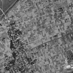
If you look into the middle of the frame in the 1961-69 photograph, the lots are divided into three large parts. Southwest of the center, many long, narrow white factory roofs line up in parallel, and at their eastern end a single small white circle is placed. A lot that looks like black dots lined up regularly spreads northwest of the center. It is a field of trees planted in rows, and this area later changes into a general park as the site of the former fruit tree research station of the Ministry of Agriculture and Forestry. North of the field, low buildings of the same shape line up in many rows, and another group of buildings including tall ones stands on the east side. A single straight road runs north-south through the middle of the lots, dividing the east and west sides. In the upper part of the frame, the squares of paddies and fields are still finely lined up, and in the lower part the downtown in front of the station has completely filled the spaces between its grid streets with houses.
Outside the lots, too, there are things that do not move through the eras. Along a road running diagonally north-northeast on the right side of the frame, houses already continue in a band at the 1961-69 stage, suggesting that it is a route that had long passed through the paddies and fields. Just south of the factory lots, beside a wide road running east-west, a single grove of thick trees appears black and round. Even as the surroundings fill with the city, this grove barely changes shape up to today's photograph.
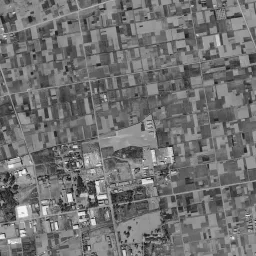
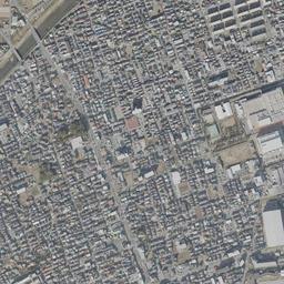
The rows of fruit trees remain northwest of the center as a dark green mass in the 1974-78 photograph too, and the rows of factory roofs and the small white circle are in the same positions. East of the center, toward the right of the frame, a group of factories with white roofs also spreads in area, standing shoulder to shoulder with the factory in the middle. In the upper part of the frame, houses have visibly increased among the fields. The photograph is layered horizontally in bands of different tones at the top and the bottom. On the left side of the frame, several buildings that look like school buildings with square sports grounds can be seen, showing that the city is in the middle of spreading north and west.
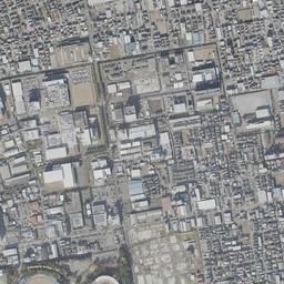
It is in the 1979-83 photograph that the northern part of the fruit tree field is dug up and the outline of an oval rises out of brown bare ground. Construction of the general park began in 1982 to commemorate the 50th anniversary of the city's municipal status, and the photograph falls around that time. West of the bare ground, black woods remain in a band, and the factory roofs and the white circle have not moved.
The factory lots and the park next door
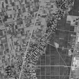
In the 1987-90 photograph, two stadiums have been built where the bare ground was. An athletics stadium with a red track and a fan-shaped baseball stadium line up east and west north of the center, and a park of lawns, paths and woods spreads south of them. The band of black woods that remained west of the bare ground in the 1979-83 photograph was taken as it was into the western edge of the park and became a grove inside the park. The park as a whole was completed in March 1991, and its area is 30.3 hectares. The factory south of the park has barely changed since 1961-69, either in the arrangement of its roofs or in the position of the white circle.
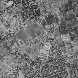
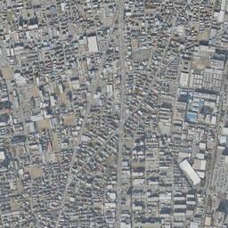
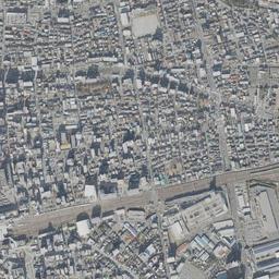
The park's woods have grown into dark green in today's photograph, and the ovals of the stadiums also remain clearly. The factory roofs have turned light gray or light blue, but their arrangement overlaps with the 1961-69 photograph. Yokohama Rubber moved its head office functions from Tokyo to this Hiratsuka Factory in March 2023, and the factory site is about 255,600 square meters. The north-south road also passes in the same position, and the outline of the factory lots has not moved since the 1961-69 photograph. The buildings from the arsenal era cannot be read from the photographs, but the site received in the sale has continued to be used as a single factory without being finely divided.
The downtown on the station side spreads in a grid, and its high density does not change as the eras advance. The factory and the park sit side by side as large surfaces at the border with that downtown, and they appear as the bright expanse in the middle of the frame. At the standard site for residential land placed in Nishi-Yawata 3-chome, in the records up to the 2026 official land prices (Chika Koji), the highest value per square meter is 225,000 yen in 2000, and the cheapest, 166,000 yen, is shared by 2013 to 2017 and by 2021 and 2022.