Sagamihara (US Army Depot) about 60 years ago and today
Then and now
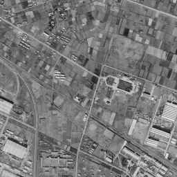
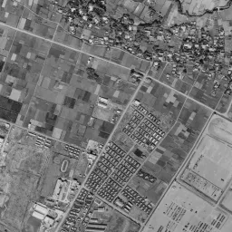
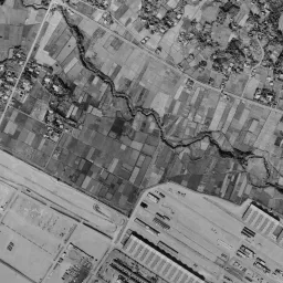
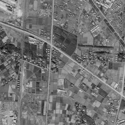
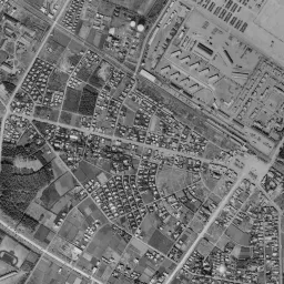
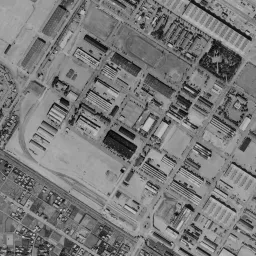
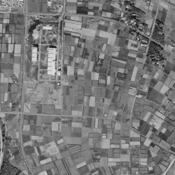
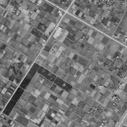
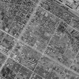
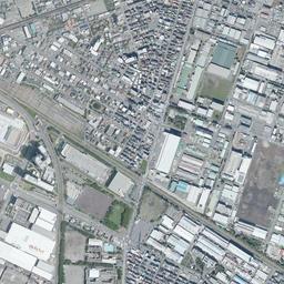
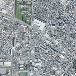
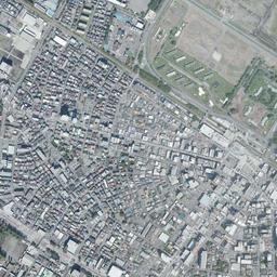
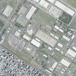
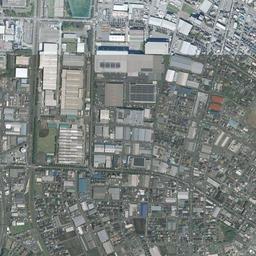
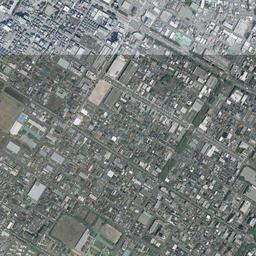
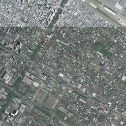
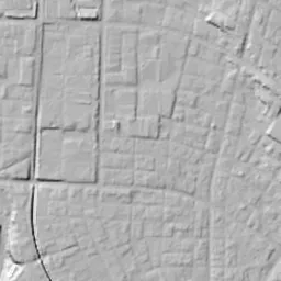
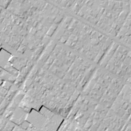
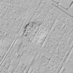


Center photograph taken: 1961-68
What to compare in this era: Look at the white warehouse buildings lined up in parallel from the upper right to the right side. In today's photograph too, long roofs facing the same way still line up
Controls: drag to move / right-drag to rotate and tilt / scroll while holding ⌘ or Ctrl to zoomControls: slide with two fingers to move / pinch to zoom / drag two fingers up or down to tilt
Note: the 3D elevation data is based on current surveys, not on the terrain at the time of the photograph. Elevation tiles: processed from GSI Tiles
The 3D view could not be loaded. Check your connection and try again.
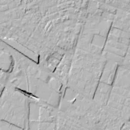
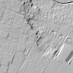
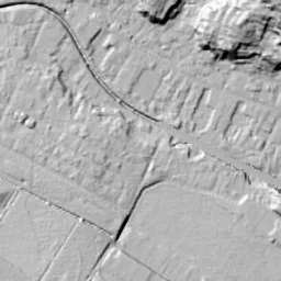
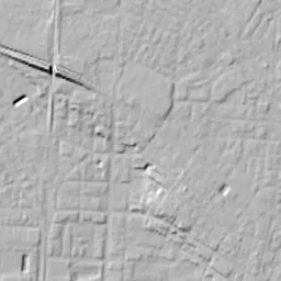
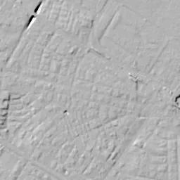
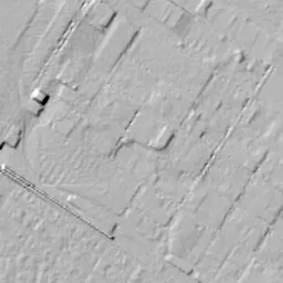
Note: the terrain shading is based on current surveys, not on the terrain at the time of the photograph. Hillshade map: processed from GSI Tiles
Note: the map is today's, not a map from the time of the photograph. Map: © OpenStreetMap contributors
Source: processed from GSI Tiles (aerial photographs by era / latest nationwide photographs / single photographs)
Explore this area on the mapMove the map to compare the surroundings then and now as well.
Overlay and compare the 1961-1969 aerial photograph and today's photograph of the Sagamihara (US Army Depot) area, Kanagawa Prefecture. All photographs are published by the Geospatial Information Authority of Japan (GSI).
Eras of photographs for this location
For the Sagamihara (US Army Depot) area, aerial photographs from the following eras can be compared.
The old photographs of this location cover 6 eras from 1945-1950 to 1987-1990; as of 2026, the newest photograph, 1987-1990, is 37 years ago.There are no photographs of this location from after that until today. The differences between eras are summarized in the guide to aerial photograph eras.
Coverage for each era differs by region. Only the eras that actually have photographs of this location are listed here.
Elevation of this location
The elevation (above sea level) near Sagamihara Station is 128.8 m (source: GSI elevation API). Elevation profiles running east-west and north-south through this location are also shown.
Profile positions (vertical green line = north-south / horizontal blue line = east-west)
Elevation is the value at the ground surface (even where a station is underground or elevated, the value is for the ground surface). Elevation is only one factor in disaster preparedness. Check actual risks such as flooding on the Hazard Map Portal Site and the hazard maps published by local governments.
Elevation tiles for the profiles: processed from GSI Tiles
Access by rail
Sagamihara Station is served by the following lines.
- JR East Yokohama Line
Source of line information: processed from National Land Numerical Information (Railway Data / Ministry of Land, Infrastructure, Transport and Tourism).
Change seen in the share of built-up area
This compares land use in 1976 and 2021. The share of built-up area within 500 m changed from 59% to 65%. Among the locations on this site, the spread of built-up area here is on the small side (bottom 20-40%). The bar below shows where this location falls in the distribution across the locations on this site.
Source: processed from National Land Numerical Information (Land Use Subdivision Mesh / 1976 and 2021 / Ministry of Land, Infrastructure, Transport and Tourism). The texture value (amount of fine detail) of the photographs changed from 16.5 to 35.2. This is a mechanical comparison between photographs and includes differences from the shooting season and from black and white versus color, so treat it only as a rough guide.
Official land prices over time
The official land price (Chika Koji) standard site nearest to this location is "2-163-35 Sagamihara, Chuo Ward, Sagamihara, Kanagawa Prefecture" (about 452 m in a straight line; use: Residential). The official prices per square meter at this standard site from 1989 to 2026 are shown below. The 2026 official price is 285,000 yen.
View as a table
| Year | Official price |
|---|---|
| 1989 | 445,000 yen |
| 1990 | 440,000 yen |
| 1991 | 459,000 yen |
| 1992 | 432,000 yen |
| 1993 | 381,000 yen |
| 1994 | 355,000 yen |
| 1995 | 348,000 yen |
| 1996 | 324,000 yen |
| 1997 | 312,000 yen |
| 1998 | 307,000 yen |
| 1999 | 287,000 yen |
| 2000 | 269,000 yen |
| 2001 | 254,000 yen |
| 2002 | 238,000 yen |
| 2003 | 224,000 yen |
| 2004 | 215,000 yen |
| 2005 | 206,000 yen |
| 2006 | 201,000 yen |
| 2007 | 203,000 yen |
| 2008 | 212,000 yen |
| 2009 | 207,000 yen |
| 2010 | 200,000 yen |
| 2011 | 198,000 yen |
| 2012 | 197,000 yen |
| 2013 | 197,000 yen |
| 2014 | 199,000 yen |
| 2015 | 200,000 yen |
| 2016 | 202,000 yen |
| 2017 | 204,000 yen |
| 2018 | 206,000 yen |
| 2019 | 212,000 yen |
| 2020 | 223,000 yen |
| 2021 | 226,000 yen |
| 2022 | 232,000 yen |
| 2023 | 242,000 yen |
| 2024 | 255,000 yen |
| 2025 | 269,000 yen |
| 2026 | 285,000 yen |
Source: processed from National Land Numerical Information (Land Price Publication Data / Ministry of Land, Infrastructure, Transport and Tourism). Official land prices are values published for standard sites as of January 1 each year and do not show the transaction price of any particular piece of land. The selection and location of standard sites may be reviewed from year to year.
Nearby locations
Sorted by distance from Sagamihara. Comparing them together shows how the same area has changed over time.
Select a marker on the map to see the location name and a link to it.
Locations with the same origins
Towns in the same category as Sagamihara (Former factory site), chosen from other regions. You can compare what they share in land use and town layout.
Select a marker on the map to see the location name and a link to it.
Articles that feature this location
Recently viewed towns
This history is saved only on your device and is not sent to any server. Depending on your browser settings, it may be deleted automatically if you do not visit for a while (it is less likely to be deleted if you use the site as an app).
Why not look at how another town has changed?
History of Sagamihara (US Army Depot)
North of the tracks of the JR Yokohama Line, from Sagamihara Station toward Yabe Station, its eastern neighbor, the US Army Japan's Sagami General Depot spreads along the tracks. According to the City of Sagamihara's materials, its area is about 196.7 hectares, the largest of the US military facilities in the city. In the aerial photographs this base takes up a large part of the frame from the upper right to the right side, with many rows of warehouses with long white roofs. Southwest across the tracks, fine rows of houses are packed in, and a composition in which two pieces of land of different character face each other across a single line of tracks appears in every postwar era.
A military city drawn on the upland
Sagamihara sits on the Sagamino Upland, which spreads east of the Sagami River. The city's materials give, as the reasons the former Imperial Japanese Army chose this place, that it was a flat upland with almost no relief, and that it was close to Tokyo and wide land could be obtained cheaply. In 1938 the Sagami Ordnance Works of the Tokyo arsenal was established, and in June 1940 it became the Sagami Army Arsenal. It was a factory that made tanks and shells, and more than 10,000 people are said to have worked there. A large-scale land readjustment that laid out radial streets starting from the arsenal went ahead, and in April 1941 two towns and six villages in the surrounding area were combined to create Sagamihara Town. Sagamihara Station on the Yokohama Line also opened in the same year, 1941. The city regards the orderly townscape centered on the station and the wide roads as what this military city plan left behind.
The base in the two black-and-white photographs
The 1945-50 photograph shows both the framework of the plan and the farming villages remaining around it. Several diagonal roads extend from around the station, and west of the station small houses are packed tightly into lots that open in a fan shape. North of the station there is a ring road drawing an oval, and the area inside it is still white ground with nothing built on it. On the right side of the frame, east of the station, long, narrow buildings line up regularly on a grid of roads crossing at right angles. This is the site of the arsenal. Apart from that, strip-shaped fields cover most of the frame, and a long straight road crosses the frame diagonally from the left to the lower right, running into a circular intersection in the lower right. In the upper right corner a river meanders, with settlements surrounded by trees huddled beside it. The US Army moved in in September 1945, the month after the end of the war, and the US military requisitioned the site in December 1949.
It is the 1961-69 photograph in which the base clearly shows its form as a supply hub. From the upper right to the right side, many long, narrow warehouse buildings line up in parallel, and the whiteness of their roofs stands out from the dark rows of houses around them. Directly north of the station there is a wide paved surface, with small squares placed in aligned rows. Around the oval road, small buildings line up along the arc. According to the city's materials, after the Korean War and the Vietnam War it became a major supply base of the US Army Japan, and there was a time when about 5,000 Japanese employees are said to have worked there. The area southwest of the tracks is filling up with rows of houses, but to the south and west of the frame there are still many field lots, and in the upper left two oval tracks of school grounds can be seen, with a factory with a large white roof at the left edge.
Rows of warehouses and a ring line
By the 1974-78 photograph, the ground of the base has turned a pale earth color, and the contrast with the rows of white warehouses grows stronger. Toward the right there is an oval sports ground, and a line drawing an arc appears along the north edge of the base. Outside the tracks the fields have almost all been replaced by housing, and the strip-shaped lots seen in the black-and-white eras survive only as the courses of roads through the rows of houses. White factories with large roofs cluster in the lower left, and with the tracks along the south edge of the base as the boundary, the pale ground to the north and the cluster of fine roofs to the south are sharply divided. By 1979-83 that arc can be clearly read as a ring line running around inside the base, and at the upper right edge long, narrow reddish-brown objects continue along the tracks. In this era only the bottom third of the frame is a separate photograph in a yellowish tone, and the seam shows as a single horizontal line.
In 1984-86, brown bare ground appears on the open land north of the station, and the paved surface east of it is completely filled with fine grains. Red roofs are added to the factories in the lower left. In the 1987-90 photograph too, the outer edge of the base and the arrangement of the warehouses are almost the same, and only patches of grassland and bare ground spread in one corner north of the station. The ring line running around the north of the base also shows without a break, and inside it paved surfaces line up, divided into sections. The rows of warehouses and the ring line keep appearing in the same positions through the four eras from 1974-78. The city's materials note that many of the warehouses still in use are buildings from the arsenal era, and near the headquarters Sagami Shrine, built in the arsenal era, remains as a shrine park.
The returned north side of the station
The city, together with its residents and the city assembly, has called for the return of the base. At the Japan-US Joint Committee in June 2008, the return of about 17 hectares on the north side of the station was decided, and it was handed back to the Japanese government on September 30, 2014. The 88 US military family housing units that adjoined the station were moved to another US military housing area to coincide with the return. On the returned land, a north-south road opened in 2017 and an east-west road in 2018. About 35 hectares continuing north of the returned land came under joint use by Japan and the United States from December 2015, and of that, the southern 10 hectares began full operation in April 2024 as the Sagamihara Sports and Recreation Park. The returned land is national land held by the Ministry of Finance, and the city has been drawing up a land use plan for it as the Station North Exit district.
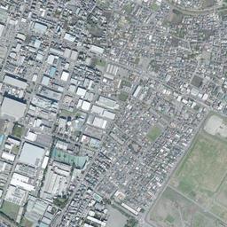
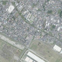
In today's photograph, the area north of the station and inside the ring line has turned into grassland and bare ground, and the rows of warehouses break off east of it. The arc-shaped line still remains, and on its right, warehouses with long white roofs continue to line up facing the same way as before. At the upper right edge, a wide green surface like turf can also be seen beside the warehouse buildings. Southwest of the tracks, large buildings have increased among the rows of houses, but the road extending diagonally southwest from the station keeps the same direction as in the 1945-50 photograph, and the trace of the military city's streets can be read there. The official land price (Chika Koji) of residential land in Sagamihara 2-chome, about 450 m from the station, fell from 459,000 yen per square meter in 1991, the highest up to the 2026 publication, to 197,000 yen in 2012 and 2013, the cheapest, and then turned upward.