Honmoku about 60 years ago and today
Then and now
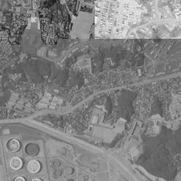
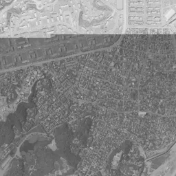
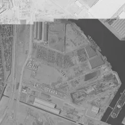
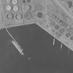
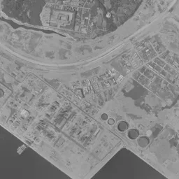
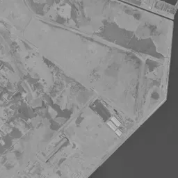
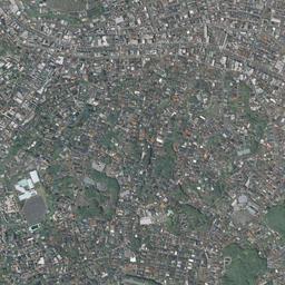
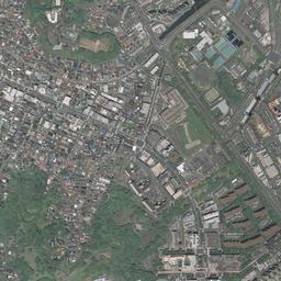
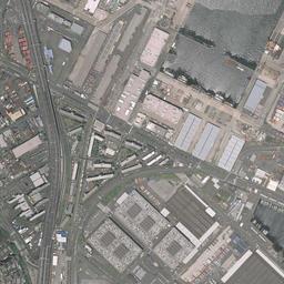
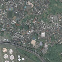
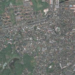
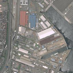
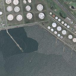
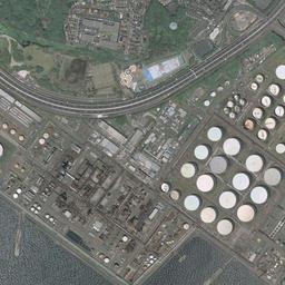
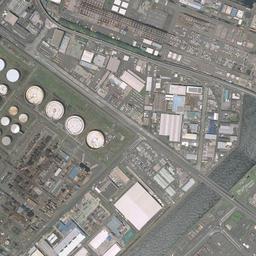


Center photograph taken: 1961-68
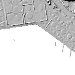
What to compare in this era: The upper half is washed out white, so look at the lower half. At the lower left of the frame, which was sea in 1945-50, round storage tanks line up, and a large ship is moored alongside the quay
Controls: drag to move / right-drag to rotate and tilt / scroll while holding ⌘ or Ctrl to zoomControls: slide with two fingers to move / pinch to zoom / drag two fingers up or down to tilt
Note: the 3D elevation data is based on current surveys, not on the terrain at the time of the photograph. Elevation tiles: processed from GSI Tiles
The 3D view could not be loaded. Check your connection and try again.
Gray areas in the old photograph: Areas where no aerial photograph of this era is available (outside the area photographed, over the sea and the like).
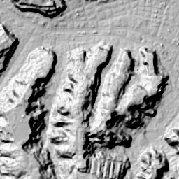
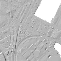
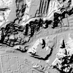
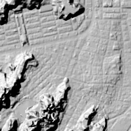
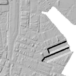
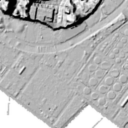
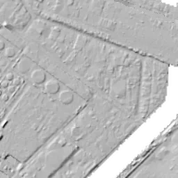
Note: the terrain shading is based on current surveys, not on the terrain at the time of the photograph. Hillshade map: processed from GSI Tiles
Note: the map is today's, not a map from the time of the photograph. Map: © OpenStreetMap contributors
Source: processed from GSI Tiles (aerial photographs by era / aerial photographs by fiscal year / latest nationwide photographs / single photographs / survey periods of the photographs)
Explore this area on the mapMove the map to compare the surroundings then and now as well.
Overlay and compare the 1961-1969 aerial photograph and today's photograph of the Honmoku area, Kanagawa Prefecture. All photographs are published by the Geospatial Information Authority of Japan (GSI).
Eras of photographs for this location
For the Honmoku area, aerial photographs from the following eras can be compared.
The old photographs of this location cover 6 eras from 1945-1950 to FY2007; as of 2026, the newest photograph, FY2007, is 18-19 years ago.There are no photographs of this location from after that until today. The differences between eras are summarized in the guide to aerial photograph eras.
Coverage for each era differs by region. Only the eras that actually have photographs of this location are listed here.
Elevation of this location
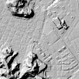
The elevation (above sea level) at the reference point of Honmoku is 5.2 m (source: GSI elevation API). Elevation profiles running east-west and north-south through this location are also shown.
Profile positions (vertical green line = north-south / horizontal blue line = east-west)
Elevation is the value at the ground surface (even where a station is underground or elevated, the value is for the ground surface). Elevation is only one factor in disaster preparedness. Check actual risks such as flooding on the Hazard Map Portal Site and the hazard maps published by local governments.
Elevation tiles for the profiles: processed from GSI Tiles
Access by rail
One of the nearest stations to Honmoku is Yamate Station, served by the following lines.
- JR East Negishi Line
Source of line information: processed from National Land Numerical Information (Railway Data / Ministry of Land, Infrastructure, Transport and Tourism).
Change seen in the share of built-up area
This compares land use in 1976 and 2021. The share of built-up area within 500 m changed from 86% to 70%. Among the locations on this site, the spread of built-up area here is among the smallest (bottom 20%). The bar below shows where this location falls in the distribution across the locations on this site.
Source: processed from National Land Numerical Information (Land Use Subdivision Mesh / 1976 and 2021 / Ministry of Land, Infrastructure, Transport and Tourism). The texture value (amount of fine detail) of the photographs changed from 17.4 to 23.3. This is a mechanical comparison between photographs and includes differences from the shooting season and from black and white versus color, so treat it only as a rough guide.
Official land prices over time
The official land price (Chika Koji) standard site nearest to this location is "228-2 Honmoku Sannotani, Naka Ward, Yokohama, Kanagawa Prefecture" (about 344 m in a straight line; use: Residential). The official prices per square meter at this standard site from 1994 to 2026 are shown below. The 2026 official price is 357,000 yen.
View as a table
| Year | Official price |
|---|---|
| 1994 | 497,000 yen |
| 1995 | 471,000 yen |
| 1996 | 451,000 yen |
| 1997 | 433,000 yen |
| 1998 | 420,000 yen |
| 1999 | 401,000 yen |
| 2000 | 375,000 yen |
| 2001 | 352,000 yen |
| 2002 | 332,000 yen |
| 2003 | 313,000 yen |
| 2004 | 298,000 yen |
| 2005 | 288,000 yen |
| 2006 | 286,000 yen |
| 2007 | 300,000 yen |
| 2008 | 320,000 yen |
| 2009 | 310,000 yen |
| 2010 | 295,000 yen |
| 2011 | 290,000 yen |
| 2012 | 287,000 yen |
| 2013 | 289,000 yen |
| 2014 | 295,000 yen |
| 2015 | 302,000 yen |
| 2016 | 309,000 yen |
| 2017 | 315,000 yen |
| 2018 | 322,000 yen |
| 2019 | 329,000 yen |
| 2020 | 336,000 yen |
| 2021 | 336,000 yen |
| 2022 | 338,000 yen |
| 2023 | 340,000 yen |
| 2024 | 345,000 yen |
| 2025 | 351,000 yen |
| 2026 | 357,000 yen |
Source: processed from National Land Numerical Information (Land Price Publication Data / Ministry of Land, Infrastructure, Transport and Tourism). Official land prices are values published for standard sites as of January 1 each year and do not show the transaction price of any particular piece of land. The selection and location of standard sites may be reviewed from year to year.
Nearby locations
Sorted by distance from Honmoku. Comparing them together shows how the same area has changed over time.
Select a marker on the map to see the location name and a link to it.
Locations with the same origins
Towns in the same category as Honmoku (Reclaimed land), chosen from other regions. You can compare what they share in land use and town layout.
Select a marker on the map to see the location name and a link to it.
Articles that feature this location
Recently viewed towns
This history is saved only on your device and is not sent to any server. Depending on your browser settings, it may be deleted automatically if you do not visit for a while (it is less likely to be deleted if you use the site as an app).
Why not look at how another town has changed?
History of Honmoku
Honmoku is the tip of a plateau jutting out south of the port of Yokohama, and the seaside land that opened at its foot. The chronology of Naka Ward records that Honmoku Village in the Edo period was a fishing village, favored by writers as a land of fine scenery. The aerial photographs of this location show, within the same frame, a corner where family housing for the US military lined up after the war, and just beyond it the sea being reclaimed and turning into industrial land and piers. The land has a hill at its back to the north and falls low toward the east, and where the slope ended, the land gave way to the sea.
US military housing at the tip of the cape
In the Great Yokohama Air Raid of May 1945, Naka Ward was almost entirely burned, but Honmoku, Negishi and part of Yamate survived the fire. According to the materials of the Yokohama City History Archives, Housing Area No. 1 in Honmoku was requisitioned in February 1946 and Housing Area No. 2 in October of the same year, and family housing for US military personnel was built. The city's materials write that the site was laid out generously and was a small American town, complete with shops, grocery stores, sports grounds and even a theater.
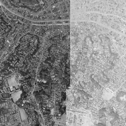
The 1945-50 photograph shows that housing area clearly. A corner where white square buildings line up in many rows, in the same orientation and at the same intervals, lies upper right of the center, on flat land near the shore. The rows of Japanese houses around it are packed irregularly, and the difference in arrangement is plain. Bright ground that looks scraped white spreads just north of the center, and the rows of buildings continue there too. The right half of the frame is sea, and the shoreline draws a natural arc around the tip of the cape and turns west in the middle of the bottom of the frame. Offshore, lots that look like black strips lined up continue in a grid. The chronology says that nori seaweed was grown off Honmoku, and these seem to be farming racks. Similar rows can be seen in the inlet at the lower left too. The upper left of the frame is a wooded hill, houses are crowded along the valleys, and a single road passes east-west along the foot of the hill. A quay and buildings that look like warehouses stand in the middle of the top edge, and the southern end of the port reached this far.
Twenty years in which the sea receded
Reclamation of the waters of Negishi Bay broke ground in February 1959, and large industrial land was created offshore from Honmoku to Negishi. The chronology says that in March 1963 there was a completion ceremony for the first phase of reclamation, and in October of the same year work began on creating land for related industries at Honmoku Pier. In May 1964 the Negishi Line opened from Sakuragicho to Isogo, and Yamate Station was newly established at that time.
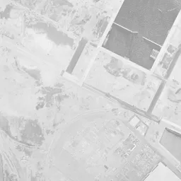
In the 1961-69 photograph, the upper half of the frame is washed out white, and the details of the housing area can barely be read. Within the white, it is just possible to make out the shadows of rows of buildings. Even so, if you look at the lower half, the change is clear at a glance. The right and bottom of the frame, which were sea in 1945-50, have mostly turned into land, and on the reclaimed land at the lower left, round storage tanks line up regularly. A large ship is moored alongside the quay, and a thin landing pier extends offshore. On the new land on the right, long buildings that look like warehouses and quays line up, and several ships are berthed. South of the center, a hill of dense trees appears as a black mass, and from its eastern slope down to the flat land, rows of houses are packed eave to eave. The arc of the former shoreline was left as it was, as the curve of a single road.
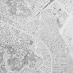
The appearance of the housing area can be seen well in 1974-78. An expanse of yellowish grassland surrounds the center, and small buildings are placed sparsely along gently curving roads. The difference in density from the Japanese town on the south side, where small roofs are packed closely together, is obvious. A long elevated line runs north-south along the eastern edge, and beyond it large buildings with red roofs and warehouses with blue roofs line up. On the reclaimed land to the south, the white round storage tanks have increased in number. In the 1979-83 image, the top third is missing, and the area around the center is also painted black and not shown. Only the lower half can be read, and the wooded hill, the packed rows of houses, the curving road and the rows of storage tanks stand in almost the same form as in the previous era.
New blocks after the return
The US military housing in Honmoku continued to be used for a long time under the Japan-US Security Treaty. The chronology says that in August 1981, the year before the return, the last Japan-US friendship Bon dance festival was held in the store plaza of the housing area. The return was on March 31, 1982, and the top 10 Yokohama news stories of that year compiled by the City of Yokohama list in first place the return of 810,000 square meters across three US military facilities, including the Yokohama Beach Housing in Honmoku. In January of the same year, 1982, the land readjustment project for the Shin-Honmoku district was approved, and work on the basic infrastructure began in November. In March 1987 the land readjustment was finished, and the first residents moved into a 12-story condominium built in the apartment housing zone on the sea side. In April 1989, the shopping center Mycal Honmoku opened on the readjusted land.
The 1987-90 photograph captures exactly that period of construction. Around the center, the grassland housing area has turned into bare ground, and the lines of newly drawn roads cut the area into fine lots. Almost no buildings are standing yet. Northeast of the center, many large dark buildings that were not there before line up. In today's photograph, the lots that were bare ground are filled with mid-rise buildings and houses, and the streets draw a neat grid. The Japanese town to the south remains with its original irregular alleys, so the boundary of the land readjustment area can be read as a difference in the shape of the streets.
The curving road that runs around the bottom of the frame overlaps with an elevated road built later, and connects to the elevated line running north-south along the eastern edge. The storage tanks on the reclaimed land to the south remain in almost the same arrangement as in 1974-78, and along the eastern quay the roofs of large warehouses line up. A green space holding a pond lies southwest of the center, continuing without changing its outline since the 1974-78 photograph.
Traces remain on the sea side too. The road that curves around the bottom of the frame almost overlaps with the shoreline shown in the 1945-50 photograph. The storage tanks and factory land outside it were all born from postwar reclamation. The flat land in the center and the east is only slightly higher above sea level than the hill to the north. The assumed flooding on the lowland and the reclaimed land is shown in the City of Yokohama's hazard map.