Chatan (Mihama) about 50 years ago and today
Then and now
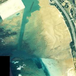
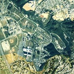
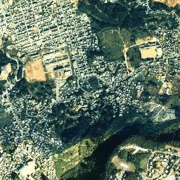
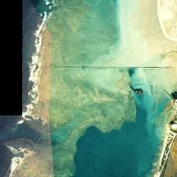
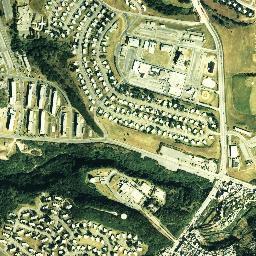
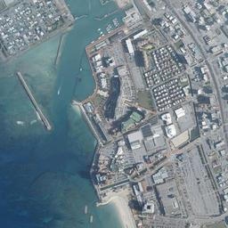
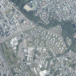
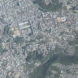
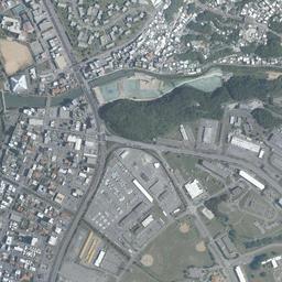
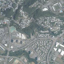
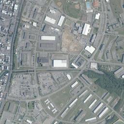
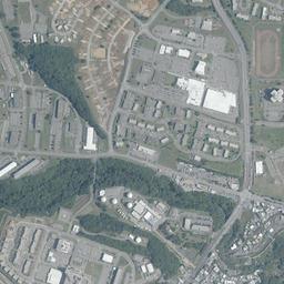


Center photograph taken: 1977
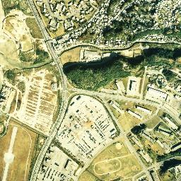
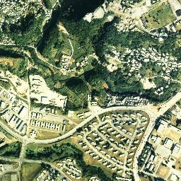
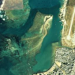
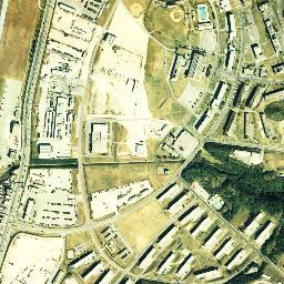
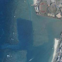
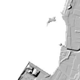
What to compare in this era: On the coast left of the middle of the frame, there is only a sandy beach bulging into the sea in a semicircle. In today's photograph, from there out to sea it has become land enclosed by seawalls, with a red athletics stadium on it
Controls: drag to move / right-drag to rotate and tilt / scroll while holding ⌘ or Ctrl to zoomControls: slide with two fingers to move / pinch to zoom / drag two fingers up or down to tilt
Note: the 3D elevation data is based on current surveys, not on the terrain at the time of the photograph. Elevation tiles: processed from GSI Tiles
The 3D view could not be loaded. Check your connection and try again.
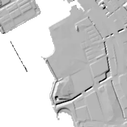
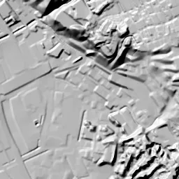
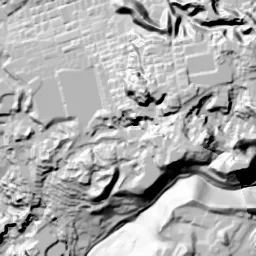
Note: the terrain shading is based on current surveys, not on the terrain at the time of the photograph. Hillshade map: processed from GSI Tiles
Note: the map is today's, not a map from the time of the photograph. Map: © OpenStreetMap contributors
Source: processed from GSI Tiles (aerial photographs by era / latest nationwide photographs / single photographs)
Explore this area on the mapMove the map to compare the surroundings then and now as well.
Overlay and compare the 1974-1978 aerial photograph and today's photograph of the Chatan (Mihama) area, Okinawa Prefecture. All photographs are published by the Geospatial Information Authority of Japan (GSI).
Eras of photographs for this location
For the Chatan (Mihama) area, aerial photographs from the following eras can be compared.
The old photographs of this location are from one era, 1974-1978, which as of 2026 is 49 years ago.There are no photographs of this location from after that until today. The differences between eras are summarized in the guide to aerial photograph eras.
Coverage for each era differs by region. Only the eras that actually have photographs of this location are listed here.
Elevation of this location
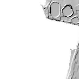
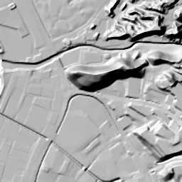
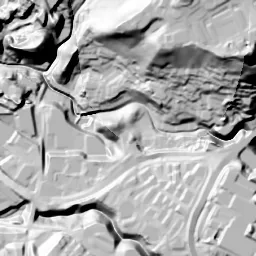
The elevation (above sea level) at the reference point of Chatan (Mihama) is 4.0 m (source: GSI elevation API). Elevation profiles running east-west and north-south through this location are also shown.
Profile positions (vertical green line = north-south / horizontal blue line = east-west)
Where the line in a profile breaks off and leaves a gap, no elevation data is available (water surfaces such as the sea or rivers).
Elevation is the value at the ground surface (even where a station is underground or elevated, the value is for the ground surface). Elevation is only one factor in disaster preparedness. Check actual risks such as flooding on the Hazard Map Portal Site and the hazard maps published by local governments.
Elevation tiles for the profiles: processed from GSI Tiles
Access by rail
One of the nearest stations to Chatan (Mihama) is Tedako-Uranishi Station, served by the following lines.
- Okinawa Urban Monorail Line
Source of line information: processed from National Land Numerical Information (Railway Data / Ministry of Land, Infrastructure, Transport and Tourism).
Change seen in the share of built-up area
This compares land use in 1976 and 2021. The share of built-up area within 500 m changed from 23% to 53%. Among the locations on this site, the spread of built-up area here is on the large side (top 20-40%). The bar below shows where this location falls in the distribution across the locations on this site.
Source: processed from National Land Numerical Information (Land Use Subdivision Mesh / 1976 and 2021 / Ministry of Land, Infrastructure, Transport and Tourism). The texture value (amount of fine detail) of the photographs changed from 66.5 to 31.7. This is a mechanical comparison between photographs and includes differences from the shooting season and from black and white versus color, so treat it only as a rough guide.
Official land prices over time
The official land price (Chika Koji) standard site nearest to this location is "1-11-9 Kuwae, Chatan Town, Nakagami District, Okinawa Prefecture" (about 903 m in a straight line; use: Residential). The official prices per square meter at this standard site from 2017 to 2026 are shown below. The 2026 official price is 240,000 yen.
View as a table
| Year | Official price |
|---|---|
| 2017 | 125,000 yen |
| 2018 | 141,000 yen |
| 2019 | 156,000 yen |
| 2020 | 177,000 yen |
| 2021 | 185,000 yen |
| 2022 | 193,000 yen |
| 2023 | 195,000 yen |
| 2024 | 203,000 yen |
| 2025 | 217,000 yen |
| 2026 | 240,000 yen |
Source: processed from National Land Numerical Information (Land Price Publication Data / Ministry of Land, Infrastructure, Transport and Tourism). Official land prices are values published for standard sites as of January 1 each year and do not show the transaction price of any particular piece of land. The selection and location of standard sites may be reviewed from year to year.
Nearby locations
Sorted by distance from Chatan. Comparing them together shows how the same area has changed over time.
Select a marker on the map to see the location name and a link to it.
Locations with the same origins
Towns in the same category as Chatan (Reclaimed land), chosen from other regions. You can compare what they share in land use and town layout.
Select a marker on the map to see the location name and a link to it.
Articles that feature this location
Recently viewed towns
This history is saved only on your device and is not sent to any server. Depending on your browser settings, it may be deleted automatically if you do not visit for a while (it is less likely to be deleted if you use the site as an app).
Why not look at how another town has changed?
History of Chatan (Mihama)
Mihama in Chatan Town was made by filling in a shallow sea facing the East China Sea. Just west of the location, in the 1974-78 aerial photograph, is sea with sandy beaches and coral reefs; land was built there, and it was at the end of the 1980s that an athletics stadium and other facilities began to sit on it. Next door to the south, an airfield ran a single runway along the coast. There are only two photographs, one from the 1970s and one from today, but between them lies the whole process of the sea and the airfield being replaced by a town.
The landing beach and the base village
Chatan was originally a farming village made up of coastal lowland and a plateau to the east. Chatan Town relates that the rice paddies spreading around the Chatan district (aza) were fine fields known throughout the prefecture. The life of that farming village was cut off by the Battle of Okinawa. The Chatan coast became a point where US forces landed on Okinawa Island, the whole village became occupied territory, and the fields turned into barracks and airfields. After the war the bases continued to take up most of the village's land, and Chatan Town's materials updated in 2023 also record that US military bases take up about 51.6% of the town's area.
To rebuild life on the land left between the bases, the village laid out trunk roads and pushed ahead with filling in the sea and developing housing land in the hills. In 1980, the year after its population passed 15,000, it became a town. The next year, 1981, Hamby Airfield and the Meimosukara Firing Range were returned. With the military land along the coast returned to the town, town building on the west coast got going in earnest.
The 1974-78 shoreline
The left half of the frame in the 1974-78 photograph is taken up by the color of the sea. White, bright sand lies near the shore, pale blue-green shallows spread offshore, and here and there deep blue depths reach in like streaks. On the coast just west of the location, a sandy beach draws a semicircle bulging slightly into the sea, and inside it there is only grassland dotted with small roofs. Most of the place that would later become the Mihama reclaimed land is still sea at this point. The black gap at the left edge lies outside the area covered by the photographs, and part of the sea is not shown.
If you move your eye to the south, a thin white runway extends straight north-south, parallel to the coast. White circles are drawn at both ends, and the surroundings are covered by dry grassland. This is Hamby Airfield, and Chatan Town's materials put the area of the returned site at 42.5 hectares. Just east of the runway a wide road runs parallel, and a base section packed with square-roofed buildings, the diamond of a baseball field, an oval track and a blue pool continues east of that.
Just south of the center there is a corner where small white squares line up neatly in many rows. It looks like an area where vehicles or materials were set out in lines, and the rules of the arrangement differ from those of house roofs. On the north side, between the trunk road coming down diagonally and the coast, there is a residential area where roofs of the same shape repeat along curved roads. The right half of the frame is densely green hills, and in their valleys and on their ridges too, several sections with houses of the same shape lined up along curved roads can be seen. The spacing between buildings is wider than in the rows of houses of a Japanese town, and lawns surround the buildings.
The 49 hectares of reclaimed land and the returned sites
The Mihama reclamation was planned with the aims of using the sites of returned military land efficiently and securing land for a sports park, housing and industry. According to Chatan Town's records, the work of filling in the public waters off Kuwae began in April 1986, was finished in September 1987 and was formally completed in 1988. The area is 49 hectares of reclaimed land. On and around it, a softball field, Sunset Beach, an athletics stadium and a pool were laid out in turn from 1986 to 1992. Work on the athletics stadium took from October 1988 to September 1990.
On the reclaimed land, the commercial and tourist blocks the town named "Mihama Town Resort American Village" opened in turn from the end of the 1990s. In the Kitamae district to the south, land readjustment was carried out on the airfield site, and in March 2003 the northern part of Camp Kuwae was returned, where town building on the former site also began. Return, reclamation and land readjustment advanced as if in a chain running north and south along the coast.
Where there was sea in 1974-78, in today's photograph land edged by straight seawalls juts out, and within it the red oval of the athletics stadium and the baseball field next to it stand side by side. Toward the north, commercial facilities with large roofs and wide parking lots continue, and a bowed white sandy beach was made on the coast. Along the southern edge of the reclaimed land, a channel runs from the east out to the sea, and the long, narrow band south of it where the runway was is completely filled with fine roofs. The line of the runway itself has vanished from the photograph, but the width of the band between the coast and the wide road to the east remains as the width of the blocks.
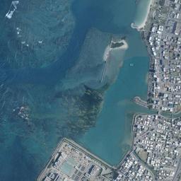
The jutting out of land does not end with Mihama. In the upper left of the frame too, in 1974-78 there was only a white sandy beach continuing north in an arc, but in today's photograph another tier of land has been built on the sea side, with a boat basin enclosed by breakwaters and a row of tall buildings along the shoreline. Chatan Town records that, following the reclamation off Kuwae, it went on to fill in the waters of Hamagawa Fishing Port and develop the Fisherina district, and that a new townscape was born on the west coast. Taking the 1974-78 shoreline as the baseline, you can see that every building standing on the sea side of that line sits on land built over the sea after this photograph was taken. The athletics stadium, the boat basin and the row of tall buildings are all outside the former water's edge.
The hills in the right half and the sections of same-shaped houses along curved roads have not changed much in today's photograph either. The diamond of the baseball field that was east of the runway can also be seen in the same position. Between the two photographs, the land that changed greatly on the sea side and the hill side that hardly moved are sharply divided.
Both the reclaimed land and the former airfield are low land facing the sea, with an elevation of only 4 m at the center and 2 m at the southern measurement point. For the expected tsunami and storm surges, the only way is to enter an address in the hazard maps of Chatan Town or Okinawa Prefecture.