Akabane (Akabanedai Danchi) about 60 years ago and today
Then and now
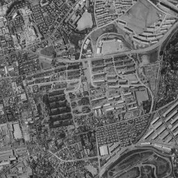
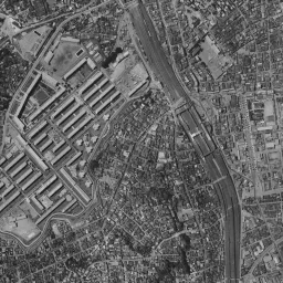
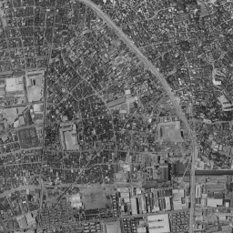
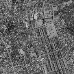
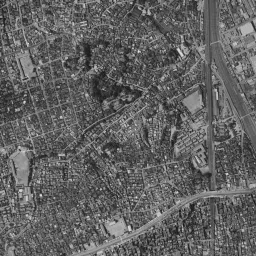
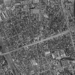
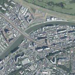
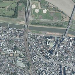
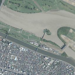
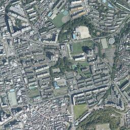
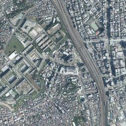
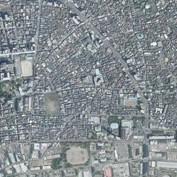
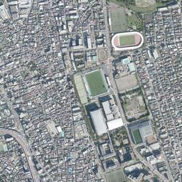
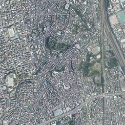
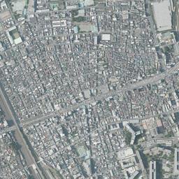


Center photograph taken: 1961-66
What to compare in this era: The rows of roofs disappear, and slab-type residential buildings line up facing the same diagonal. Their direction is the same as the rows of roofs in c. 1936-42
Controls: drag to move / right-drag to rotate and tilt / scroll while holding ⌘ or Ctrl to zoomControls: slide with two fingers to move / pinch to zoom / drag two fingers up or down to tilt
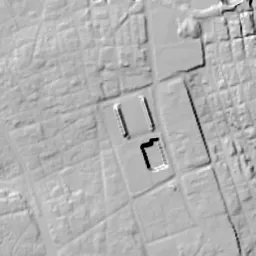
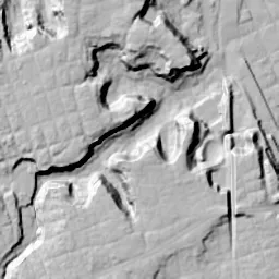
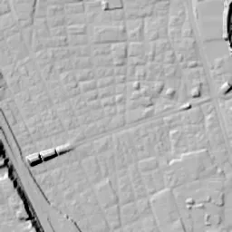
This 3D terrain is today's. The mismatch when you overlay an old photograph is the evidence of the land development that cut hills and filled valleys.
Note: the 3D elevation data is based on current surveys, not on the terrain at the time of the photograph. Elevation tiles: processed from GSI Tiles
The 3D view could not be loaded. Check your connection and try again.
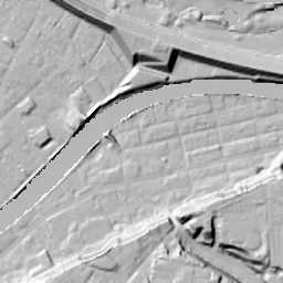
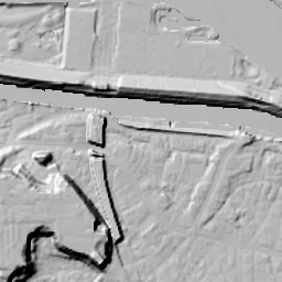
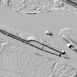
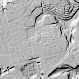
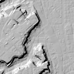
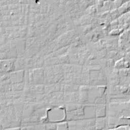
Note: the terrain shading is based on current surveys, not on the terrain at the time of the photograph. Hillshade map: processed from GSI Tiles
Note: the map is today's, not a map from the time of the photograph. Map: © OpenStreetMap contributors
Source: processed from GSI Tiles (aerial photographs by era / aerial photographs by fiscal year / latest nationwide photographs / single photographs / survey periods of the photographs)
Explore this area on the mapMove the map to compare the surroundings then and now as well.
Overlay and compare the 1961-1969 aerial photograph and today's photograph of the Akabane (Akabanedai Danchi) area, Tokyo. All photographs are published by the Geospatial Information Authority of Japan (GSI).
Eras of photographs for this location
For the Akabane (Akabanedai Danchi) area, aerial photographs from the following eras can be compared.
The old photographs of this location cover 8 eras from c. 1936-1942 to FY2007; as of 2026, the newest photograph, FY2007, is 18-19 years ago.There are no photographs of this location from after that until today. The differences between eras are summarized in the guide to aerial photograph eras.
Coverage for each era differs by region. Only the eras that actually have photographs of this location are listed here.
Elevation of this location
The elevation (above sea level) near Akabane Station is 5.7 m (source: GSI elevation API). Elevation profiles running east-west and north-south through this location are also shown.
Profile positions (vertical green line = north-south / horizontal blue line = east-west)
Elevation is the value at the ground surface (even where a station is underground or elevated, the value is for the ground surface). Elevation is only one factor in disaster preparedness. Check actual risks such as flooding on the Hazard Map Portal Site and the hazard maps published by local governments.
Elevation tiles for the profiles: processed from GSI Tiles
Access by rail
Akabane Station is served by the following lines.
- JR East Akabane Line
- JR East Tohoku Line
Source of line information: processed from National Land Numerical Information (Railway Data / Ministry of Land, Infrastructure, Transport and Tourism).
Change seen in the share of built-up area
This compares land use in 1976 and 2021. The share of built-up area within 500 m changed from 93% to 90%. Among the locations on this site, the spread of built-up area here is among the smallest (bottom 20%). The bar below shows where this location falls in the distribution across the locations on this site.
Source: processed from National Land Numerical Information (Land Use Subdivision Mesh / 1976 and 2021 / Ministry of Land, Infrastructure, Transport and Tourism). The texture value (amount of fine detail) of the photographs changed from 16.3 to 39.6. This is a mechanical comparison between photographs and includes differences from the shooting season and from black and white versus color, so treat it only as a rough guide.
Official land prices over time
The official land price (Chika Koji) standard site nearest to this location is "1-19 Akabane-nishi, Kita Ward, Tokyo" (about 375 m in a straight line; use: Residential). The official prices per square meter at this standard site from 1983 to 2026 are shown below. The 2026 official price is 696,000 yen.
View as a table
| Year | Official price |
|---|---|
| 1983 | 367,000 yen |
| 1984 | 375,000 yen |
| 1985 | 389,000 yen |
| 1986 | 402,000 yen |
| 1987 | 735,000 yen |
| 1988 | 950,000 yen |
| 1989 | 941,000 yen |
| 1990 | 941,000 yen |
| 1991 | 940,000 yen |
| 1992 | 880,000 yen |
| 1993 | 720,000 yen |
| 1994 | 645,000 yen |
| 1995 | 593,000 yen |
| 1996 | 558,000 yen |
| 1997 | 527,000 yen |
| 1998 | 508,000 yen |
| 1999 | 480,000 yen |
| 2000 | 457,000 yen |
| 2001 | 438,000 yen |
| 2002 | 421,000 yen |
| 2003 | 408,000 yen |
| 2004 | 399,000 yen |
| 2005 | 394,000 yen |
| 2006 | 395,000 yen |
| 2007 | 415,000 yen |
| 2008 | 440,000 yen |
| 2009 | 422,000 yen |
| 2010 | 407,000 yen |
| 2011 | 405,000 yen |
| 2012 | 401,000 yen |
| 2013 | 401,000 yen |
| 2014 | 406,000 yen |
| 2015 | 411,000 yen |
| 2016 | 423,000 yen |
| 2017 | 439,000 yen |
| 2018 | 469,000 yen |
| 2019 | 500,000 yen |
| 2020 | 532,000 yen |
| 2021 | 530,000 yen |
| 2022 | 536,000 yen |
| 2023 | 555,000 yen |
| 2024 | 587,000 yen |
| 2025 | 634,000 yen |
| 2026 | 696,000 yen |
Source: processed from National Land Numerical Information (Land Price Publication Data / Ministry of Land, Infrastructure, Transport and Tourism). Official land prices are values published for standard sites as of January 1 each year and do not show the transaction price of any particular piece of land. The selection and location of standard sites may be reviewed from year to year.
Nearby locations
Sorted by distance from Akabane. Comparing them together shows how the same area has changed over time.
Select a marker on the map to see the location name and a link to it.
Locations with the same origins
Towns in the same category as Akabane (New town), chosen from other regions. You can compare what they share in land use and town layout.
Select a marker on the map to see the location name and a link to it.
Recently viewed towns
This history is saved only on your device and is not sent to any server. Depending on your browser settings, it may be deleted automatically if you do not visit for a while (it is less likely to be deleted if you use the site as an app).
Why not look at how another town has changed?
History of Akabane (Akabanedai Danchi)
On a height reached by climbing a slope, residential buildings stand around courtyards. This site west of Akabane Station is where the Japan Housing Corporation built the Akabanedai danchi (public housing complex) in 1962, and it has been rebuilt since 2000. A dark band of woods winding north-south on the west side of the station appears in the same position in the aerial photographs of every era. Low ground packed with rows of houses lies east of the band, and a plateau lies west of it. On the plateau, the buildings were replaced twice, from military facilities to the danchi and from the danchi to a new danchi. Even so, the diagonal lines that set the direction of the buildings have not changed through the three periods.
The ground above and below the bluff
Akabane Station opened in 1885. The tracks run north-south along the foot of the plateau's bluff. North of the station they cross the Arakawa River, and the land beyond the river is already Saitama Prefecture. On the low-ground side, rows of houses spread out from the station area, and the streets are finely tangled. On the plateau side there was once the Army Clothing Depot. The collection of the Kita City Asukayama Museum includes tableware of the Army Clothing Depot dug up from the Akabanedai site. A ring moat and the corridor-style stone chamber of a burial mound have also been found at the same site, and the land on the plateau was a place where people lived long before the army came.
The rows of roofs of the clothing depot
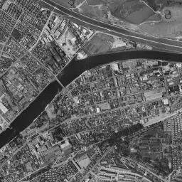
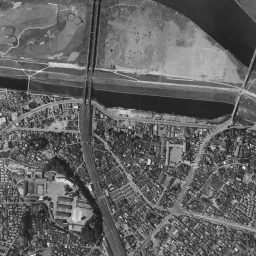
In the c. 1936-42 photograph, on the plateau slightly west of the center, there is a large facility with dozens of long, narrow buildings lined up in parallel. The buildings are set diagonally to north-south, and the orderly rows of roofs nearly fill the square site. According to the Urban Renaissance Agency (UR), the danchi site is the former site of the Army Clothing Depot, and the foundations of its buildings came up during the rebuilding work. The rows of roofs in the photograph are thought to be the clothing depot's buildings. A dark band of woods edges the east side of the facility along the bluff. Further west there is another facility with buildings arranged in a grid, and in the lower left, long, narrow buildings like row houses form regular lines. At the top edge of the frame the railway crosses the Arakawa River on an iron bridge, and in the upper right the river bends sharply so that the land juts out like a sandbar.
In the 1945-50 photograph too, the rows of roofs on the plateau remain in the same shape. The water surface of the Arakawa River at the top edge shows clearly, and fine structures can be seen on the land at the bend in the upper right. The grid-like facility to the west and the lines of long, narrow buildings in the lower left also appear in the same places as in the prewar photograph. On the low ground east of the station, the grid of houses continues to the right edge of the frame.
Residential buildings set at a diagonal
In the 1961-69 photograph, the scene on the plateau changes. The rows of roofs of the clothing depot have disappeared, and many rows of slab-type residential buildings facing the same diagonal stand in their place. This is the Akabanedai danchi. In 1962 the Japan Housing Corporation built this large danchi of 3,373 homes on the plateau. It was the first danchi in the 23 wards to exceed 1,000 homes, and its site covers about 20 hectares. The buildings were set at 45 degrees to north-south. UR explains that this was to make use of the alignment of the roads that were already there. The diagonal lines of the clothing depot era were thus carried over as they were into the framework of the danchi. With four- and five-story mid-rise buildings as the basis, areas with pairs of buildings turned at right angles and with star houses, which have a star-shaped plan, were also planned. There were originally eight star houses, and they are said to have been placed with the fact in mind that they stood on the height and could be seen well from the station. Another group of residential buildings also appears west of the danchi, and the plateau fills with apartment housing. At the top edge of the same photograph, two rivers flow side by side, and the many tracks running north from the station cross them still bundled together. On the west edge of the plateau, a road running in a large arc around the outside of the danchi can also be seen. The site had a school, a shopping street, a post office and a clinic, with several parks spread evenly, so it was built so that daily life was complete on the plateau.
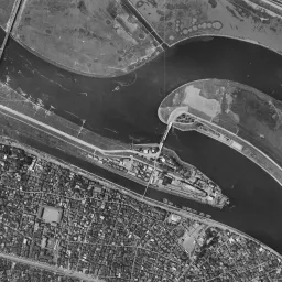
In 1974-78 the rows of residential buildings keep the same shape as in the previous era. In the lower left a large white rectangular site appears, shaped like a sports ground. Even if you move on through 1979-83, 1984-86 and 1987-90, the plateau hardly changes. The change is in the low ground below the bluff. Large buildings increase around the station, and the roofs grow denser with each era. In 1985 the Saikyo Line opened, and the Tohoku and Joetsu Shinkansen also came to pass through the ward. On the floodplain of the Arakawa River at the top edge, a white facility of geometric shape appears from 1979-83. In this era only the right half is tinted bluish. 1987-90 shows the site about 10 years before rebuilding began; the diagonal rows of buildings are still in line, and the trees grown between the buildings stitch the rows of roofs with green.
Toward a district of courtyards
Rebuilding began in 2000 because of aging and earthquake-resistance issues, and the first block was completed in 2006 and the next two blocks in 2010. The new residential buildings follow streets running lengthwise and crosswise that inherit the road framework of the old danchi, and they are placed so as to loosely surround courtyards. Terraces and entrances are placed on the sides facing the streets, a design that brings the buildings closer to the street. The row of ginkgo trees and the flowering tree garden were kept, and the bricks of the clothing depot's foundations that were dug up were used for benches in the danchi. Of the old danchi's residential buildings, four including a star house were preserved, and in 2019 they became the first danchi buildings to be registered as national Tangible Cultural Properties. In September 2023, an exhibition facility of UR that conveys the history of apartment housing opened beside them.
In today's photograph, many of the diagonal rows of long, narrow buildings have been replaced by large blocks of buildings holding courtyards. Even so, the blocks face the same diagonal as in the old eras, and a few long, narrow buildings can still be seen toward the north. The band of woods along the bluff also remains as a green strip west of the station. East of the station tall buildings stand densely, on the floodplain of the Arakawa River at the top edge shapes that look like baseball fields line up, and in the lower left there is a stadium with a red running track. The low ground below the bluff is close to the Arakawa River, and if you open the Kita Ward hazard map, you can see how the assumed flooding differs between the low ground east of the station and the plateau to the west.