Suidobashi (Former Army Arsenal) about 60 years ago and today
Then and now
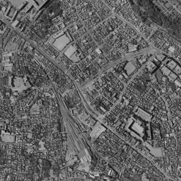
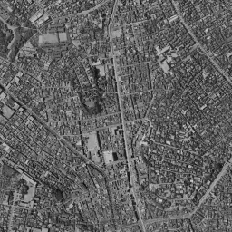
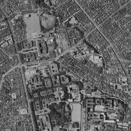
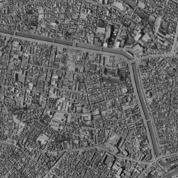
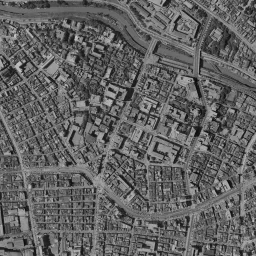
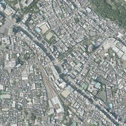
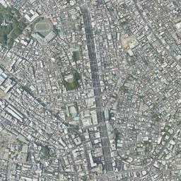
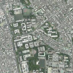
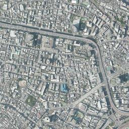
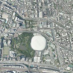
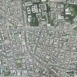
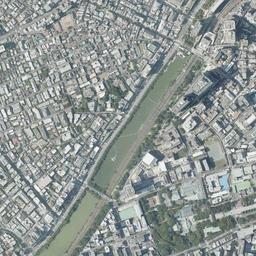
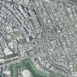
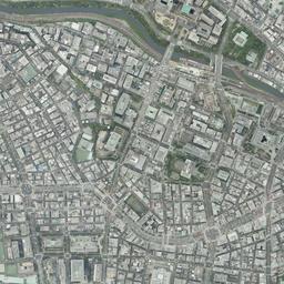


Nearby single photograph taken: June 26, 1963 (0.5 km from this spot)
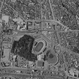
What to compare in this era: East of the garden, the oval track toward the north and the fan-shaped stadium in the southeast sit side by side. In today's photograph, the position where the track was is under the roof of the dome
Controls: drag to move / right-drag to rotate and tilt / scroll while holding ⌘ or Ctrl to zoomControls: slide with two fingers to move / pinch to zoom / drag two fingers up or down to tilt
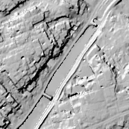
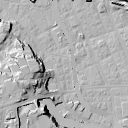
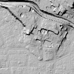
Note: the 3D elevation data is based on current surveys, not on the terrain at the time of the photograph. Elevation tiles: processed from GSI Tiles
The 3D view could not be loaded. Check your connection and try again.
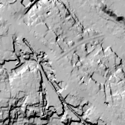
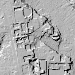
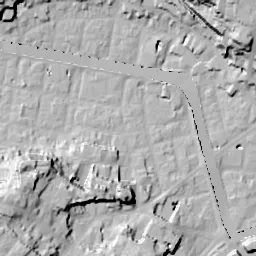
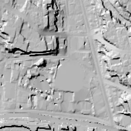
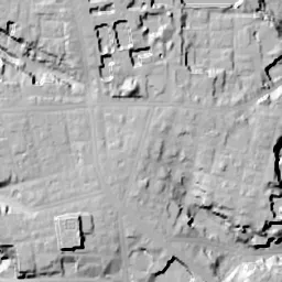
Note: the terrain shading is based on current surveys, not on the terrain at the time of the photograph. Hillshade map: processed from GSI Tiles
Note: the map is today's, not a map from the time of the photograph. Map: © OpenStreetMap contributors
Source: processed from GSI Tiles (aerial photographs by era / latest nationwide photographs / single photographs)
Explore this area on the mapMove the map to compare the surroundings then and now as well.
Overlay and compare the 1961-1969 aerial photograph and today's photograph of the Suidobashi (Former Army Arsenal) area, Tokyo. All photographs are published by the Geospatial Information Authority of Japan (GSI).
Eras of photographs for this location
For the Suidobashi (Former Army Arsenal) area, aerial photographs from the following eras can be compared.
The old photographs of this location cover 7 eras from c. 1936-1942 to 1987-1990; as of 2026, the newest photograph, 1987-1990, is 37 years ago.There are no photographs of this location from after that until today. The differences between eras are summarized in the guide to aerial photograph eras.
Coverage for each era differs by region. Only the eras that actually have photographs of this location are listed here.
Elevation of this location
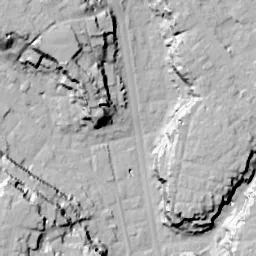
The elevation (above sea level) near Suidobashi Station is 4.4 m (source: GSI elevation API). Elevation profiles running east-west and north-south through this location are also shown.
Profile positions (vertical green line = north-south / horizontal blue line = east-west)
Elevation is the value at the ground surface (even where a station is underground or elevated, the value is for the ground surface). Elevation is only one factor in disaster preparedness. Check actual risks such as flooding on the Hazard Map Portal Site and the hazard maps published by local governments.
Elevation tiles for the profiles: processed from GSI Tiles
Access by rail
Suidobashi Station is served by the following lines.
- Toei Mita Line
- JR East Chuo Line
Source of line information: processed from National Land Numerical Information (Railway Data / Ministry of Land, Infrastructure, Transport and Tourism).
Change seen in the share of built-up area
This compares land use in 1976 and 2021. The share of built-up area within 500 m changed from 68% to 88%. Among the locations on this site, the spread of built-up area here is in the middle. The bar below shows where this location falls in the distribution across the locations on this site.
Source: processed from National Land Numerical Information (Land Use Subdivision Mesh / 1976 and 2021 / Ministry of Land, Infrastructure, Transport and Tourism). The texture value (amount of fine detail) of the photographs changed from 16.9 to 38.3. This is a mechanical comparison between photographs and includes differences from the shooting season and from black and white versus color, so treat it only as a rough guide.
Official land prices over time
The official land price (Chika Koji) standard site nearest to this location is "1-107-1 Hongo, Bunkyo Ward, Tokyo" (about 401 m in a straight line; use: Residential). The official prices per square meter at this standard site from 2013 to 2026 are shown below. The 2026 official price is 2,900,000 yen.
View as a table
| Year | Official price |
|---|---|
| 2013 | 1,100,000 yen |
| 2014 | 1,140,000 yen |
| 2015 | 1,190,000 yen |
| 2016 | 1,270,000 yen |
| 2017 | 1,360,000 yen |
| 2018 | 1,460,000 yen |
| 2019 | 1,600,000 yen |
| 2020 | 1,770,000 yen |
| 2021 | 1,770,000 yen |
| 2022 | 1,840,000 yen |
| 2023 | 1,950,000 yen |
| 2024 | 2,120,000 yen |
| 2025 | 2,400,000 yen |
| 2026 | 2,900,000 yen |
Source: processed from National Land Numerical Information (Land Price Publication Data / Ministry of Land, Infrastructure, Transport and Tourism). Official land prices are values published for standard sites as of January 1 each year and do not show the transaction price of any particular piece of land. The selection and location of standard sites may be reviewed from year to year.
Nearby locations
Sorted by distance from Suidobashi. Comparing them together shows how the same area has changed over time.
Select a marker on the map to see the location name and a link to it.
Locations with the same origins
Towns in the same category as Suidobashi (Former factory site), chosen from other regions. You can compare what they share in land use and town layout.
Select a marker on the map to see the location name and a link to it.
Articles that feature this location
Recently viewed towns
This history is saved only on your device and is not sent to any server. Depending on your browser settings, it may be deleted automatically if you do not visit for a while (it is less likely to be deleted if you use the site as an app).
Why not look at how another town has changed?
History of Suidobashi (Former Army Arsenal)
In a corner north of Suidobashi with the Kanda River at its back, a daimyo garden from the early Edo period and a large stadium with a white roof sit next to each other. The site of the Mito family residence that held the garden was occupied by an army weapons factory from the Meiji era into the 1930s. The aerial photographs show the scene after that factory left. There is no era that shows the factory itself. If you follow the photographs, you can see the process in which only the black woods of the garden stay still, a stadium and an oval track appear on the open ground to its east, and eventually a white roof sits on the position of the track.
The residence garden and the weapons factory
The garden is said to have been built at the residence in 1629 (Kan'ei 6) by Yorifusa of the Mito Tokugawa family and completed in the time of the second lord, Mitsukuni. The name Korakuen was given from the thinking of Zhu Shunshui, a Confucian scholar of the Ming whom Mitsukuni consulted. In the Meiji era the site of the residence came under the Ministry of Military Affairs, later the Ministry of the Army, the Tokyo Army Arsenal was built, and the garden was kept as a garden attached to the arsenal. While the whole residence turned into a factory, only the pond and the artificial hill were protected.
The Kanda Aqueduct, which drew spring water from Inokashira Pond, filled the pond of the garden. The aqueduct passed through the residence and crossed the Kanda River on a raised water channel called Suidobashi (the name means waterworks bridge), the same name as the station, distributing water to the town of Edo. Even after it ended its role as drinking water in 1901, the aqueduct continued to be used as industrial water for the arsenal, and it was abolished in 1933 in step with the relocation of the arsenal. The channel through which the aqueduct passed keeps its form as a stream in the garden.
The turning point was the Great Kanto Earthquake of 1923. Most of the arsenal's facilities burned, and in the garden too, stone bridges and rock arrangements fell. In 1927 it was decided to move the arsenal to Kokura in Kyushu, and the garden passed to the Ministry of Education. According to materials of the Tokyo Metropolitan Government, the relocation of the arsenal was completed in December 1936, and the City of Tokyo took over the management of the garden. In the same December 1936, the Korakuen Stadium company was founded as a company to build and run a stadium for professional baseball.
In terms of terrain, this area lies on low land along the Kanda River, and only the east side reaches the edge of the Hongo Plateau and is one step higher. The hazard maps of Bunkyo Ward and the Tokyo Metropolitan Government respectively show as assumptions what would happen to the low land along the river in heavy rain or shaking.
The open ground east of the garden
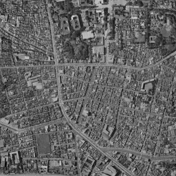
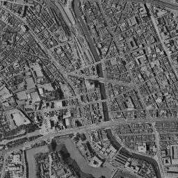
In the photograph from around 1936-42, slightly left of the center of the frame, the woods of the garden sink as a black mass. Its east side is brightly open ground, where lines of roads and square traces that seem to be building foundations remain faintly, with only roofs scattered here and there. It is thought to be the site after the factory buildings were removed. However, the grain is coarse, and even if you zoom in, the oval of a stadium cannot be read clearly. Toward the bottom of the center, the river and tracks run side by side east-west, and on the plateau side to the right, fine rows of houses are packed in black. In the upper right of the frame there is a wide compound where large buildings line up around courtyards. In the lower left corner, the water surface of a moat extends diagonally and joins the river beyond. The whiteness of the open ground stands out all the more, set between the blackness of the rows of houses that fill the surroundings.
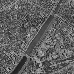
In the 1945-50 photograph, an oval stadium appears clearly east of the garden. It is Korakuen Stadium, which opened in September 1937. According to the records of the operating company, at the end of the war the stadium became an anti-aircraft gun position and the field turned into a vegetable garden. In November 1945 it was requisitioned by the occupation forces, and it was released the next year. In the war damage of the same year, 1945, a hall and gates of the garden also burned. In the photograph the lower half of the frame is washed out white, and the fine shading of the rows of houses can hardly be read. Only the woods of the garden and the oval of the stadium keep their outlines within that white expanse.
An oval track and a fan-shaped stadium
In 1961-69, two sports venues line up east of the garden. The one toward the north is a long, narrow oval track, which corresponds to the Korakuen Velodrome, opened in October 1949. To its southeast, on the side near the station, there is a stadium opening in a fan shape, with the color of the ground divided between infield and outfield. South of the two venues, large square buildings line up, and the contrast between the black woods of the garden and the white venues is sharpest in this era. The lower half of the frame, which was washed out white in 1945-50, is also filled with the fine shading of roofs in this era.
Bright green covers the inside of the oval, with several black round dots scattered on it. This is the figure that appears in the 1974-78 photograph. The metropolitan keirin races were abolished in 1973, and the inside of the track was used as a swimming pool in summer and a golf practice range in winter. The outfield of the stadium is green too, and in 1976 artificial turf for baseball was laid for the first time in Japan. In 1979-83, a long, narrow building with a white roof is added on the east side of the stadium. The green of the outfield and the brown of the infield mark off the fan shape sharply, and the inside of the oval is still green. In 1984-86 the oval track still keeps the form of a white line, but the venue closed in 1984.
A white roof on the site of the track
In the 1987-90 photograph, a white, round dome roof sits where the oval track was. It is Tokyo Dome, which opened on March 17, 1988. The fan-shaped stadium in the southeast ended its role in 1987, and its position has turned into an irregular gray surface that looks partway through demolition. The woods of the garden have not changed their form in this era either.
In today's photograph too, the composition in which the white roof of the dome and the green of the garden sit side by side is the same. A large building stands on the position of the old stadium, and the surroundings of the dome are filled with paving and buildings. The wide compound in the upper right of the frame and the water surface of the moat extending diagonally in the lower left are in the same places as in the photograph from around 1936-42. Through the seven eras and today's photograph, only the land east of the garden was largely replaced. Inside the garden, a monument to the arsenal remains, modeled on the shape of the former residence, and something said to be a part of a machine for making ammunition is also placed there. After the times of the residence and the factory, a stadium was built east of the garden. During all that time, only the outline of the garden never moved once.