Hikarigaoka (Former Grant Heights) about 60 years ago and today
Then and now
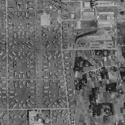
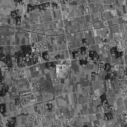
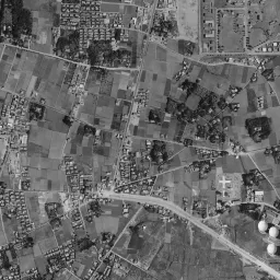
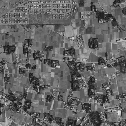
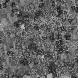
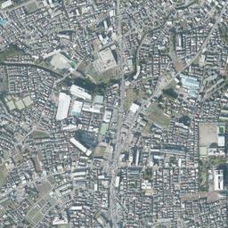
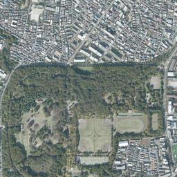
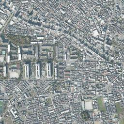
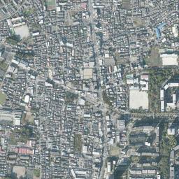
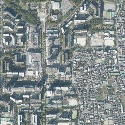
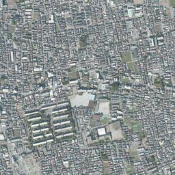
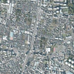
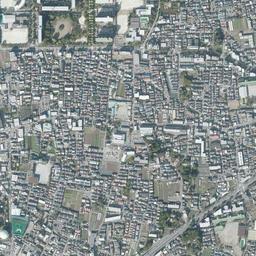
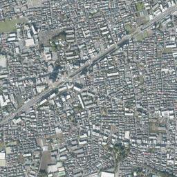
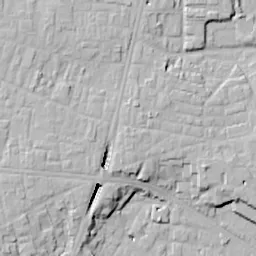
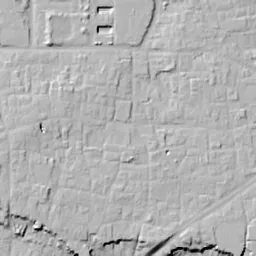
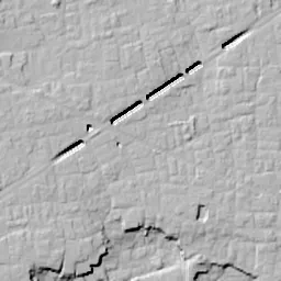


Center photograph taken: 1961-66
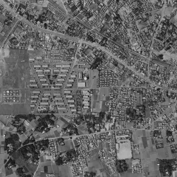
What to compare in this era: Comparing the small houses lined up inside the housing with the fields and uneven rows of houses outside, you can see the difference in the shape of the lots
Controls: drag to move / right-drag to rotate and tilt / scroll while holding ⌘ or Ctrl to zoomControls: slide with two fingers to move / pinch to zoom / drag two fingers up or down to tilt
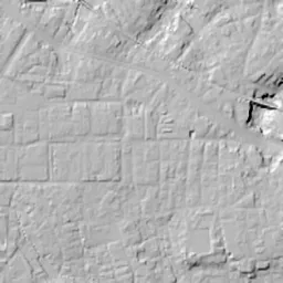
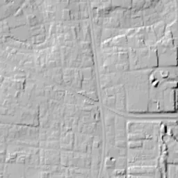
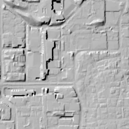
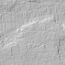
This 3D terrain is today's. The mismatch when you overlay an old photograph is the evidence of the land development that cut hills and filled valleys.
Note: the 3D elevation data is based on current surveys, not on the terrain at the time of the photograph. Elevation tiles: processed from GSI Tiles
The 3D view could not be loaded. Check your connection and try again.
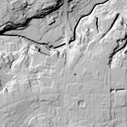
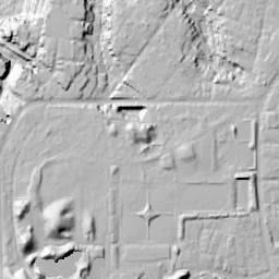
Note: the terrain shading is based on current surveys, not on the terrain at the time of the photograph. Hillshade map: processed from GSI Tiles
Note: the map is today's, not a map from the time of the photograph. Map: © OpenStreetMap contributors
Source: processed from GSI Tiles (aerial photographs by era / aerial photographs by fiscal year / latest nationwide photographs / single photographs / survey periods of the photographs)
Explore this area on the mapMove the map to compare the surroundings then and now as well.
Overlay and compare the 1961-1969 aerial photograph and today's photograph of the Hikarigaoka (Former Grant Heights) area, Tokyo. All photographs are published by the Geospatial Information Authority of Japan (GSI).
Eras of photographs for this location
For the Hikarigaoka (Former Grant Heights) area, aerial photographs from the following eras can be compared.
The old photographs of this location cover 8 eras from c. 1936-1942 to FY2007; as of 2026, the newest photograph, FY2007, is 18-19 years ago.There are no photographs of this location from after that until today. The differences between eras are summarized in the guide to aerial photograph eras.
Coverage for each era differs by region. Only the eras that actually have photographs of this location are listed here.
Elevation of this location
The elevation (above sea level) near Hikarigaoka Station is 36.6 m (source: GSI elevation API). Elevation profiles running east-west and north-south through this location are also shown.
Profile positions (vertical green line = north-south / horizontal blue line = east-west)
Elevation is the value at the ground surface (even where a station is underground or elevated, the value is for the ground surface). Elevation is only one factor in disaster preparedness. Check actual risks such as flooding on the Hazard Map Portal Site and the hazard maps published by local governments.
Elevation tiles for the profiles: processed from GSI Tiles
Access by rail
Hikarigaoka Station is served by the following lines.
- Toei Oedo Line
Source of line information: processed from National Land Numerical Information (Railway Data / Ministry of Land, Infrastructure, Transport and Tourism).
Change seen in the share of built-up area
This compares land use in 1976 and 2021. The share of built-up area within 500 m changed from 76% to 83%. Among the locations on this site, the spread of built-up area here is on the small side (bottom 20-40%). The bar below shows where this location falls in the distribution across the locations on this site.
Source: processed from National Land Numerical Information (Land Use Subdivision Mesh / 1976 and 2021 / Ministry of Land, Infrastructure, Transport and Tourism). The texture value (amount of fine detail) of the photographs changed from 15.4 to 43.4. This is a mechanical comparison between photographs and includes differences from the shooting season and from black and white versus color, so treat it only as a rough guide.
Official land prices over time
The official land price (Chika Koji) standard site nearest to this location is "5-5308-14 and adjacent lots, Tagara, Nerima Ward, Tokyo" (about 401 m in a straight line; use: Residential). The official prices per square meter at this standard site from 2015 to 2026 are shown below. The 2026 official price is 491,000 yen.
View as a table
| Year | Official price |
|---|---|
| 2015 | 349,000 yen |
| 2016 | 355,000 yen |
| 2017 | 362,000 yen |
| 2018 | 373,000 yen |
| 2019 | 388,000 yen |
| 2020 | 401,000 yen |
| 2021 | 397,000 yen |
| 2022 | 402,000 yen |
| 2023 | 415,000 yen |
| 2024 | 433,000 yen |
| 2025 | 460,000 yen |
| 2026 | 491,000 yen |
Source: processed from National Land Numerical Information (Land Price Publication Data / Ministry of Land, Infrastructure, Transport and Tourism). Official land prices are values published for standard sites as of January 1 each year and do not show the transaction price of any particular piece of land. The selection and location of standard sites may be reviewed from year to year.
Nearby locations
Sorted by distance from Hikarigaoka. Comparing them together shows how the same area has changed over time.
Select a marker on the map to see the location name and a link to it.
Locations with the same origins
Towns in the same category as Hikarigaoka (New town), chosen from other regions. You can compare what they share in land use and town layout.
Select a marker on the map to see the location name and a link to it.
Articles that feature this location
Recently viewed towns
This history is saved only on your device and is not sent to any server. Depending on your browser settings, it may be deleted automatically if you do not visit for a while (it is less likely to be deleted if you use the site as an app).
Why not look at how another town has changed?
History of Hikarigaoka (Former Grant Heights)
Hikarigaoka, in the northern part of Nerima Ward, is a town of danchi (public housing complexes) and a park spreading over the Musashino Plateau. Over a little more than 80 years this land has changed its use four times: from fields to an army airfield, to family housing for the US military, to grassland, and then to the danchi. In every era the replacement took place within almost the same frame. The airfield set the frame, and according to Nerima Ward, the single road running north-south through the town is the trace of the runway of Narimasu Airfield. In the era of the postwar housing, it was also a place cut off from the surrounding town, so much so that the ward newsletter describes it as an area of extraterritoriality.
The fields before the airfield
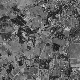
The c. 1936-42 photograph is one taken before the airfield was completed. Small fields divided into strips and squares fill almost the whole frame, and the woods around homesteads are scattered here and there as black masses. Until the early 1930s this area was a farming village called Kami-Nerima Village, and the photograph preserves that appearance as it was. One thin road runs east to west toward the top, and in the upper right corner rows of houses continue along the road. The center catches the eye. The field lots are hard to read only there, and a whitish, bright surface spreads in a shape close to an oval. Its tone clearly differs from the dark fields on the north side, but you cannot tell from the photograph alone whether it is the start of development or a difference of crops or season. It is certain that at this point neither the straight line of a runway nor rows of buildings appear yet.
The airfield was built by the army in 1943 for the defense of the capital, on land spanning Doshida, Tagara and Takamatsu. About 80 households were evicted at that time. The ward newsletter carries a recollection that nearby residents pulled military aircraft to the revetments that protected the aircraft from air raids. From completion to the end of the war there were only about two years.
Housing with the runway at its core
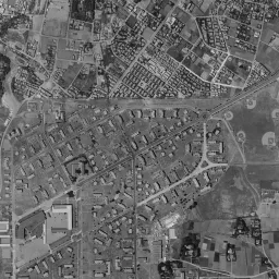
In the 1945-50 photograph, a long white north-south rectangle appears in the center where fields had spread, and a single axis runs vertically through its middle. Inside the rectangle a grid of roads has been drawn, but buildings are still sparse. On the north side, several streets draw curves, and small houses begin to stand in rows. In the upper right there is a corner where long, narrow buildings of the same shape line up neatly. From the east of the frame, a thin line runs into the right of the center. Soon after the end of the war, a railway to carry construction materials for the housing was laid from Kami-Itabashi Station, and this line is thought to be that railway. Outside the rectangle there are still fields and homestead woods.
The housing was completed in June 1948 and was called Grant Heights, after Grant, the 18th President of the United States. In the 1961-69 photograph, the inside of the rectangle is filled with small houses. Houses that look single-story line up regularly along the north-south streets, and similar houses continue along the curving streets on the north side too. Toward the northeast of the center there are a wide rectangle like a sports ground and large buildings, and the row of long, narrow buildings in the upper right also remains. Outside the housing, small clusters of houses increase among the fields, and in the lower left corner several white round storage tanks line up. In the photograph of this era you can clearly see that the shape of the lots differs inside and outside the housing.
In 1959 the relocation of the housing to Yokota Air Base and elsewhere began, and in time a movement demanding its return arose. In 1968 the US military agreed to the return, and in the following year, 1969, the area was named "Hikarigaoka" as a name symbolizing a town of greenery and sunshine. After a first return in 1972, about 182 hectares were returned in full on September 30, 1973.
Ten years covered with grass
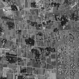
1974-78 shows the former site shortly after its return. In the southern half of the rectangle the houses have almost disappeared, and only the grid of the old streets remains as lines on pale brown bare ground. Vacant land stands out in the northern half too, and at the upper left edge there is an oval running track. In the upper right four high-rise slab-shaped residential buildings line up. The band along the top edge was taken on a different day and appears purplish. The surroundings are already city area, and fields remain only as fragmented lots.
By 1979-83 the former site has turned an even greenish brown. Grass and low shrubs spread out, and the grid of the old streets shows through. After the Tokyo Metropolitan Government's development plan was adopted as an urban planning decision in 1979, construction of a large white rectangle is under way in a corner toward the north. It took about ten years after the return before the site of the housing became a town.
Dividing between the danchi and the park
The shape of the town begins to show in 1984-86. A wide road crosses east to west just north of the location, and high-rise residential buildings line up west and southwest of it. The northern zone has become a park with woods, lawns and an oval track, and part of it opened in December 1981 as the Tokyo Metropolitan Hikarigaoka Park. From the middle of the frame, the shadow of a thin, tall structure stretches in a single streak to the northwest. It is thought to be the chimney of the waste incineration plant completed in October 1983. In the same year, 1983, residents began moving into the danchi in Hikarigaoka 5-chome.
In 1987-90, high-rise residential buildings fill both sides of the north-south axis that was the runway, leaving no gaps. The axis has been kept as the backbone of the town, and the woods of the park to the north have grown denser. Inside the park an oval track and a square plaza sit side by side, and along the western and southern edges of the group of residential buildings several square buildings with white flat roofs are placed. In 1991 Toei Subway Line 12, later the Oedo Line, opened from Nerima to Hikarigaoka.
In today's photograph, the park to the north is covered with dense woods, keeping the outline of a rectangle with rounded corners, with the square plaza and the oval track contained inside it. According to the ward newsletter, the trees at the time of the opening had just been planted and were small, and even in the 1984-86 photograph the woods were only clustered here and there, but now the tree crowns join up and the ground can hardly be seen. Between the high-rise buildings at the center, a north-south green strip runs straight through. The area occupied by the park and the danchi almost overlaps the area left vacant as the former site in 1974-78, and the border with the fine rows of houses around it has become the edge of the town as it is. The white round storage tanks in the lower left and the four residential buildings in the upper right continue to appear in the same places from the old eras on.