Akita Port (Tsuchizaki) about 60 years ago and today
Then and now
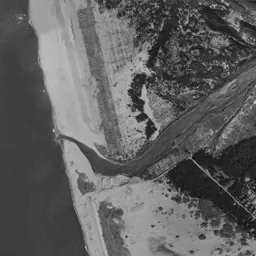


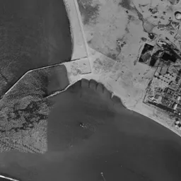


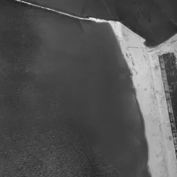




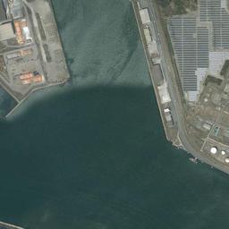


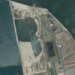








Center photograph taken: 1962-67
What to compare in this era: Look for the long, narrow sandbar in the water cutting in diagonally from the lower left. You can also confirm that the port side is only bright sandy surfaces and round storage tanks placed here and there, with nothing shaped like blocks
Controls: drag to move / right-drag to rotate and tilt / scroll while holding ⌘ or Ctrl to zoomControls: slide with two fingers to move / pinch to zoom / drag two fingers up or down to tilt
Note: the 3D elevation data is based on current surveys, not on the terrain at the time of the photograph. Elevation tiles: processed from GSI Tiles
The 3D view could not be loaded. Check your connection and try again.
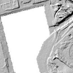
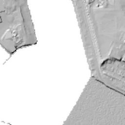
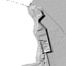
Note: the terrain shading is based on current surveys, not on the terrain at the time of the photograph. Hillshade map: processed from GSI Tiles
Note: the map is today's, not a map from the time of the photograph. Map: © OpenStreetMap contributors
Source: processed from GSI Tiles (aerial photographs by era / latest nationwide photographs / single photographs)
Explore this area on the mapMove the map to compare the surroundings then and now as well.
Overlay and compare the 1961-1969 aerial photograph and today's photograph of the Akita Port (Tsuchizaki) area, Akita Prefecture. All photographs are published by the Geospatial Information Authority of Japan (GSI).
Eras of photographs for this location
For the Akita Port (Tsuchizaki) area, aerial photographs from the following eras can be compared.
The old photographs of this location cover 2 eras from 1961-1969 to 1974-1978; as of 2026, the newest photograph, 1974-1978, is 51 years ago.There are no photographs of this location from after that until today. The differences between eras are summarized in the guide to aerial photograph eras.
Coverage for each era differs by region. Only the eras that actually have photographs of this location are listed here.
Elevation of this location
The elevation (above sea level) at the reference point of Akita Port (Tsuchizaki) is 3.1 m (source: GSI elevation API). Elevation profiles running east-west and north-south through this location are also shown.
Profile positions (vertical green line = north-south / horizontal blue line = east-west)
Elevation is the value at the ground surface (even where a station is underground or elevated, the value is for the ground surface). Elevation is only one factor in disaster preparedness. Check actual risks such as flooding on the Hazard Map Portal Site and the hazard maps published by local governments.
Elevation tiles for the profiles: processed from GSI Tiles
Access by rail
One of the nearest stations to Akita Port (Tsuchizaki) is Tsuchizaki Station, served by the following lines.
- JR East Ou Line
Source of line information: processed from National Land Numerical Information (Railway Data / Ministry of Land, Infrastructure, Transport and Tourism).
Change seen in the share of built-up area
This compares land use in 1976 and 2021. The share of built-up area within 500 m changed from 30% to 49%. Among the locations on this site, the spread of built-up area here is in the middle. The bar below shows where this location falls in the distribution across the locations on this site.
Source: processed from National Land Numerical Information (Land Use Subdivision Mesh / 1976 and 2021 / Ministry of Land, Infrastructure, Transport and Tourism). The texture value (amount of fine detail) of the photographs changed from 17.9 to 30.5. This is a mechanical comparison between photographs and includes differences from the shooting season and from black and white versus color, so treat it only as a rough guide.
Official land prices over time
The official land price (Chika Koji) standard site nearest to this location is "17-11 and adjacent lots, Tsuchizakiminato Aisome-machi Oyachi, Akita, Akita Prefecture" (about 1.6 km in a straight line; use: Residential). The official prices per square meter at this standard site from 1995 to 2026 are shown below. The 2026 official price is 27,400 yen.
View as a table
| Year | Official price |
|---|---|
| 1995 | 45,500 yen |
| 1996 | 47,000 yen |
| 1997 | 48,500 yen |
| 1998 | 49,300 yen |
| 1999 | 50,000 yen |
| 2000 | 50,500 yen |
| 2001 | 50,500 yen |
| 2002 | 50,500 yen |
| 2003 | 50,500 yen |
| 2004 | 49,200 yen |
| 2005 | 46,500 yen |
| 2006 | 44,000 yen |
| 2007 | 41,500 yen |
| 2008 | 39,500 yen |
| 2009 | 37,500 yen |
| 2010 | 35,500 yen |
| 2011 | 33,500 yen |
| 2012 | 31,600 yen |
| 2013 | 29,900 yen |
| 2014 | 28,500 yen |
| 2015 | 27,400 yen |
| 2016 | 26,400 yen |
| 2017 | 25,800 yen |
| 2018 | 25,400 yen |
| 2019 | 25,400 yen |
| 2020 | 25,400 yen |
| 2021 | 25,400 yen |
| 2022 | 25,400 yen |
| 2023 | 25,600 yen |
| 2024 | 26,100 yen |
| 2025 | 26,700 yen |
| 2026 | 27,400 yen |
Source: processed from National Land Numerical Information (Land Price Publication Data / Ministry of Land, Infrastructure, Transport and Tourism). Official land prices are values published for standard sites as of January 1 each year and do not show the transaction price of any particular piece of land. The selection and location of standard sites may be reviewed from year to year.
Nearby locations
Sorted by distance from Akita Port. Comparing them together shows how the same area has changed over time.
Select a marker on the map to see the location name and a link to it.
Locations with the same origins
Towns in the same category as Akita Port (Reclaimed land), chosen from other regions. You can compare what they share in land use and town layout.
Select a marker on the map to see the location name and a link to it.
Recently viewed towns
This history is saved only on your device and is not sent to any server. Depending on your browser settings, it may be deleted automatically if you do not visit for a while (it is less likely to be deleted if you use the site as an app).
Why not look at how another town has changed?
History of Akita Port (Tsuchizaki)
The frame of Akita Port (Tsuchizaki) is split left and right by a single stretch of water running diagonally. The water of the port and sandy shores lie on the left, the streets of Tsuchizaki lie on the right, and along the boundary between them oil facilities and cargo-handling buildings form a long, narrow band. The shape of the port and the town lined up back to back is the framework of this frame through the three eras.
Tsuchizaki was a port town used as the outer port of the Kubota Domain in the Edo period, where kitamaebune trading ships came and went loaded with rice and timber. Because the port used the mouth of the Omono River as it was, it was constantly troubled by sediment carried from upstream and by the winter seasonal winds. When a floodway was opened downstream in the 1930s and the main stream moved south, the old river channel left on the Tsuchizaki side came to be used as the port's water. The long, narrow water crossing the frame diagonally is that channel; the town was placed on the east bank, and cargo handling and industry on the west bank. Only two eras can be chosen on the older side, 1961-69 and 1974-78, so you read what moved in the ten-odd years between them from three photographs including today's.
Shores of sand and storage tanks
The 1961-69 photograph is black and white, and the texture of the frame is completely different between the port side on the left and the town side on the right. On the port side, bright sandy surfaces take up a wide area, round storage tanks are placed here and there on them, and in the middle there is a corner where small buildings and tanks are tightly clustered. These are oil-handling facilities. The water cuts deep in diagonally from the lower left, and inside it a long, narrow sandbar juts out, extending as if dividing the water in two. Offshore, a white sandy beach along the coastline and a long, narrow structure crossing the water diagonally also appear. On the north side of the port, a dark mass of woods continues as a band, standing where it takes the wind blowing in from the sea. The side with nothing but sand, water and woods was the hinterland of the port in this period.
The fact that oil facilities lined that band of sand was the reason for the air raid of the night of August 14 to 15, 1945. The target was the refinery facilities next to the port, and it is remembered as one of the last air raids on the Japanese mainland, carried out on the night just before news of the end of the war arrived. The era of the photograph is ten-odd to twenty-odd years after that night.
Streets and stripes of ridges between paddies
The right side is dense with information. Rows of houses with small roofs continue without gaps, a railway and roads running north-south pass through the town, and there is a corner where the tracks split into many sidings. Tsuchizaki is also the name of the nearest station, and that the port and the railway were linked by freight can also be read from another line extending in a gentle curve toward the industrial area. Between the port side and the town side, a wide pale surface that cannot be told apart as fields or vacant land remains, crossed diagonally by narrow roads. It was a period when the places where people lived and the places where cargo was handled were still well apart.
In the upper half of the frame, rice paddies spread in the middle, with sand dunes and windbreak woods on the left and the rows of houses of Tsuchizaki continuing on the right. They are divided into large rectangles, and inside the lots thin stripes of ridges line up. The fact that right behind the port were rice paddies is the biggest highlight of this era.
The band where land development comes in
Switching to 1974-78 brings color, and the places that moved and the places that did not are seen separately. On the port side the storage tanks have been replaced, two large white circles appear, and below them many small round tanks line up tightly. Around them, bright beige bare ground with neither grass nor buildings spreads in a band, with buildings standing sparsely in lots divided by straight lines. The water's edge is lined with straight seawalls, and ships float on the water. In the vacant land between the port and the town, a row of buildings with red roofs has come in, and a corner where the tracks split in many curves has also appeared.
On the other hand, the paddies remain almost without gaps. In the upper half of the frame, yellow, green and brown strips line up, and both the shape of the lots and the direction of the ridges match 1961-69. Only the port side was replaced in ten-odd years, and the paddies behind it were left as they were. In this frame, the clock runs at different speeds on the left and right. Note that this photograph is made by joining photographs taken at different times, and rectangular seams with different color tones remain on the left side and the bottom, so they need to be read apart from differences in the color of the ground.
A hinterland lined with warehouses
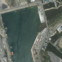
In the latest aerial photograph, almost none of the paddies in the upper half remain. They have been replaced by warehouses and factories with large blue, white and gray roofs, lined up neatly with wide pavement and parking lots. The direction still matches, the lots of paddies becoming rows of warehouses as they were, suggesting that the framework of the blocks was inherited from the farmland era. The corner that was dark woods in 1961-69 has been left green, with a dirt sports ground inside it.
On the port side, a wide gray-blue surface with thin stripes lined up neatly has been placed on the surface that was bare ground in 1974-78, and white round storage tanks line up along the same band. A large white ship is berthed at the quay. Ferry routes linking Hokkaido and Honshu call at Akita Port, and it is used as a port handling both freight and passengers. In the lower left of the frame, long, narrow buildings with reddish-brown roofs line up in parallel on the sandy surface, and black heaps are also piled up. The streets on the right are filled without gaps, and the corner where the tracks split into sidings is in the same band in all three photographs.
The ground in this frame is almost the same height wherever it is measured. The center is 3.1 m, the north 3.5 m, the south 3.8 m, and the east and west both 2.9 m, so the difference between the highest and lowest points is less than 1 m. The port side and the town side are equally low, and it is not a landform that rises in steps from the water's edge inland. On the low flat ground formed behind the sand dunes, the port, the town and the paddies all line up on the same surface. The City of Akita's hazard map shows in map form how far water of each assumed height would reach.
The value per square meter starts at 45,500 yen in 1995, and 50,500 yen, which continued from 2000 to 2003, is the highest on record up to the 2026 publication. It then kept falling, and 25,400 yen from 2018 to 2022 is the cheapest up to the 2026 publication; 2025 was 26,700 yen. In the 2026 publication it is 27,400 yen. The referenced residential land is in Tsuchizakiminato Aisome-machi, about 1.6 km from the location. While the port facilities were replaced and the paddies behind them turned into warehouses, the residential value fell to about half of its highest.
The memory of the port town also remains outside the photographs. The hikiyama float event of the Tsuchizaki Shinmei Shrine Festival, which moves through the town every July, is designated a national Important Intangible Folk Cultural Property, and the ties among the neighborhoods that prospered through ships and cargo are carried on in the form of the event.