Sendai Port (Sendai Shinko) about 60 years ago and today
Then and now
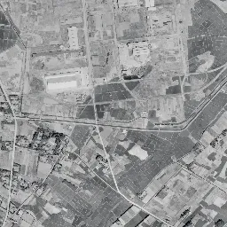
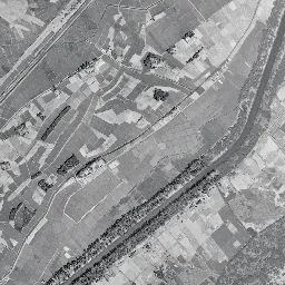
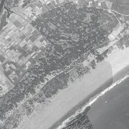
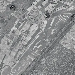
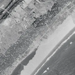
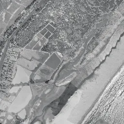
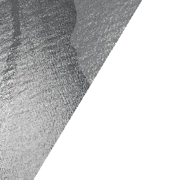
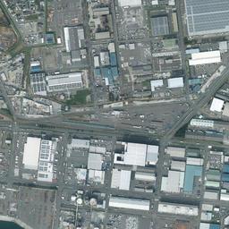
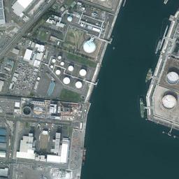
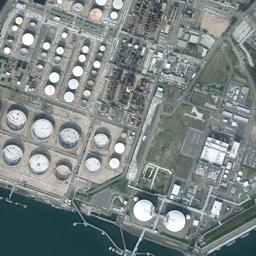
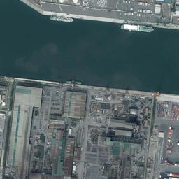
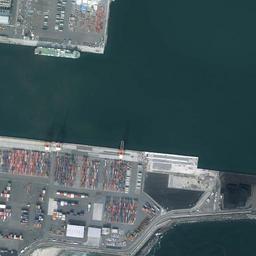
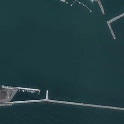
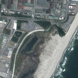
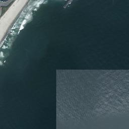
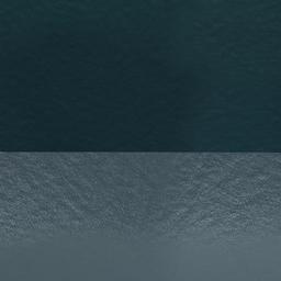




Center photograph taken: 1961-68
What to compare in this era: Notice that the positions of the pine woods and the fields have hardly moved since the previous era. There is not yet a single channel or pier.
Controls: drag to move / right-drag to rotate and tilt / scroll while holding ⌘ or Ctrl to zoomControls: slide with two fingers to move / pinch to zoom / drag two fingers up or down to tilt
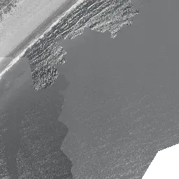
Note: the 3D elevation data is based on current surveys, not on the terrain at the time of the photograph. Elevation tiles: processed from GSI Tiles
The 3D view could not be loaded. Check your connection and try again.
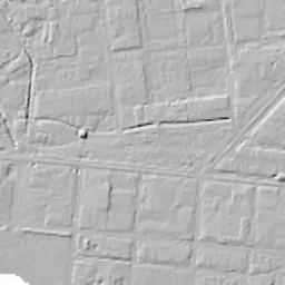
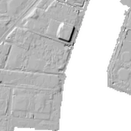
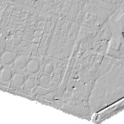
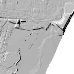
Note: the terrain shading is based on current surveys, not on the terrain at the time of the photograph. Hillshade map: processed from GSI Tiles
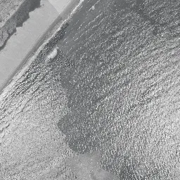
Note: the map is today's, not a map from the time of the photograph. Map: © OpenStreetMap contributors
Source: processed from GSI Tiles (aerial photographs by era / latest nationwide photographs / single photographs)
Explore this area on the mapMove the map to compare the surroundings then and now as well.
Overlay and compare the 1961-1969 aerial photograph and today's photograph of the Sendai Port (Sendai Shinko) area, Miyagi Prefecture. All photographs are published by the Geospatial Information Authority of Japan (GSI).
Eras of photographs for this location
For the Sendai Port (Sendai Shinko) area, aerial photographs from the following eras can be compared.
The old photographs of this location cover 4 eras from 1945-1950 to 1984-1986; as of 2026, the newest photograph, 1984-1986, is 42 years ago.There are no photographs of this location from after that until today. The differences between eras are summarized in the guide to aerial photograph eras.
Coverage for each era differs by region. Only the eras that actually have photographs of this location are listed here.
Elevation of this location
The elevation (above sea level) at the reference point of Sendai Port (Sendai Shinko) is 3.4 m (source: GSI elevation API). Elevation profiles running east-west and north-south through this location are also shown.
Profile positions (vertical green line = north-south / horizontal blue line = east-west)
Where the line in a profile breaks off and leaves a gap, no elevation data is available (water surfaces such as the sea or rivers).
Elevation is the value at the ground surface (even where a station is underground or elevated, the value is for the ground surface). Elevation is only one factor in disaster preparedness. Check actual risks such as flooding on the Hazard Map Portal Site and the hazard maps published by local governments.
Elevation tiles for the profiles: processed from GSI Tiles
Access by rail
One of the nearest stations to Sendai Port (Sendai Shinko) is Nakanosakae Station, served by the following lines.
- JR East Senseki Line
Source of line information: processed from National Land Numerical Information (Railway Data / Ministry of Land, Infrastructure, Transport and Tourism).
Change seen in the share of built-up area
This compares land use in 1976 and 2021. The share of built-up area within 500 m changed from 0% to 1%. Among the locations on this site, the spread of built-up area here is among the smallest (bottom 20%). The bar below shows where this location falls in the distribution across the locations on this site.
Source: processed from National Land Numerical Information (Land Use Subdivision Mesh / 1976 and 2021 / Ministry of Land, Infrastructure, Transport and Tourism). The texture value (amount of fine detail) of the photographs changed from 18.7 to 44.5. This is a mechanical comparison between photographs and includes differences from the shooting season and from black and white versus color, so treat it only as a rough guide.
Official land prices over time
The official land price (Chika Koji) standard site nearest to this location is "4-1-2 Minato, Miyagino Ward, Sendai, Miyagi Prefecture" (about 1.7 km in a straight line; use: Office, Warehouse). The official prices per square meter at this standard site from 2013 to 2026 are shown below. The 2026 official price is 79,800 yen.
View as a table
| Year | Official price |
|---|---|
| 2013 | 31,000 yen |
| 2014 | 33,500 yen |
| 2015 | 35,000 yen |
| 2016 | 36,500 yen |
| 2017 | 39,200 yen |
| 2018 | 41,000 yen |
| 2019 | 43,000 yen |
| 2020 | 45,100 yen |
| 2021 | 47,300 yen |
| 2022 | 50,000 yen |
| 2023 | 56,000 yen |
| 2024 | 63,000 yen |
| 2025 | 71,000 yen |
| 2026 | 79,800 yen |
Source: processed from National Land Numerical Information (Land Price Publication Data / Ministry of Land, Infrastructure, Transport and Tourism). Official land prices are values published for standard sites as of January 1 each year and do not show the transaction price of any particular piece of land. The selection and location of standard sites may be reviewed from year to year.
Nearby locations
Sorted by distance from Sendai Port. Comparing them together shows how the same area has changed over time.
Select a marker on the map to see the location name and a link to it.
Locations with the same origins
Towns in the same category as Sendai Port (Reclaimed land), chosen from other regions. You can compare what they share in land use and town layout.
Select a marker on the map to see the location name and a link to it.
Articles that feature this location
Recently viewed towns
This history is saved only on your device and is not sent to any server. Depending on your browser settings, it may be deleted automatically if you do not visit for a while (it is less likely to be deleted if you use the site as an app).
Why not look at how another town has changed?
History of Sendai Port (Sendai Shinko)
The shore of Sendai had no inlet to receive large ships. Sand carried by the Natori River and the Nanakita River built a long beach, and rows of dunes and the low wetlands behind them continue along the coastline. Ships that needed deep water had no choice but to call at Shiogama to the north, and the Teizan Canal, running lengthwise just inside the coast, had carried rice and goods by boat since the days of the domain. This area, a little more than 10 km east of the town area and far from any railway station, was for a long time a land of fields and pine woods. The idea of digging out a sandy beach to make a port is the reverse side of this terrain.
If there is no natural depth of water, you can cut away the land and let the water in. The dug-in method, which makes channels and anchorages by digging down into a sandy plain, only works when there is a wide, low, flat area with nothing in the way and a large city standing behind it. The shore of Sendai had both conditions. As the creation of industrial land advanced across the country in the 1960s, this beach was chosen because having nothing but sand, pines and paddies counted directly as an advantage.
The era of beach and pine woods
The 1945-50 aerial photograph begins with a single line drawn diagonally from the upper right to the lower left. It is the coastline. The area above and to the left of the line is land, the area below and to the right is sea, the waves line up white streaks layer upon layer, and just inside the sandy beach the treetops of pines continue as a black band. On the inland side of the band, strip-like lots of fields are finely cut, and in the upper left there is one site with a group of large buildings. At the bottom of the center, a long, narrow water surface extends parallel to the coast, its tip bending like a hook. In the lower left corner many water surfaces divided into squares line up, and in the upper right woods and fields are mixed in patches. The triangle in the lower right is blank white because it is a range the photographs of this era do not cover.
Even if you switch to 1961-69, the scenery moves surprisingly little. The band of pine woods is in the same position, and the lots of the fields and the arrangement of the settlements are unchanged. The only difference is that a few buildings increased on the site in the upper left and the road leading to it became a little wider. The sea surface glitters finely in the sun, and dark shadows drift offshore. Neither channel nor pier appears anywhere at this point. The last coastline before the digging began is preserved here.
Ten years of digging
In the 1974-78 photograph the scenery turns inside out. A wide water surface runs diagonally through the center of the frame. It is not a natural bay but a channel made by digging down into the sandy plain to let ships in. In the upper right, tanks with round roofs stand in rows, and one ship lies alongside their quay. The left half is still under construction, with buildings standing only sparsely among white ground cut into lots. Many small shadows that seem to be work boats are scattered on the water. In this era the color leans toward yellow-green and the brightness changes from lot to lot, so the rawness of the land creation comes out even more strongly. It is the period just after the port opened in 1971, when port and town were growing at the same time.
When the beach turned into a port, it was not only paddies and pine woods that vanished from the map. Land on which people had made their living from the beach and the fields was replaced by the plans for channels and piers. If you set the two eras side by side, the gap is less than ten years, but in that time both the way the land was used and the kinds of work done there changed.
By 1984-86, the straight lines of piers are in place on both banks of the channel. In the upper left a group of smaller tanks and a yard stacked with materials have been added, and two ships are berthed at the quay. In the middle of the channel one ship moves ahead trailing a white wake, and toward the sea in the southeast a thin breakwater extends far, taking the waves of the open sea. The tank base in the upper right has hardly changed its form, and one building with a red roof has been added. On the southern shore a wide sandy beach still remains, with waves drawing white lines. Inland of it, buildings with large roofs line up.
A shore of containers and cars
In today's photograph, the southwestern shore is filled with grains of color. Red and blue containers form rows, and several long-legged cranes stand on the quay. On the next lot, cars line up neatly, waiting to be loaded. Along the northwestern quay long warehouses line up and several white ships lie alongside, and you can see from above that the shores are divided by the kind of cargo handled. Spherical tanks have been added to the tank base on the opposite bank, and while the width of the channel is unchanged, only the use of both banks has been updated. A sandy beach remains on the south side, but white straight structures continue between the beach and the sites. In the 1984-86 photograph, this was where the sandy surface touched the sites directly. In 2011, 40 years after the port opened, the tsunami of the Great East Japan Earthquake reached this coast. If you go back and forth between the two eras, you can follow with your eyes where the build of the shore changed.
The cross-section has a missing section. In the north-south direction, both points have no value and the line breaks off partway. This is because the water surface of the channel lies beyond that point. On the side that has values, it is 4.3 m in the west, 3.4 m at the center, and drops to 1.5 m toward the east, sloping gently toward the sea. The flooding assumptions for tsunamis and storm surges are shown as zones on the hazard maps published by the local government. If you open them side by side with the values of the cross-section, what this slope means becomes concrete.
Land value records can be picked up from a site for offices and warehouses in Minato 4-chome. At a point about 1.7 km from the location, the value was 31,000 yen per square meter in 2013 and 79,800 yen in the official land prices (Chika Koji) of 2026. From 2013 to the 2026 official land prices, that is growth of more than 2.5 times, which suggests that the land spreading behind the piers has gained value as a place for handling cargo.
The remnants of the beach are in the southwestern corner of the frame. Ponds, grassland and narrow waterways remain as the lowland on the side that was not dug, and fragments of pine woods can also be seen. If you trace in today's photograph the long, narrow water surface that extended parallel to the coast in the 1945-50 photograph, its continuity is hard to confirm because piers and sites block it. The waterways and ponds in the southwestern corner faintly carry on its direction. The skeleton, in which dunes and the canal lined up along the coastline, remains in the frame only as the way the lowland has survived. The nearest station to this area is Nakanosakae Station on the Senseki Line, and no tracks or station were built for the port. The land born from digging was given names and lots by a logic different from that of towns that grew around a railway station. If you advance through the eras and follow the same place with your eyes, only the outline of that logic remains where the band of pine woods disappeared.