Chofu Station Area about 60 years ago and today
Then and now
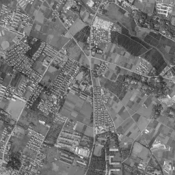
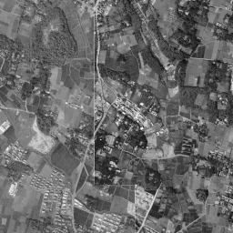
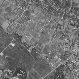
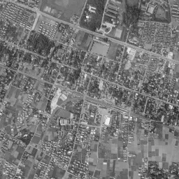
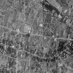
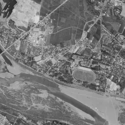
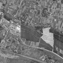
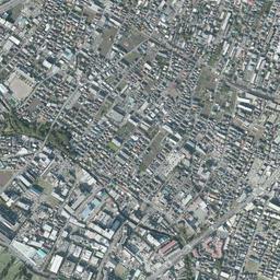
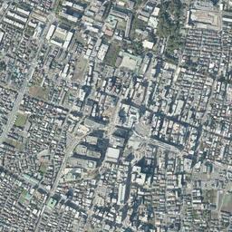
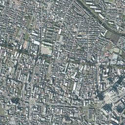
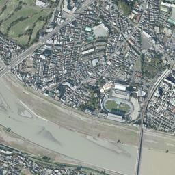


Nearby single photograph taken: October 28, 1965 (0.4 km from this spot)
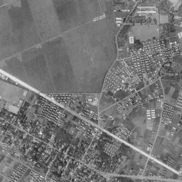
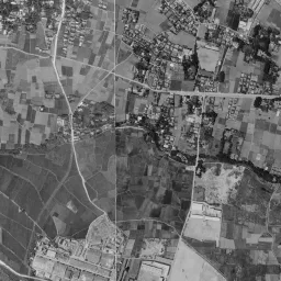
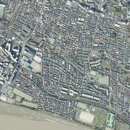
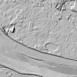
What to compare in this era: The farther from the center, the larger the lots of fields. The white riverbed of the Tama River and an oval stadium lie at the bottom edge
Controls: drag to move / right-drag to rotate and tilt / scroll while holding ⌘ or Ctrl to zoomControls: slide with two fingers to move / pinch to zoom / drag two fingers up or down to tilt
Note: the 3D elevation data is based on current surveys, not on the terrain at the time of the photograph. Elevation tiles: processed from GSI Tiles
The 3D view could not be loaded. Check your connection and try again.
Gray areas in the old photograph: Areas where no aerial photograph of this era is available (outside the area photographed, over the sea and the like).
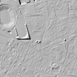
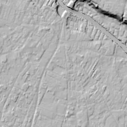
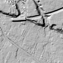
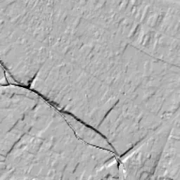
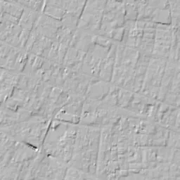
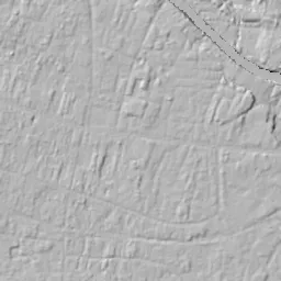
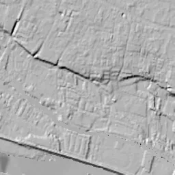
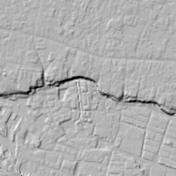
Note: the terrain shading is based on current surveys, not on the terrain at the time of the photograph. Hillshade map: processed from GSI Tiles
Note: the map is today's, not a map from the time of the photograph. Map: © OpenStreetMap contributors
Source: processed from GSI Tiles (aerial photographs by era / latest nationwide photographs / single photographs)
Explore this area on the mapMove the map to compare the surroundings then and now as well.
Overlay and compare the 1961-1969 aerial photograph and today's photograph of the Chofu Station Area area, Tokyo. All photographs are published by the Geospatial Information Authority of Japan (GSI).
Eras of photographs for this location
For the Chofu Station Area area, aerial photographs from the following eras can be compared.
The old photographs of this location cover 6 eras from 1945-1950 to 1987-1990; as of 2026, the newest photograph, 1987-1990, is 37 years ago.There are no photographs of this location from after that until today. The differences between eras are summarized in the guide to aerial photograph eras.
Coverage for each era differs by region. Only the eras that actually have photographs of this location are listed here.
Elevation of this location
The elevation (above sea level) near Chofu Station is 36.0 m (source: GSI elevation API). Elevation profiles running east-west and north-south through this location are also shown.
Profile positions (vertical green line = north-south / horizontal blue line = east-west)
Elevation is the value at the ground surface (even where a station is underground or elevated, the value is for the ground surface). Elevation is only one factor in disaster preparedness. Check actual risks such as flooding on the Hazard Map Portal Site and the hazard maps published by local governments.
Elevation tiles for the profiles: processed from GSI Tiles
Access by rail
Chofu Station is served by the following lines.
- Keio Line
- Keio Sagamihara Line
Source of line information: processed from National Land Numerical Information (Railway Data / Ministry of Land, Infrastructure, Transport and Tourism).
Change seen in the share of built-up area
This compares land use in 1976 and 2021. The share of built-up area within 500 m changed from 80% to 96%. Among the locations on this site, the spread of built-up area here is in the middle. The bar below shows where this location falls in the distribution across the locations on this site.
Source: processed from National Land Numerical Information (Land Use Subdivision Mesh / 1976 and 2021 / Ministry of Land, Infrastructure, Transport and Tourism). The texture value (amount of fine detail) of the photographs changed from 15.1 to 43.5. This is a mechanical comparison between photographs and includes differences from the shooting season and from black and white versus color, so treat it only as a rough guide.
Official land prices over time
The official land price (Chika Koji) standard site nearest to this location is "4-8-9 and adjacent lots, Fuda, Chofu, Tokyo" (about 207 m in a straight line; use: Residential). The official prices per square meter at this standard site from 2013 to 2026 are shown below. The 2026 official price is 750,000 yen.
View as a table
| Year | Official price |
|---|---|
| 2013 | 453,000 yen |
| 2014 | 460,000 yen |
| 2015 | 470,000 yen |
| 2016 | 482,000 yen |
| 2017 | 492,000 yen |
| 2018 | 507,000 yen |
| 2019 | 530,000 yen |
| 2020 | 553,000 yen |
| 2021 | 555,000 yen |
| 2022 | 566,000 yen |
| 2023 | 594,000 yen |
| 2024 | 635,000 yen |
| 2025 | 690,000 yen |
| 2026 | 750,000 yen |
Source: processed from National Land Numerical Information (Land Price Publication Data / Ministry of Land, Infrastructure, Transport and Tourism). Official land prices are values published for standard sites as of January 1 each year and do not show the transaction price of any particular piece of land. The selection and location of standard sites may be reviewed from year to year.
Nearby locations
Sorted by distance from Chofu Station Area. Comparing them together shows how the same area has changed over time.
Select a marker on the map to see the location name and a link to it.
Locations with the same origins
Towns in the same category as Chofu Station Area (Redevelopment), chosen from other regions. You can compare what they share in land use and town layout.
Select a marker on the map to see the location name and a link to it.
Recently viewed towns
This history is saved only on your device and is not sent to any server. Depending on your browser settings, it may be deleted automatically if you do not visit for a while (it is less likely to be deleted if you use the site as an app).
Why not look at how another town has changed?
History of Chofu Station Area
The Keio Line, extending from Shinjuku, divides in two at Chofu, and one branch becomes the Sagamihara Line, which crosses the Tama River and heads south. In August 2012 the tracks before and after the station were moved underground, and on the surface where level crossings had lined up, passages, parks and buildings were laid out in stages. In the aerial photographs, more than the tracks themselves, it is how densely the land around the tracks is packed that clearly changes from era to era. The way fields are replaced little by little by roofs centered on the station, and large buildings gather around the station, is captured in six eras and today's photograph.
A post-town road and the first trains
In the Edo period this area was a post town on the Koshu Kaido. According to the city's local history museum, the five villages of Kokuryo, Shimofuda, Kamifuda, Shimoishihara and Kamiishihara took turns carrying out the duties of the post town and were called the five post towns of Fuda (Fuda Goshuku). The post town was a little over 3 km long, and the townscape continued long and narrow along the highway. There were few inns, and its main role is said to have been passing people and goods on to the next post town.
In April 1913, the Keio Electric Tramway ran trains between Sasazuka and Chofu. This was the beginning of the Keio Line. Later a line from Chofu to Tamagawara and a line to Fuchu were extended, and the station took the form of a split in two directions. Being connected to central Tokyo by train, this land drew attention as a pleasure resort and suburban residential area, and after the Great Kanto Earthquake more people moved in. Around the late 1920s and early 1930s, Keiokaku and the Nikkatsu film studio were built, and in 1931 the Koshu Kaido was paved.
Starting from the part that appears
In the 1945-50 photograph, most of the frame is a gray gap, outside the area covered by the photographs. Only a fan-shaped part from the upper right to the right appears. There, finely divided fields spread out, and two corners where small buildings line up at equal intervals can be seen. In the middle of the right side of the frame, a single road extends east-west, with rows of houses lining both sides in long, narrow strips. You cannot tell from this photograph what the area around the station looked like at the time.
By 1961-69 the gap is gone, and the whole frame can be seen. Rows of houses gather densely around the center, and the lots of fields grow larger farther out. In the upper left, a thick straight line cuts the frame diagonally, and at the bottom edge the wide riverbed of the Tama River shines white. Just north of the riverbed there is an oval stadium. Toward the bottom of the frame, due south of the center, there is a bright triangular lot with small white buildings lined up neatly. The farther a place is from the center, the sharper the boundary between fields and roofs.
The era when fields turned into roofs
Around the time this photograph was taken, the town was rapidly gaining people. When Chofu Town and Jindai Town merged in 1955 to create the City of Chofu, the population was a little over 45,000. According to the city, the population increased rapidly as danchi (housing complexes) began to be built, passing 100,000 in 1965. At the 1964 Tokyo Olympics the Koshu Kaido became the marathon route, and Tobitakyu in the city was chosen as the turnaround point. The rows of houses packed around the center in the 1961-69 photograph and the fields still remaining widely outside them are the scene in the middle of this growth.
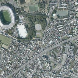
In the 1974-78 photograph, an elevated road crosses the upper part of the frame in an arc and descends to a grade-separated interchange of overlapping loops in the upper left. It is the Chuo Expressway, which also appears on the maps in the city's urban planning materials. In the color frame, only the lower right looks purplish. In the upper left corner, bright ground with an oval track spreads out. The rows of houses around the center are packed even more densely, and the fields are pushed to the south and east of the frame.
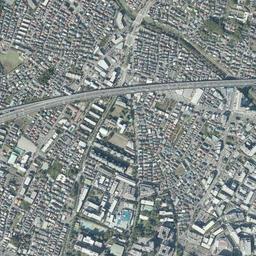
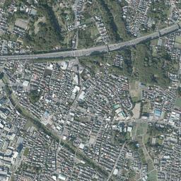
In 1979-83 and 1984-86, large buildings increase little by little in the center, and the fields to the south and east are split into small lots that remain only here and there. The bright ground in the upper left corner appears in 1984-86 as a wide grassland edged by dark woods, and the oval of the stadium by the riverbed is in the same position. The flow of the Tama River changes the shape of its sandbars from era to era, and the white band of sand shifts right and left. In 1987-90, a thin bright band can be seen passing west-northwest near the center, with large buildings lining both sides. The tracks still run above ground, and the level crossings before and after the station remain for more than another 20 years until the tracks are put underground.
Tracks moved underground
The Keio Line continuous grade separation project, which removes the crossings of roads and railway all together, moved the tracks underground. In August 2012, about 2.8 km of the Keio Line from Shibasaki Station to Nishi-Chofu Station and about 0.9 km of the Sagamihara Line from Chofu Station to Keio-tamagawa Station were put underground, and 18 level crossings disappeared. Not only Chofu Station but also the neighboring Fuda Station and Kokuryo Station became underground stations.
On the long, narrow railway land left above ground, commercial facilities, parks, bicycle parking, green paths and local roads were laid out in stages. The plan drawing for the plaza in front of the station was decided in March 2021, and its development was finished at the end of fiscal 2025. It covers about 17,000 square meters, and the city also uses it as a place for events.
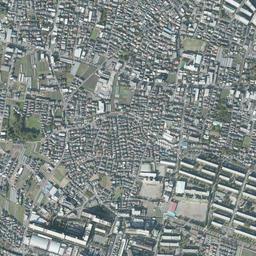
In today's photograph too, with tall buildings gathered in the center, the elevated road in the upper part draws the same arc as in 1974-78. In the upper left corner, where there was grassland edged by woods in 1984-86, the roof of a large stadium and a building with a large white roof have appeared, and the fields that stood out in the 1961-69 photograph hardly remain. Dense green woods gather only in the upper right corner, keeping almost the same outline since 1961-69. The closer a lot is to the station, the larger its buildings, and farther away the frame returns to rows of fine roofs. The riverbed at the bottom edge is still white and wide. Since this is lowland along the Tama River, the condition of the land on the side closer to the river can be checked on the hazard map published by the city.
The city lists smoother north-south traffic among the results of putting the tracks underground, along with the removal of level crossings. The official land prices (Chika Koji) also have a standard site at a residential area 207 m from the station (Fuda 4-chome); among the values up to the 2026 official land prices, the lowest is 453,000 yen per square meter in 2013 and the highest is 750,000 yen in 2026.