Numazu Station Area about 60 years ago and today
Then and now
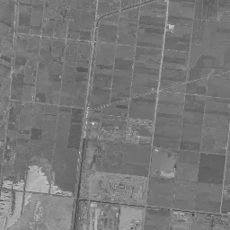
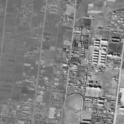
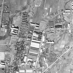
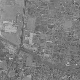
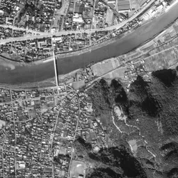
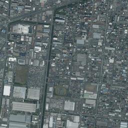
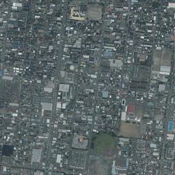
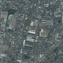
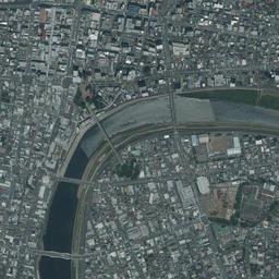
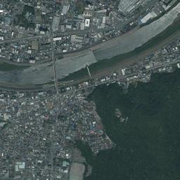


Nearby single photograph taken: April 26, 1961 (0.5 km from this spot)
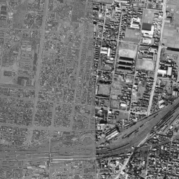
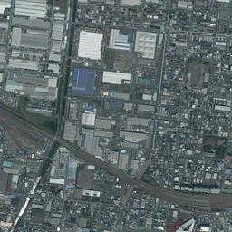
What to compare in this era: Strips of paddies remain all over the left half of the upper part of the frame. By 1979-83, most of them have changed into houses and buildings
Controls: drag to move / right-drag to rotate and tilt / scroll while holding ⌘ or Ctrl to zoomControls: slide with two fingers to move / pinch to zoom / drag two fingers up or down to tilt
Note: the 3D elevation data is based on current surveys, not on the terrain at the time of the photograph. Elevation tiles: processed from GSI Tiles
The 3D view could not be loaded. Check your connection and try again.
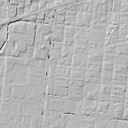
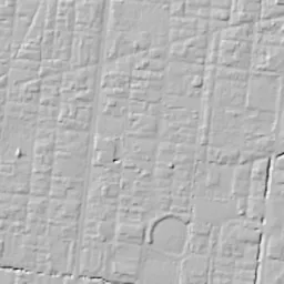
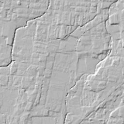
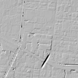
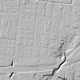
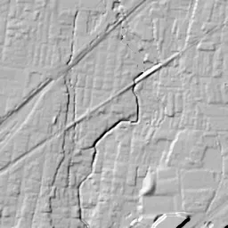
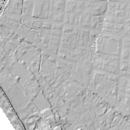
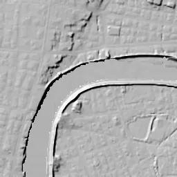
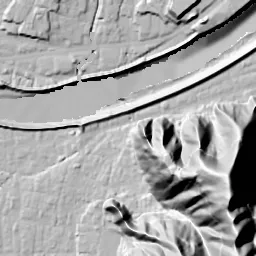
Note: the terrain shading is based on current surveys, not on the terrain at the time of the photograph. Hillshade map: processed from GSI Tiles
Note: the map is today's, not a map from the time of the photograph. Map: © OpenStreetMap contributors
Source: processed from GSI Tiles (aerial photographs by era / latest nationwide photographs / single photographs)
Explore this area on the mapMove the map to compare the surroundings then and now as well.
Overlay and compare the 1961-1969 aerial photograph and today's photograph of the Numazu Station Area area, Shizuoka Prefecture. All photographs are published by the Geospatial Information Authority of Japan (GSI).
Eras of photographs for this location
For the Numazu Station Area area, aerial photographs from the following eras can be compared.
The old photographs of this location cover 4 eras from 1961-1969 to 1987-1990; as of 2026, the newest photograph, 1987-1990, is 38 years ago.There are no photographs of this location from after that until today. The differences between eras are summarized in the guide to aerial photograph eras.
Coverage for each era differs by region. Only the eras that actually have photographs of this location are listed here.
Elevation of this location
The elevation (above sea level) near Numazu Station is 8.2 m (source: GSI elevation API). Elevation profiles running east-west and north-south through this location are also shown.
Profile positions (vertical green line = north-south / horizontal blue line = east-west)
Elevation is the value at the ground surface (even where a station is underground or elevated, the value is for the ground surface). Elevation is only one factor in disaster preparedness. Check actual risks such as flooding on the Hazard Map Portal Site and the hazard maps published by local governments.
Elevation tiles for the profiles: processed from GSI Tiles
Access by rail
Numazu Station is served by the following lines.
- JR Central Gotemba Line
- JR Central Tokaido Line
Source of line information: processed from National Land Numerical Information (Railway Data / Ministry of Land, Infrastructure, Transport and Tourism).
Change seen in the share of built-up area
This compares land use in 1976 and 2021. The share of built-up area within 500 m changed from 100% to 99%. Among the locations on this site, the spread of built-up area here is among the smallest (bottom 20%). The bar below shows where this location falls in the distribution across the locations on this site.
Source: processed from National Land Numerical Information (Land Use Subdivision Mesh / 1976 and 2021 / Ministry of Land, Infrastructure, Transport and Tourism). The texture value (amount of fine detail) of the photographs changed from 17.2 to 26.6. This is a mechanical comparison between photographs and includes differences from the shooting season and from black and white versus color, so treat it only as a rough guide.
Official land prices over time
The official land price (Chika Koji) standard site nearest to this location is "1850-20 Kitatakashima-cho, Numazu, Shizuoka Prefecture" (about 949 m in a straight line; use: Residential). The official prices per square meter at this standard site from 1995 to 2026 are shown below. The 2026 official price is 135,000 yen.
View as a table
| Year | Official price |
|---|---|
| 1995 | 230,000 yen |
| 1996 | 218,000 yen |
| 1997 | 207,000 yen |
| 1998 | 198,000 yen |
| 1999 | 187,000 yen |
| 2000 | 176,000 yen |
| 2001 | 167,000 yen |
| 2002 | 158,000 yen |
| 2003 | 149,000 yen |
| 2004 | 139,000 yen |
| 2005 | 132,000 yen |
| 2006 | 128,000 yen |
| 2007 | 127,000 yen |
| 2008 | 131,000 yen |
| 2009 | 131,000 yen |
| 2010 | 130,000 yen |
| 2011 | 130,000 yen |
| 2012 | 130,000 yen |
| 2013 | 130,000 yen |
| 2014 | 130,000 yen |
| 2015 | 130,000 yen |
| 2016 | 130,000 yen |
| 2017 | 130,000 yen |
| 2018 | 130,000 yen |
| 2019 | 130,000 yen |
| 2020 | 130,000 yen |
| 2021 | 129,000 yen |
| 2022 | 130,000 yen |
| 2023 | 131,000 yen |
| 2024 | 132,000 yen |
| 2025 | 133,000 yen |
| 2026 | 135,000 yen |
Source: processed from National Land Numerical Information (Land Price Publication Data / Ministry of Land, Infrastructure, Transport and Tourism). Official land prices are values published for standard sites as of January 1 each year and do not show the transaction price of any particular piece of land. The selection and location of standard sites may be reviewed from year to year.
Nearby locations
Sorted by distance from Numazu Station Area. Comparing them together shows how the same area has changed over time.
Select a marker on the map to see the location name and a link to it.
Locations with the same origins
Towns in the same category as Numazu Station Area (Redevelopment), chosen from other regions. You can compare what they share in land use and town layout.
Select a marker on the map to see the location name and a link to it.
Articles that feature this location
Recently viewed towns
This history is saved only on your device and is not sent to any server. Depending on your browser settings, it may be deleted automatically if you do not visit for a while (it is less likely to be deleted if you use the site as an app).
Why not look at how another town has changed?
History of Numazu Station Area
In Numazu, where the Gotemba Line joins the Tokaido Line, there are two urban areas of different character on either side of the station. South of the station a long-established urban area spreads toward the Kano River, and an area where rows of houses filled in after the north exit opened after the war lies to the north. In the aerial photographs, a wide band of tracks crosses the lower part of the center of the frame in a bow from west to northeast, and the Kano River flows across the lower part of the frame in a large arc. The two lines, tracks and river, hardly change position in any era, and you can read how the density of the town between and outside them changed as you advance the eras.
The band of tracks and the arc of the river
The station opened in 1889, the year the Tokaido Line opened along its entire length. It was in 1923 that the town merged with Yanagihara Village to become the City of Numazu, and around then, in 1913 and 1926, the urban area was also struck by great fires. No steps or slopes can be found in the frame. The urban area sits on sediment carried by the lower reaches of the Kano River, and in 1958 the Kanogawa Typhoon brought great damage to the city. For how far water would spread if it overflowed on the low flat land near the river, the City of Numazu issues a flood hazard map.
In the black-and-white 1961-69 photograph, station grounds bundling many tracks extend long west of the station, standing out as a thick gray band. Past the station the band turns northeast and splits into two directions toward the right of the frame. North of the tracks, strips of paddies still remain all over the left half of the upper part of the frame, and to their south, up to the tracks, low rows of houses spread along a grid of roads. In the middle near the top edge, away to the north of the station, there is an oval sports ground, and in the upper right of the frame several long factory roofs line up.
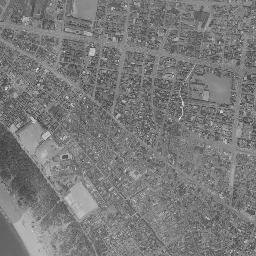
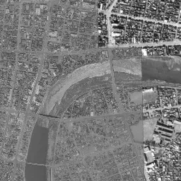
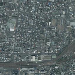
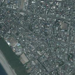
South of the tracks it looks different. The rows of houses fill the spaces between the roads without leaving any, and wide roads pass straight east to west and north to south. The road heading from the station front toward the river is also thick, showing that these are blocks of a redrawn grid, different from the look of an old town where narrow alleys are tangled. In the lower part of the frame, the Kano River flows from right to left, changes direction greatly southwest of the station and bends south. The water spreads wide and gray, and white sandbars peek out on the inside of the bend. On the opposite bank to the southeast of the river a mountain covered with forest rises black, and in the lower left corner a sandy beach and the band of pine woods along it appear. The river mouth opening to the sea and the port are outside the frame.
A grid drawn over burned ground
There is a reason the roads south of the tracks are straight. In July 1945, the urban area of Numazu was burned in a large-scale air raid. In January 1947 the city received project approval for war damage reconstruction land readjustment; the work area covering the center south of the station alone was 19.9 hectares, and the work area covering the Takashima and Takasawa area north of the station reached 63.1 hectares. It was work to redraw a new grid of roads over the burned ground and reallocate the lots of land, and the replotting disposition of the central work area was completed in 1985. In 1956 the north exit of the station was opened, and it became possible to enter the station directly from the north side of the tracks too.
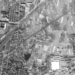
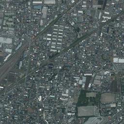
In the 1974-78 photograph the band of tracks changes into a thick band of rusty brown. The rows of houses north of the tracks have become far denser, and the strips of paddies remain only a little at the upper left edge of the frame. Only the band at the top edge has a tone leaning toward gray. Toward the left of the frame, factories with large white roofs line up along the tracks, and south of the tracks tall buildings increase near the station. Northeast of the station, between the two branches of the tracks, a corner that looks like a danchi (housing complex), with many rows of white buildings facing the same direction, has been made, filling a place where fields and houses were mixed in 1961-69. The Kano River is a greenish water surface, with sandbars floating long and narrow in the river.
Northwest of the station, among the rows of houses a little to the north away from the tracks, a large white roof holding a wide parking lot appears in the 1979-83 photograph. Among the fine rows of houses only this roof is strikingly large, occupying a whole block by itself. The paddies in the upper part of the frame have almost all been replaced by houses and buildings. On the Kano River dark water spreads to the full width between the banks, and the sandbars can hardly be seen. In the 1987-90 photograph, a tall building stands beside that large roof, and the blocks north of the tracks lose their gaps as much as those to the south. By this era, the difference in density between north and south of the tracks had almost vanished.
The band of tracks that does not move
In today's photograph too, the station grounds west of the station remain with their width kept, and they continue to be one of the largest surfaces in the frame. Just north of the station new buildings with white roofs line up, and the shape of the station front on the north exit side looks different from the 1987-90 photograph. The large white roof that appeared in 1979-83 also remains in the same place. The oval sports ground in the middle of the upper part of the frame and the long factory roofs lined up in the upper right have not changed position from 1961-69 to today's photograph. A tendency can be read from this frame: even when rows of houses are replaced, the facilities with large surfaces are the ones that stay in the same place. The project to elevate the tracks around the station received approval in fiscal 2006, and in October 2023 construction of the main railway facilities began at the new freight terminal at the relocation site. The relocation site is outside the frame, and the band of tracks in the frame divides the town north and south at the same position whichever era you choose.
In today's photograph the Kano River shows wide whitish sandbars, and the threads of water look thinner than in the 1961-69 photograph. The levees on both banks have become green bands, and many bridges cross the river. The amount of water and how the sandbars look differ greatly with the day of shooting, but the shape of the arc itself has hardly moved since 1961-69. The sandy beach and the band of pine woods in the lower left corner also keep the same line in every era, showing that the urban area meets the sea there. At a residential area in Kitatakashima-cho about 1 km north of the station, in the land price record up to the 2026 official land prices (Chika Koji), 230,000 yen per square meter in 1995 is the highest value and 127,000 yen in 2007 is the lowest.