Ogaki Station Area about 60 years ago and today
Then and now
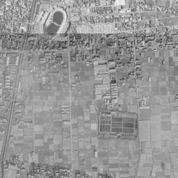
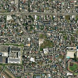
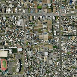
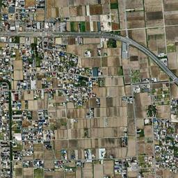


Center photograph taken:
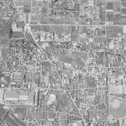
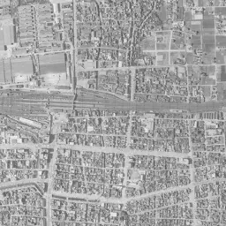
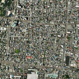
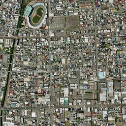
What to compare in this era: Just north of the station, long buildings with sawtooth roofs line up in many rows. In today's photograph, those rows have been replaced by the large roof of a commercial facility and a parking lot
Controls: drag to move / right-drag to rotate and tilt / scroll while holding ⌘ or Ctrl to zoomControls: slide with two fingers to move / pinch to zoom / drag two fingers up or down to tilt
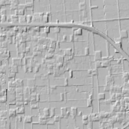
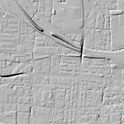
Note: the 3D elevation data is based on current surveys, not on the terrain at the time of the photograph. Elevation tiles: processed from GSI Tiles
The 3D view could not be loaded. Check your connection and try again.
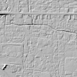
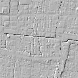
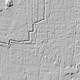
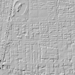
Note: the terrain shading is based on current surveys, not on the terrain at the time of the photograph. Hillshade map: processed from GSI Tiles
Note: the map is today's, not a map from the time of the photograph. Map: © OpenStreetMap contributors
Source: processed from GSI Tiles (aerial photographs by era / latest nationwide photographs / single photographs)
Explore this area on the mapMove the map to compare the surroundings then and now as well.
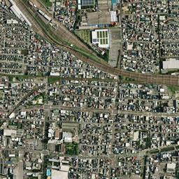
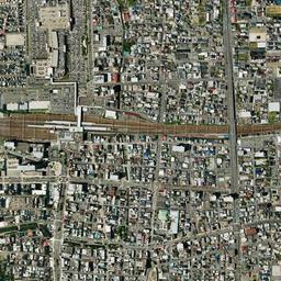
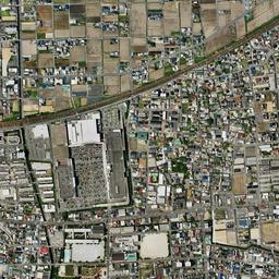
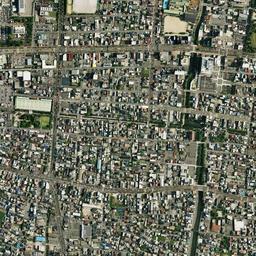
Overlay and compare the 1961-1969 aerial photograph and today's photograph of the Ogaki Station Area area, Gifu Prefecture. All photographs are published by the Geospatial Information Authority of Japan (GSI).
Eras of photographs for this location
For the Ogaki Station Area area, aerial photographs from the following eras can be compared.
The old photographs of this location cover 4 eras from 1961-1969 to 1987-1990; as of 2026, the newest photograph, 1987-1990, is 39 years ago.There are no photographs of this location from after that until today. The differences between eras are summarized in the guide to aerial photograph eras.
Coverage for each era differs by region. Only the eras that actually have photographs of this location are listed here.
Elevation of this location
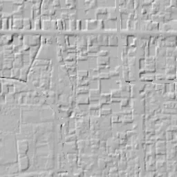
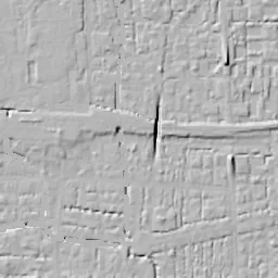
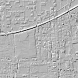
The elevation (above sea level) near Ogaki Station is 7.2 m (source: GSI elevation API). Elevation profiles running east-west and north-south through this location are also shown.
Profile positions (vertical green line = north-south / horizontal blue line = east-west)
Elevation is the value at the ground surface (even where a station is underground or elevated, the value is for the ground surface). Elevation is only one factor in disaster preparedness. Check actual risks such as flooding on the Hazard Map Portal Site and the hazard maps published by local governments.
Elevation tiles for the profiles: processed from GSI Tiles
Access by rail
Ogaki Station is served by the following lines.
- Tarumi Railway Tarumi Line
- JR Central Tokaido Line
- Yoro Railway Yoro Line
Source of line information: processed from National Land Numerical Information (Railway Data / Ministry of Land, Infrastructure, Transport and Tourism).
Change seen in the share of built-up area
This compares land use in 1976 and 2021. The share of built-up area within 500 m changed from 100% to 85%. Among the locations on this site, the spread of built-up area here is among the smallest (bottom 20%). The bar below shows where this location falls in the distribution across the locations on this site.
Source: processed from National Land Numerical Information (Land Use Subdivision Mesh / 1976 and 2021 / Ministry of Land, Infrastructure, Transport and Tourism). The texture value (amount of fine detail) of the photographs changed from 13.4 to 48.9. This is a mechanical comparison between photographs and includes differences from the shooting season and from black and white versus color, so treat it only as a rough guide.
Official land prices over time
The official land price (Chika Koji) standard site nearest to this location is "6-80-203 Hayashi-machi, Ogaki, Gifu Prefecture" (about 393 m in a straight line; use: Residential). The official prices per square meter at this standard site from 2023 to 2026 are shown below. The 2026 official price is 97,300 yen.
View as a table
| Year | Official price |
|---|---|
| 2023 | 93,400 yen |
| 2024 | 94,200 yen |
| 2025 | 95,200 yen |
| 2026 | 97,300 yen |
Source: processed from National Land Numerical Information (Land Price Publication Data / Ministry of Land, Infrastructure, Transport and Tourism). Official land prices are values published for standard sites as of January 1 each year and do not show the transaction price of any particular piece of land. The selection and location of standard sites may be reviewed from year to year.
Nearby locations
Sorted by distance from Ogaki Station Area. Comparing them together shows how the same area has changed over time.
Select a marker on the map to see the location name and a link to it.
Locations with the same origins
Towns in the same category as Ogaki Station Area (Redevelopment), chosen from other regions. You can compare what they share in land use and town layout.
Select a marker on the map to see the location name and a link to it.
Recently viewed towns
This history is saved only on your device and is not sent to any server. Depending on your browser settings, it may be deleted automatically if you do not visit for a while (it is less likely to be deleted if you use the site as an app).
Why not look at how another town has changed?
History of Ogaki Station Area
Ogaki Station is partway along the Tokaido Line where it crosses the western end of the Nobi Plain in a gentle arc. With those tracks running east to west through the center of the frame as the border, fine rows of houses continuing from the castle town lay to the south, and factories with large roofs were gathered to the north. The castle, the station and the factory sites fit within one frame, and as you advance the eras, the framework of streets south of the tracks hardly moves, while only the factory lots to the north change their look.
From a castle town to a station town
According to a plan document of the City of Ogaki, Ogaki Castle was founded in 1535. In the Battle of Sekigahara in 1600, Ishida Mitsunari of the Western Army made it his base, and after Toda Ujikane entered in 1635 as lord of the castle with 100,000 koku (a koku is about 180 liters of rice), 11 generations of the Toda clan served as lords of the castle until the Meiji era. The Minoji road passed through the castle town, and the town thrived as a post town and also as a port for river boat transport. The site of the river port remains as the Funamachi Port site; it is regarded as the place where Matsuo Basho ended the journey of Oku no Hosomichi, and in 2014 it was designated a national Place of Scenic Beauty. On the bank of the Suimon River, which served as the castle's outer moat, a promenade lined with stone monuments bearing haiku from that travel journal has been laid out.
The railway moved this center of gravity. When Ogaki Station opened in 1884, the place where retail trade gathered moved from around Funamachi Port to around the station, and a shopping street began to take shape on the street extending south from the station. In 1918 the city system was put in place. The city writes that manufacturing, starting with textiles, gathered, factories increased after the war too, and in the period of the postwar economic boom it became an industrial city in western Gifu Prefecture where many spinning-related factories gathered.
Water has been deeply tied both to the life and to the trade of this town. In the center of the city there remain wells where groundwater springs up on its own. The city's plan document explains that it was also because of this abundant water that textile and chemical factories pumping up and using groundwater increased after the war. The reason the town calls itself a city of water and the reason the factories gathered lie in the same water underfoot.
The air raid of July 1945 burned most of the central urban area. The main keep of Ogaki Castle, then a National Treasure, was also lost at this time. After the war, centered on the station street, shopping streets of reinforced concrete combined with housing were built, and a modern townscape of a large scale for a regional city was born. The main keep was rebuilt in 1959. The grid south of the station in the aerial photographs is made up of the streets remade in this war damage reconstruction land readjustment.
Roofs lined up north of the tracks
In the 1961-69 photograph, only the band toward the bottom of the frame appears dark and coarse-grained. The tracks draw an arc east to west through the center, and at the position of the station the lines are bundled thickly. Toward the left of the frame the tracks open like a fan, and the grounds spread toward the west. North of the tracks, from the center to the left of the frame, there is a factory site where long buildings with sawtooth roofs line up in many rows. To its north, in the middle of the top edge, a sports ground and an oval running track can be seen. Toward the right of the frame there is a large factory site holding a pond, and to its south another oval running track appears. The right side of the upper half of the frame is finely divided paddies, with settlements surrounded by trees clustered here and there.
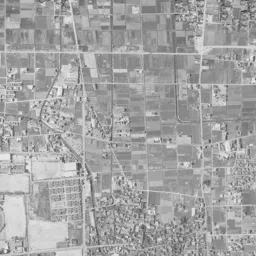
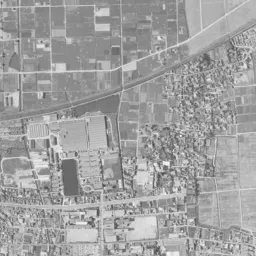
In the 1974-78 photograph the tracks stand out as a thick reddish-brown band. The paddies to the north remain widely as green lots, and the rows of sawtooth roofs also line up in the same place as in the previous era. A square building with a light-blue roof has been added in one corner of that site, and in the sports ground in the middle of the top edge a fan-shaped baseball field can be read. In the factory toward the right, buildings with long white roofs line up, and the pond remains without being filled in.
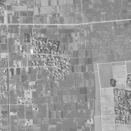
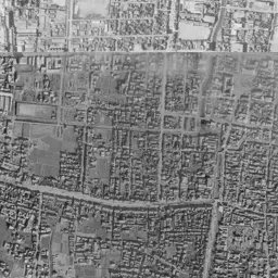
In the 1979-83 photograph, houses have increased among the paddies to the north, and brown lots where the harvest is over stand out. On the factory site toward the right, a large white roof and gray paved surfaces appear, suggesting that a use different from a factory has begun. In the urban area south of the tracks, both the density of the grains of roofs and the direction of the streets hardly change from the previous era.
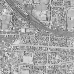
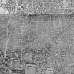
It is in the 1987-90 photograph that part of the rows of sawtooth roofs is replaced by a large flat white roof. In the middle of the top edge, the form in which a baseball field and an athletics track line up has been completed, and the paddies to the north have been shaved further by housing. South of the tracks, toward the bottom and a little west of the station, there is a small green mass surrounded by trees, and to its left a dark waterway runs north to south. These are the position of Ogaki Castle and the flow of the Suimon River, which served as the outer moat.
The site of the spinning mills and the north exit of the station
Not one of the sawtooth roofs that lined up north of the station can be seen in today's photograph; the roof of a large commercial facility and a wide parking lot occupy that place. The City of Ogaki's plan document states that the improvement of the infrastructure in the district north of the station had lagged, but that roads and plazas were laid out in step with a large-scale commercial facility and other buildings going up on the site left after the spinning mill withdrew. In October 2007 Aqua Walk Ogaki opened on the north side of the station, and in September 2009 a free passage linking the south and north of the station opened. On the same spinning mill site north of the station, an electronics retail store and a fitness gym later opened, and a residential subdivision of about 200 homes was also developed.
South of the tracks too, the blocks in front of the station have been rebuilt little by little. In the redevelopment of the block south of the station, a complex housing residences, commercial facilities and child-rearing support facilities was completed in September 2016, and in January 2020 the new city hall building was completed. Toward the left of the frame, in the grounds west of the station, the tracks still open in a fan shape in today's photograph.
In the sports ground in the middle of the top edge two red running tracks line up, the paddies to the north are almost filled with housing, and lots of paddies remain together only in the upper right corner. The road piercing east to west near the top edge of the frame was a thin line between paddies in 1961-69, but in today's photograph it has become a wide road, drawing an arc at the right edge and descending to the southeast. The factory site toward the right has changed into a large roof and a wide parking lot, and the oval running track to its south is in the same position as in the old eras. South of the tracks, the street extending south from the station and the grid of streets still draw almost the same lines as in the 1961-69 photograph, and the castle woods and the Suimon River have not moved either. It is a composition in which the south, which kept the framework of the castle town and the war damage reconstruction, and the north, which replaced its factory sites, line up on either side of a single line of tracks.