Senboku New Town (Toga-Mikita) about 60 years ago and today
Then and now
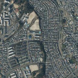
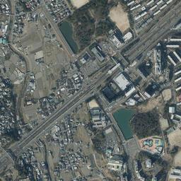
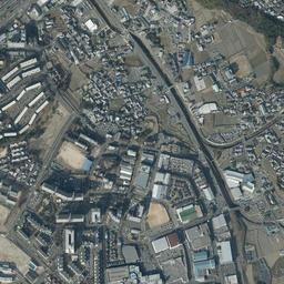
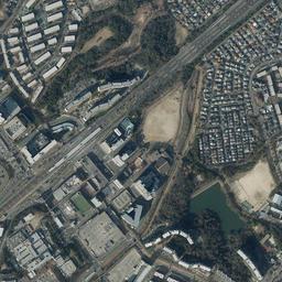
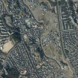
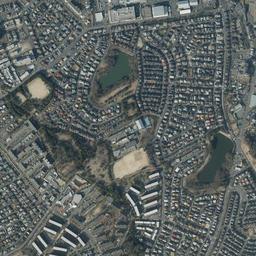


Center photograph taken:
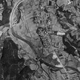
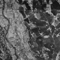
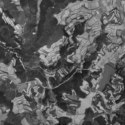
What to compare in this era: The river flowing up and down in bends along the left side, and the fine paddies filling both its banks. The right half is woods and terraced fields
Controls: drag to move / right-drag to rotate and tilt / scroll while holding ⌘ or Ctrl to zoomControls: slide with two fingers to move / pinch to zoom / drag two fingers up or down to tilt
This 3D terrain is today's. The mismatch when you overlay an old photograph is the evidence of the land development that cut hills and filled valleys.
Note: the 3D elevation data is based on current surveys, not on the terrain at the time of the photograph. Elevation tiles: processed from GSI Tiles
The 3D view could not be loaded. Check your connection and try again.
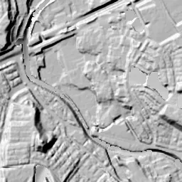
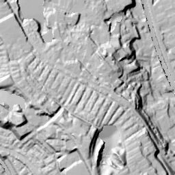
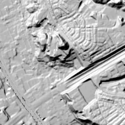
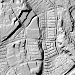
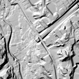
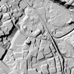
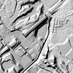
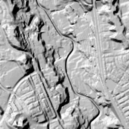
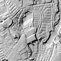
Note: the terrain shading is based on current surveys, not on the terrain at the time of the photograph. Hillshade map: processed from GSI Tiles
Note: the map is today's, not a map from the time of the photograph. Map: © OpenStreetMap contributors
Source: processed from GSI Tiles (aerial photographs by era / aerial photographs by fiscal year / latest nationwide photographs / single photographs / survey periods of the photographs)
Explore this area on the mapMove the map to compare the surroundings then and now as well.
Overlay and compare the 1961-1969 aerial photograph and today's photograph of the Senboku New Town (Toga-Mikita) area, Osaka Prefecture. All photographs are published by the Geospatial Information Authority of Japan (GSI).
Eras of photographs for this location
For the Senboku New Town (Toga-Mikita) area, aerial photographs from the following eras can be compared.
The old photographs of this location cover 5 eras from 1961-1969 to FY2007; as of 2026, the newest photograph, FY2007, is 18-19 years ago.There are no photographs of this location from after that until today. The differences between eras are summarized in the guide to aerial photograph eras.
Coverage for each era differs by region. Only the eras that actually have photographs of this location are listed here.
Elevation of this location
The elevation (above sea level) near Toga-Mikita Station is 62.4 m (source: GSI elevation API). Elevation profiles running east-west and north-south through this location are also shown.
Profile positions (vertical green line = north-south / horizontal blue line = east-west)
Elevation is the value at the ground surface (even where a station is underground or elevated, the value is for the ground surface). Elevation is only one factor in disaster preparedness. Check actual risks such as flooding on the Hazard Map Portal Site and the hazard maps published by local governments.
Elevation tiles for the profiles: processed from GSI Tiles
Access by rail
Toga-Mikita Station is served by the following lines.
- Nankai Electric Railway Semboku Line
Source of line information: processed from National Land Numerical Information (Railway Data / Ministry of Land, Infrastructure, Transport and Tourism).
Change seen in the share of built-up area
This compares land use in 1976 and 2021. The share of built-up area within 500 m changed from 32% to 59%. Among the locations on this site, the spread of built-up area here is on the large side (top 20-40%). The bar below shows where this location falls in the distribution across the locations on this site.
Source: processed from National Land Numerical Information (Land Use Subdivision Mesh / 1976 and 2021 / Ministry of Land, Infrastructure, Transport and Tourism). The texture value (amount of fine detail) of the photographs changed from 21 to 33.7. This is a mechanical comparison between photographs and includes differences from the shooting season and from black and white versus color, so treat it only as a rough guide.
Official land prices over time
The official land price (Chika Koji) standard site nearest to this location is "4-8-10 Momoyamadai, Minami Ward, Sakai, Osaka Prefecture" (about 967 m in a straight line; use: Residential). The official prices per square meter at this standard site from 2021 to 2026 are shown below. The 2026 official price is 106,000 yen.
View as a table
| Year | Official price |
|---|---|
| 2021 | 100,000 yen |
| 2022 | 100,000 yen |
| 2023 | 101,000 yen |
| 2024 | 102,000 yen |
| 2025 | 102,000 yen |
| 2026 | 106,000 yen |
Source: processed from National Land Numerical Information (Land Price Publication Data / Ministry of Land, Infrastructure, Transport and Tourism). Official land prices are values published for standard sites as of January 1 each year and do not show the transaction price of any particular piece of land. The selection and location of standard sites may be reviewed from year to year.
Nearby locations
Sorted by distance from Toga-Mikita. Comparing them together shows how the same area has changed over time.
Select a marker on the map to see the location name and a link to it.
Locations with the same origins
Towns in the same category as Toga-Mikita (New town), chosen from other regions. You can compare what they share in land use and town layout.
Select a marker on the map to see the location name and a link to it.
Recently viewed towns
This history is saved only on your device and is not sent to any server. Depending on your browser settings, it may be deleted automatically if you do not visit for a while (it is less likely to be deleted if you use the site as an app).
Why not look at how another town has changed?
History of Senboku New Town (Toga-Mikita)
Peaches grown across the hills gave the town name Momoyamadai (momo means peach). According to the introduction to place names by Minami Ward of the City of Sakai, the town names of Senboku New Town, developed by Osaka Prefecture, were made uniform in the form "-dai", following Senri New Town, which was built earlier. Around Toga-Mikita Station, the names Harayamadai, Niwashirodai and Miikedai line up besides Momoyamadai. The project was carried out by Osaka Prefecture: under the New Residential Town Development Act, about 1,557 hectares were built over the period from December 1965 to March 1983. The planned population is about 180,000.
A valley falling to the west and woods in the east
The elevation of the center of the location is 62.4 m. The point to the east is the highest at 74.4 m, and the point to the west drops to 47.4 m, a difference of 27 m between east and west. The north at 64.5 m and the south at 65.6 m are only about 2 m and about 3 m higher than the center. The land slopes from east to west.
The 1961-69 photograph is black and white, and a river runs up and down through the left side of the frame in large bends. The low ground on both sides of the river is filled with finely divided paddies, and several villages with clustered roofs continue along the river. Dark woods cover the right half of the frame, and narrow terraced fields tracing the contour lines are cut among them. In the upper right corner, a single wide surface with white bare earth showing is open. In the middle of the left edge, too, there is a corner where short white lines are lined up regularly.
The terminal station and the soil of March 1975
On December 7, 1973, the Semboku Rapid Railway Line was extended from Izumigaoka Station to Toga-Mikita Station, and the station opened. The new line was run by Osaka-fu Toshi Kaihatsu Co., Ltd., a third-sector company of Osaka Prefecture, and Nankai carried out the work on site under contract from that company. The town opening of Momoyamadai was in April 1972, one year and eight months before the opening of the station.
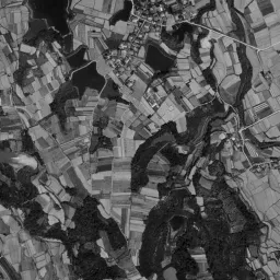
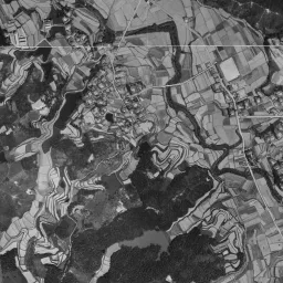
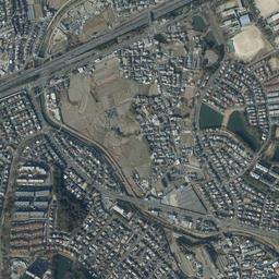
The 1974-78 photograph was taken in March 1975, one year and three months after the station opened. The scene has changed completely. A wide straight line runs diagonally from the lower left to the upper right of the frame and crosses a road running up and down slightly below the center. Woods and fields have almost disappeared, and long buildings of apartment housing line up in many rows on the whitish surface of soil. The straight line also extends from the center to the lower left, but the tracks reached Komyoike Station only in August 1977, and at the time of the photograph Toga-Mikita Station was the terminus. Dark woods are left like islands in the soil, and several pond surfaces also remain. Left of the center, the roofs of a village that appeared in the 1960s photograph remain together. In the middle of the right side, a corner where large buildings with blue roofs line up has appeared. The town opening of Harayamadai was in April 1974, the year before, and that of Niwashirodai in April 1975, a month later.
A valley where yellow paddies remained
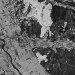
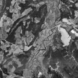
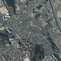
The 1979-83 photograph was taken in November 1979. The town opening of Miikedai was in April of the same year. Bare soil remains only in the lower half and at the left edge of the frame, and the roofs of detached houses fill the surfaces of the hills as fine grains. In the middle of the left side, inside a road drawing an arc, a surface with only lot lines drawn on it spreads out, and no houses have been built there yet. The diagonal straight line continues to the lower left corner and runs out of the frame. The period of the Osaka Prefecture project ended in March 1983, a little over three years after this photograph.
The 1984-86 photograph was taken in October 1985, and houses now line the surface in the middle of the left side that had only lot lines. The valley paddies, which appear yellow, catch the eye. In the valley running up and down left of the center and in the valley in the upper right, the grid of paddies remains untouched by the land grading. Even after the tops of the hills were filled with houses, the valley floors are used as paddies, just as in the 1960s photograph.
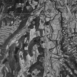
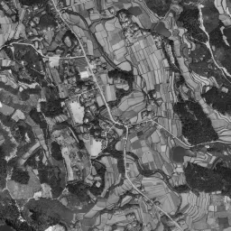
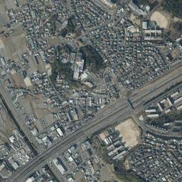
In the FY2007 photograph, those valley paddies appear green, and the grid of paddies continuing from below the center to the bottom edge can be seen clearly. The villages along the paddies are also in the same positions as in the 1961-69 photograph. Between the houses, square open spaces the color of soil are scattered here and there in the frame. In the lower left corner, buildings with large flat roofs gather on both sides of the diagonal straight line.
A ward office placed in front of the station
In today's photograph, too, more than half of the frame is the roofs of detached houses and apartment housing. The share of built-up area around the location rose from 32% in 1976 to 58.9% in 2021. Among the roofs, the valley paddies, the woods at the foot of the hills, and ponds scattered here and there remain. The corner of blue roofs in the middle of the right side is also in the same place as in the 1975 photograph.
In Senboku New Town, district centers were placed in front of three stations, and their roles were divided. Izumigaoka takes on commerce and leisure, Komyoike commerce, business and sports facilities, and Toga administration and cultural and educational facilities. According to the plan for land use in front of the station that the City of Sakai compiled in September 2016, the Minami Ward Office, the Toga Cultural Hall and the Minami-Sakai Police Station gather in front of Toga-Mikita Station, and rental housing of the prefecture, of the prefectural public corporation and of the Urban Renaissance Agency stands in Momoyamadai and Harayamadai. Near the station there are Harayama Park, about 7.8 hectares, and Nishihara Park, about 12.7 hectares.
The population of the whole of Senboku New Town began to fall after 164,587 in 1992 and was 118,181 at the end of December 2020. In the City of Sakai's statistics by town block, at the end of September 2026, 7,023 people live in Momoyamadai and 9,226 in Harayamadai. According to the figures of Nankai, the average daily number of passengers getting on and off at Toga-Mikita Station was 16,615 in fiscal 2024. Semboku Rapid Railway was merged into Nankai Electric Railway on April 1, 2025, and the line became the Semboku Line of Nankai. The limited express Semboku Liner stops at this station.
The standard site of the official land prices (Chika Koji) is a residential site in Momoyamadai 4-cho, 967 m from the center of the location. The values are available from 2021. In the records up to the 2026 publication, the lowest price per square meter is 100,000 yen in both 2021 and 2022, and the highest is 106,000 yen in 2026. In between, 2023 was 101,000 yen, and 2024 and 2025 were 102,000 yen.