Akishima (Former Airfield) about 60 years ago and today
Then and now
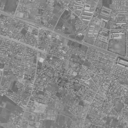
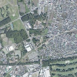
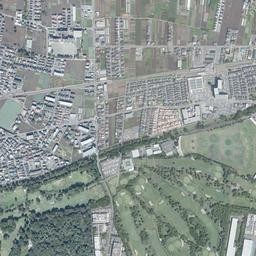
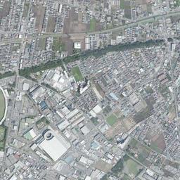
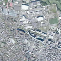
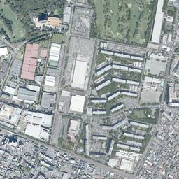
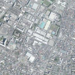
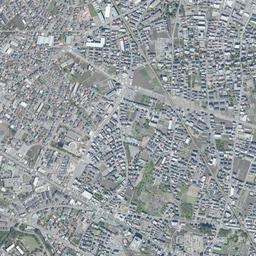
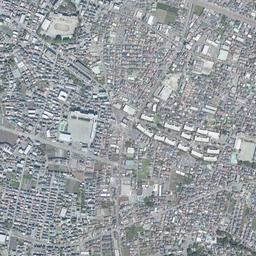
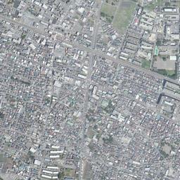


Center photograph taken:
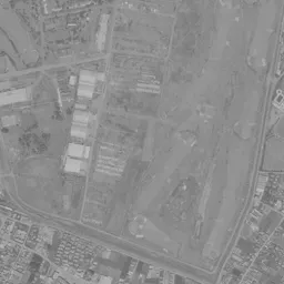
What to compare in this era: Look for the bright band running north-south through the pale flat area northeast of the station. In today's photograph, the area that was flat ground is shared by the golf course to the north and the danchi and commercial facility to the south
Controls: drag to move / right-drag to rotate and tilt / scroll while holding ⌘ or Ctrl to zoomControls: slide with two fingers to move / pinch to zoom / drag two fingers up or down to tilt
Note: the 3D elevation data is based on current surveys, not on the terrain at the time of the photograph. Elevation tiles: processed from GSI Tiles
The 3D view could not be loaded. Check your connection and try again.
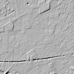
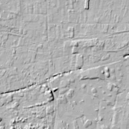
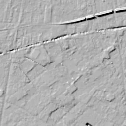
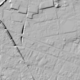
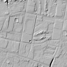
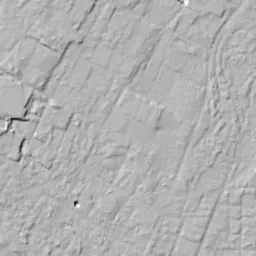
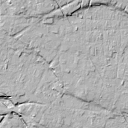
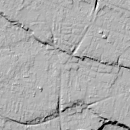
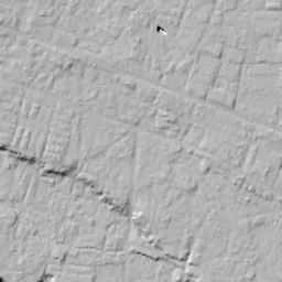
Note: the terrain shading is based on current surveys, not on the terrain at the time of the photograph. Hillshade map: processed from GSI Tiles
Note: the map is today's, not a map from the time of the photograph. Map: © OpenStreetMap contributors
Source: processed from GSI Tiles (aerial photographs by era / latest nationwide photographs / single photographs)
Explore this area on the mapMove the map to compare the surroundings then and now as well.
Overlay and compare the 1961-1969 aerial photograph and today's photograph of the Akishima (Former Airfield) area, Tokyo. All photographs are published by the Geospatial Information Authority of Japan (GSI).
Eras of photographs for this location
For the Akishima (Former Airfield) area, aerial photographs from the following eras can be compared.
The old photographs of this location cover 5 eras from 1961-1969 to 1987-1990; as of 2026, the newest photograph, 1987-1990, is 37 years ago.There are no photographs of this location from after that until today. The differences between eras are summarized in the guide to aerial photograph eras.
Coverage for each era differs by region. Only the eras that actually have photographs of this location are listed here.
Elevation of this location
The elevation (above sea level) near Akishima Station is 108.6 m (source: GSI elevation API). Elevation profiles running east-west and north-south through this location are also shown.
Profile positions (vertical green line = north-south / horizontal blue line = east-west)
Elevation is the value at the ground surface (even where a station is underground or elevated, the value is for the ground surface). Elevation is only one factor in disaster preparedness. Check actual risks such as flooding on the Hazard Map Portal Site and the hazard maps published by local governments.
Elevation tiles for the profiles: processed from GSI Tiles
Access by rail
Akishima Station is served by the following lines.
- JR East Ome Line
Source of line information: processed from National Land Numerical Information (Railway Data / Ministry of Land, Infrastructure, Transport and Tourism).
Change seen in the share of built-up area
This compares land use in 1976 and 2021. The share of built-up area within 500 m changed from 74% to 79%. Among the locations on this site, the spread of built-up area here is on the small side (bottom 20-40%). The bar below shows where this location falls in the distribution across the locations on this site.
Source: processed from National Land Numerical Information (Land Use Subdivision Mesh / 1976 and 2021 / Ministry of Land, Infrastructure, Transport and Tourism). The texture value (amount of fine detail) of the photographs changed from 5.6 to 41.2. This is a mechanical comparison between photographs and includes differences from the shooting season and from black and white versus color, so treat it only as a rough guide.
Official land prices over time
The official land price (Chika Koji) standard site nearest to this location is "4-250-42 Showa-cho, Akishima, Tokyo" (about 294 m in a straight line; use: Residential). The official prices per square meter at this standard site from 2020 to 2026 are shown below. The 2026 official price is 275,000 yen.
View as a table
| Year | Official price |
|---|---|
| 2020 | 245,000 yen |
| 2021 | 245,000 yen |
| 2022 | 247,000 yen |
| 2023 | 252,000 yen |
| 2024 | 258,000 yen |
| 2025 | 266,000 yen |
| 2026 | 275,000 yen |
Source: processed from National Land Numerical Information (Land Price Publication Data / Ministry of Land, Infrastructure, Transport and Tourism). Official land prices are values published for standard sites as of January 1 each year and do not show the transaction price of any particular piece of land. The selection and location of standard sites may be reviewed from year to year.
Nearby locations
Sorted by distance from Akishima. Comparing them together shows how the same area has changed over time.
Select a marker on the map to see the location name and a link to it.
Locations with the same origins
Towns in the same category as Akishima (Former factory site), chosen from other regions. You can compare what they share in land use and town layout.
Select a marker on the map to see the location name and a link to it.
Recently viewed towns
This history is saved only on your device and is not sent to any server. Depending on your browser settings, it may be deleted automatically if you do not visit for a while (it is less likely to be deleted if you use the site as an app).
Why not look at how another town has changed?
History of Akishima (Former Airfield)
Beyond a large commercial facility and its parking lots, apartment buildings stand in rows, and further north a grass golf course spreads east-west. Of this area extending north of Akishima Station, the part that became the golf course was the airfield area of a company that built airplanes, a place long requisitioned by the US military after the war. The aerial photographs show flat open ground without buildings being divided little by little into a golf course, a danchi (housing complex) and a commercial facility.
From mulberry fields to an airplane town
According to the history of the City of Akishima, there were nine villages in this area from the Edo period to the early Meiji era, and in 1928 eight of them, all except Haijima, merged to form Showa Village. From the end of the Meiji era silk-reeling factories began operating one after another, and in the 1910s and early 1920s the area became mulberry fields and was known as a sericulture village centered on producing silkworm eggs. But from the late 1920s the price of raw silk fell sharply, and as the wartime system tightened, munitions factories, mainly for aircraft, and army facilities were built one after another in this village close to Tachikawa Airfield. Showa Village, whose population grew suddenly, became a town in 1941.
One of these was Showa Aircraft Industry. According to the company's history, it was founded in 1937, and the following year, 1938, it began building aircraft at its Tokyo Works in what is now Tanaka-cho in the City of Akishima. After the war the aircraft business was banned, and the company repaired US military aircraft and fuel tank trucks. The company's facilities, including the airfield area, were requisitioned by the US military. In 1954 Showa Town merged with Haijima Village, and taking one character from each of the two names, it became the City of Akishima.
The eras when the open ground remained
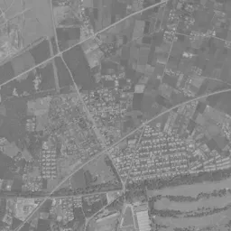
In the 1961-69 photograph, a broad flat area without buildings northeast of the station takes up a large part of the center of the frame. The ground is uniformly pale, and a straight bright band runs long north-south through it. Along the west edge of the flat area, several buildings with large white roofs cluster, and further west a factory site with rows of long, narrow roofs is grouped together. North of the flat area, many bright, long, narrow bands lie between rows of woods in a wavy pattern.
The railway runs diagonally from the left of the frame to the lower right, and the station touches the southwest corner of the flat area. Between the flat area and the tracks there is only a thin band of houses, and the edge of the flat area comes down almost to the tracks. South of the tracks the houses are packed, and in the lower third of the frame lots of fields and houses are mixed together. At the right edge too there is a factory building and a corner with many rows of long, narrow buildings. The fact that only the area northeast of the station looks like a hole opened in the middle of the town is the feature of this era.
The eras after the return
According to the company's history, the airfield area was returned in August 1969 and the requisition was lifted entirely, and an 18-hole public golf course was opened there and began business in November of the same year. The City of Akishima's own description also says that, to make use of the former airfield and the land of natural woods, the company worked with the city on property development centered on "Showa no Mori".
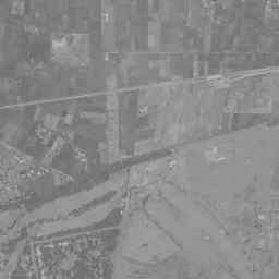
In 1974-78 the flat area has become reddish-brown bare ground, and small squares line up regularly in its west half. In this era the colors appear different at the top and bottom of the frame. The north-south band has faded, and only the outline where the east edge of the flat area is cut diagonally toward the southeast stands out. North of the flat area, many bright bands of grass extend between rows of woods, taking a shape that looks like golf holes.
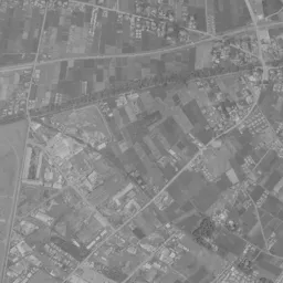
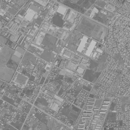
In 1979-83, several tall residential buildings stand at the southeast corner of the flat area, and to their north a row of mid-rise buildings drawing an arc is being assembled. On the northeast edge one long, narrow white building extends. The buildings with white roofs clustered along the west edge of the flat area remain in the same position as in 1961-69. Just north of the station is still open ground. In 1984-86, the east half of the flat area is almost filled with apartment buildings, and a large building surrounded by a wide parking lot appears at the northeast corner of the station. This is the position of Mori Town, facing the north exit of Akishima Station. North of the parking lot, a corner with rows of green roofs can also be seen. The history of the City of Akishima records that after the city was formed, the construction of large danchi went ahead alongside the attraction of factories, and that it became a city of 100,000 people in 1987. The photograph showing the rows of buildings that filled the east half of the flat area is exactly from the few years before that.
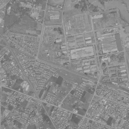
In the 1987-90 photograph too, the layout does not change much. The differences are that a long, narrow strip of brown bare ground running north-south remains between the commercial facility and the danchi, and that a square of blue water has been added at the north end of the golf course. North of the golf course, a band of dense woods crosses diagonally from the left to the upper right, and beyond the band lots of fields still spread. In the middle of the right side of the frame, factory buildings with white and blue roofs are gathered together.
What lines up north of the station
As of 2026, that strip of brown bare ground holds a building with a large white roof and a square building that looks like a multistory parking garage. Along its west edge, buildings with pink roofs line up, and a building surrounded by trees stands on the north side where it touches the golf course. The rows of apartment buildings to the east and the shape of the golf course to the north are almost the same as in the 1984-86 photograph, and the outline of the open ground survives unchanged as the boundary of the blocks. On the golf course to the north, bands of grass between rows of woods extend east-west, overlapping in shape with the bands in the north of the 1974-78 photograph. South of the tracks the houses are packed even more densely, and the lots of fields that were in the lower third of the frame can hardly be found.
In October 2020, the company split off its property, hotel, and sports and leisure businesses into Showa Aircraft Urban Development. Meanwhile Showa Aircraft Industry itself, as of 2026, still has its head office in the City of Akishima and continues to manufacture equipment for air transport and tank trucks. Through the five eras, the area that turned into town was mainly the flat area that had no buildings. If you overlay the outline of the flat area in the 1961-69 photograph with the combined area of the golf course, the danchi and the commercial facility in today's photograph, the two largely coincide.