Kofu Station North Exit about 60 years ago and today
Then and now
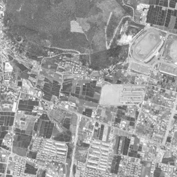
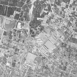
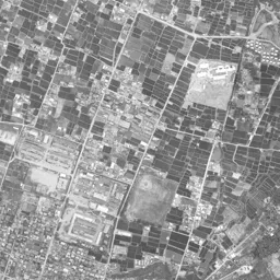
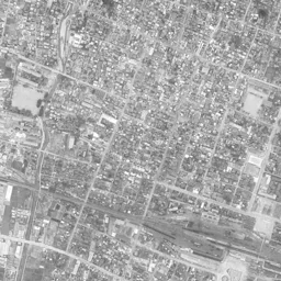
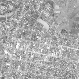
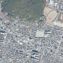
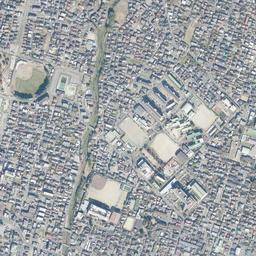
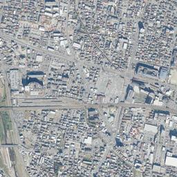
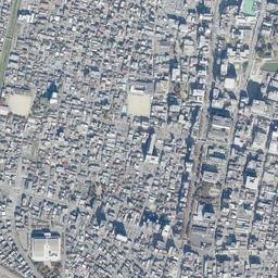
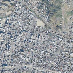


Center photograph taken: May 1962
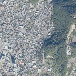
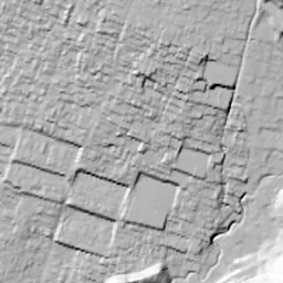
What to compare in this era: West of the center of the location, the tracks split into many lines, forming spindle-shaped station grounds. In today's photograph the same band has become a thin bundle, and a wide paved surface appears on its north side
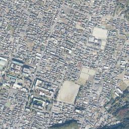
Controls: drag to move / right-drag to rotate and tilt / scroll while holding ⌘ or Ctrl to zoomControls: slide with two fingers to move / pinch to zoom / drag two fingers up or down to tilt
Note: the 3D elevation data is based on current surveys, not on the terrain at the time of the photograph. Elevation tiles: processed from GSI Tiles
The 3D view could not be loaded. Check your connection and try again.
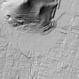
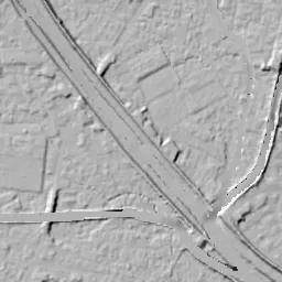
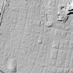
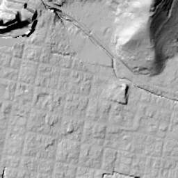
Note: the terrain shading is based on current surveys, not on the terrain at the time of the photograph. Hillshade map: processed from GSI Tiles
Note: the map is today's, not a map from the time of the photograph. Map: © OpenStreetMap contributors
Source: processed from GSI Tiles (aerial photographs by era / aerial photographs by fiscal year / latest nationwide photographs / single photographs / survey periods of the photographs)
Explore this area on the mapMove the map to compare the surroundings then and now as well.
Overlay and compare the 1961-1969 aerial photograph and today's photograph of the Kofu Station North Exit area, Yamanashi Prefecture. All photographs are published by the Geospatial Information Authority of Japan (GSI).
Eras of photographs for this location
For the Kofu Station North Exit area, aerial photographs from the following eras can be compared.
The old photographs of this location cover 3 eras from 1961-1969 to FY2007; as of 2026, the newest photograph, FY2007, is 18-19 years ago.There are no photographs of this location from after that until today. The differences between eras are summarized in the guide to aerial photograph eras.
Coverage for each era differs by region. Only the eras that actually have photographs of this location are listed here.
Elevation of this location
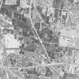
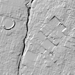
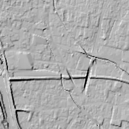
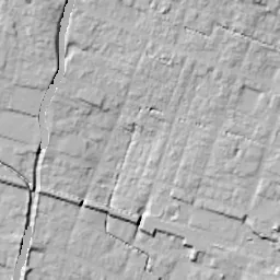
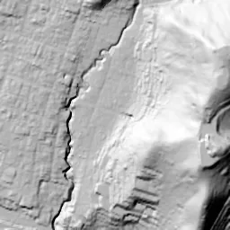
The elevation (above sea level) near Kofu Station is 276.1 m (source: GSI elevation API). Elevation profiles running east-west and north-south through this location are also shown.
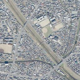
Profile positions (vertical green line = north-south / horizontal blue line = east-west)
Elevation is the value at the ground surface (even where a station is underground or elevated, the value is for the ground surface). Elevation is only one factor in disaster preparedness. Check actual risks such as flooding on the Hazard Map Portal Site and the hazard maps published by local governments.
Elevation tiles for the profiles: processed from GSI Tiles
Access by rail
Kofu Station is served by the following lines.
- JR Central Minobu Line
- JR East Chuo Line
Source of line information: processed from National Land Numerical Information (Railway Data / Ministry of Land, Infrastructure, Transport and Tourism).
Change seen in the share of built-up area
This compares land use in 1976 and 2021. The share of built-up area within 500 m changed from 100% to 91%. Among the locations on this site, the spread of built-up area here is among the smallest (bottom 20%). The bar below shows where this location falls in the distribution across the locations on this site.
Source: processed from National Land Numerical Information (Land Use Subdivision Mesh / 1976 and 2021 / Ministry of Land, Infrastructure, Transport and Tourism). The texture value (amount of fine detail) of the photographs changed from 13.7 to 36.9. This is a mechanical comparison between photographs and includes differences from the shooting season and from black and white versus color, so treat it only as a rough guide.
Official land prices over time
The official land price (Chika Koji) standard site nearest to this location is "3-415 Takeda, Kofu, Yamanashi Prefecture" (about 1.1 km in a straight line; use: Residential). The official prices per square meter at this standard site from 2004 to 2026 are shown below. The 2026 official price is 61,000 yen.
View as a table
| Year | Official price |
|---|---|
| 2004 | 83,900 yen |
| 2005 | 76,100 yen |
| 2006 | 70,500 yen |
| 2007 | 68,800 yen |
| 2008 | 67,900 yen |
| 2009 | 67,500 yen |
| 2010 | 66,700 yen |
| 2011 | 65,500 yen |
| 2012 | 64,400 yen |
| 2013 | 63,000 yen |
| 2014 | 62,000 yen |
| 2015 | 61,300 yen |
| 2016 | 61,100 yen |
| 2017 | 61,100 yen |
| 2018 | 61,100 yen |
| 2019 | 61,100 yen |
| 2020 | 61,100 yen |
| 2022 | 61,100 yen |
| 2024 | 61,000 yen |
| 2026 | 61,000 yen |
Source: processed from National Land Numerical Information (Land Price Publication Data / Ministry of Land, Infrastructure, Transport and Tourism). Official land prices are values published for standard sites as of January 1 each year and do not show the transaction price of any particular piece of land. The selection and location of standard sites may be reviewed from year to year.
Nearby locations
Sorted by distance from Kofu Station North Exit. Comparing them together shows how the same area has changed over time.
Select a marker on the map to see the location name and a link to it.
Locations with the same origins
Towns in the same category as Kofu Station North Exit (Redevelopment), chosen from other regions. You can compare what they share in land use and town layout.
Select a marker on the map to see the location name and a link to it.
Recently viewed towns
This history is saved only on your device and is not sent to any server. Depending on your browser settings, it may be deleted automatically if you do not visit for a while (it is less likely to be deleted if you use the site as an app).
Why not look at how another town has changed?
History of Kofu Station North Exit
The center of the castle town spreads south of the tracks, and the site of Kofu Castle also adjoins the station on its southeast. For a long time the north exit of Kofu Station was on the back side of the station. On the north side the railway grounds lay long and narrow from east to west, and beyond them rows of houses, schools and fields continued. If you line up the aerial photographs of two eras, 1961-69 and 1974-78, with today's photograph, you can see that while the grid of the surrounding streets hardly moves, only the contents of the band touching the north of the station are replaced. The bundle of tracks grows thin, and plazas and public buildings line up on the freed ground. This is the process by which a second gateway to the prefectural capital was made on the other side of the station.
Tracks that grazed the north of the castle
The railway linking Kofu and Tokyo came through only after a long tunnel through the mountains was ready. According to the City of Kofu's explanation, the Sasago Tunnel opened in July 1902, and the following year the Chuo Line was extended to Kofu Station. The journey that had taken three to four days along the Koshu Kaido shrank to about six hours. In 1911 the line from Kofu Station west to Kobuchizawa Station opened, and Kofu changed from a station where the tracks ended to a station along the way. The station was placed just north of the castle site, and the tracks ended up running east to west along the northern edge of the castle town. The orientation of the station, with the castle town side as its front and beyond the tracks as its back, was born this way.
The station grounds in two eras
In the default photograph, 1961-69, the railway crosses the frame straight from left to right. Just west of the north exit the tracks split into many lines, forming station grounds swollen into a spindle shape. Along their northern edge small roofs line up eave to eave, and the boundary between the grounds and the town looks as if it is divided by a single line. Toward the southeast of the station there is a rise edged by black curves. These are the remains of the stone walls and moat of the castle site. From the south of the station a wide, straight street extends toward the bottom edge, and the grid of streets on the castle town side is aligned with that street as its axis.
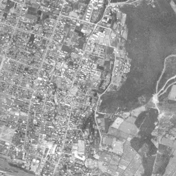
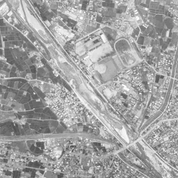
If you move your eye to the upper half of the frame, the north of the station becomes clear. The area at the upper right and along the top edge is fields where small black and white squares line up like a checkerboard, with white open spaces that look like schoolyards breaking through here and there. Several white square open spaces can be counted in the upper half alone, each accompanied by a building with a large roof, placed here and there at the boundary between the fields and the rows of houses. At the upper left two oval stadiums stand side by side, and at the right edge a dark mountain covered with forest runs north to south. Below the stadiums, toward the left edge, there is a section where long, narrow white roofs line up in many parallel rows, and among the fields only that section is as orderly as if lines had been drawn. From the lower left a river showing streaks of white sand flows in diagonally. The rows of houses are packed around the station and on the south side, and the farther north you go, the more the pattern of fields wins out.
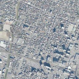
The change in density over the same range becomes clear in the 1974-78 photograph. Most of the field lots that spread at the top and upper right have been replaced by roofs, and green squares remain only here and there. The stadiums at the upper left show red-brown running tracks, with the dark green foot of the mountain pressing in behind them. White, tall buildings line both sides of the street south of the station. Along the tracks away to the west of the station, several large white square roofs have also appeared in a cluster. Even so, the bundle of tracks in the grounds keeps almost the same width as in 1961-69, and the spindle-shaped swelling west of the north exit can be read clearly. At the lower left a wide road runs in a curve along the river and merges with another road. The town spread north, but the width of the station grounds did not move. The photograph of this era shows that contrast best.
Public buildings lined up on the former site
The band of the station grounds was worked on after the eras of the photographs. The City of Kofu began the Kofu Station Area Land Readjustment Project in fiscal 1991. The project area is 21.9 hectares; the city treated this area as large vacant land such as former railway sites, and used it to reorganize roads and building lots. It is a project that redrew the long, narrow land left vacant beside the tracks into a form usable as lots of the town. In March 2004 the Kofu City Civic Core District Development Plan, which places national government facilities and private buildings together as one, received the national government's consent.
The north exit took shape from 2007 to 2013. In March 2007 Kofu City Historical Park, which restored the Yamate Gate and the Yamate Watari Yagura Gate of Kofu Castle, was completed. In July 2010 the north exit station plaza was completed, and in the same month the building of the Fujimura Memorial Museum was also finished. This museum is the school building of the former Mutsuzawa School, an Important Cultural Property of the nation, moved from the grounds of Takeda Shrine to the north exit of the station, and it opened in October. In December Yocchabare Plaza was completed, forming one space with the station plaza. In 2012 the Yamanashi Prefectural Library moved into a new building at the north exit of Kofu Station, and in March 2013 Koshu Yumekoji, by a private operator, opened. A castle gate, a Meiji-era school building and the prefectural library: the north exit is marked by buildings of different character gathered in one area.
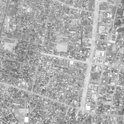
In today's photograph the tracks in the grounds are no more than a thin bundle with fewer lines. On their north side a wide paved surface and buildings with large roofs appear together. Their position almost overlaps the northern half of the grounds that had been swollen into a spindle shape up to 1974-78. If you compare the two eras, the overlap of the outlines shows that the ground freed by trimming the width of the tracks was handed over just as it was to the town side. Tall buildings have increased on both sides of the station, and the arrangement in which only the south was the center of the city area has broken down. Not one of the fields at the top and upper right remains, and wherever you look in the frame the rows of houses continue. Among those rows of houses, several pairs of a white schoolyard and a large roof can be counted in the upper half alone, and many of the open spaces that were placed here and there at the edges of the fields in 1961-69 remain in the same positions. In the middle of the upper half a thin green line runs down from north to south and blends into the rows of houses just before the tracks. The green of the mountain at the right edge and the stadiums at the upper left, whose outlines are almost the same as in 1961-69, do not change. The curve of the stone walls of the castle site also remains southeast of the station, facing the restored gate at the north exit across the tracks.
Land prices in the residential area that spread north of the station can be traced at Takeda 3-chome, about 1,060 m from the station. The value per square meter, up to the 2026 official land prices (Chika Koji), was highest at 83,900 yen in 2004 and lowest at 61,000 yen in 2024 and 2026.