Okaya (Silk-Reeling Town) about 60 years ago and today
Then and now
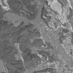
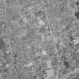
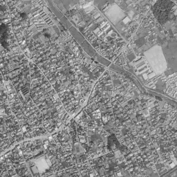
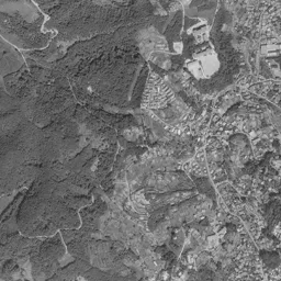
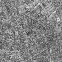
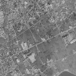
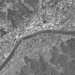
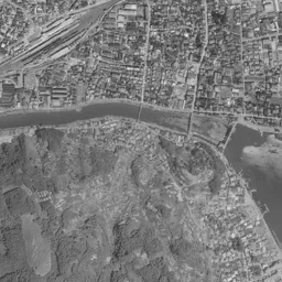
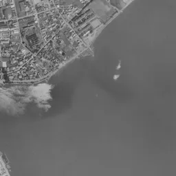
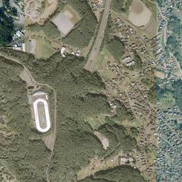
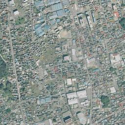
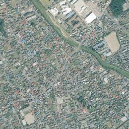
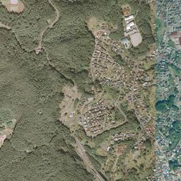
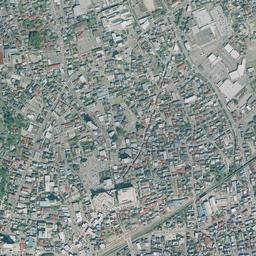
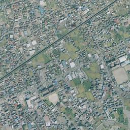
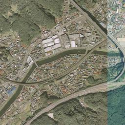
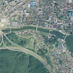
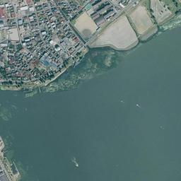
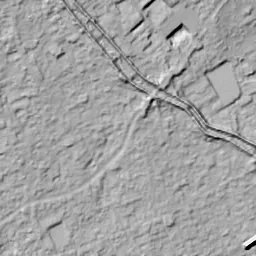


Center photograph taken: 1962-69
What to compare in this era: In a corner toward the upper right from the center of the frame, there are factories with long, narrow roofs lined up in parallel. The same place becomes a flat white roof and a parking lot in today's photograph
Controls: drag to move / right-drag to rotate and tilt / scroll while holding ⌘ or Ctrl to zoomControls: slide with two fingers to move / pinch to zoom / drag two fingers up or down to tilt
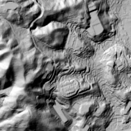
Note: the 3D elevation data is based on current surveys, not on the terrain at the time of the photograph. Elevation tiles: processed from GSI Tiles
The 3D view could not be loaded. Check your connection and try again.
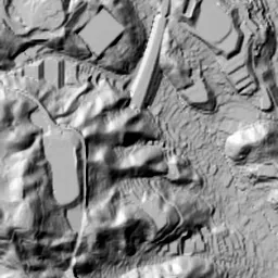
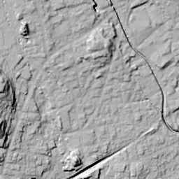
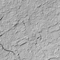
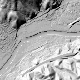
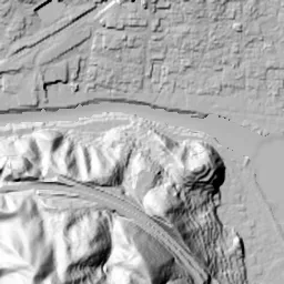
Note: the terrain shading is based on current surveys, not on the terrain at the time of the photograph. Hillshade map: processed from GSI Tiles
Note: the map is today's, not a map from the time of the photograph. Map: © OpenStreetMap contributors
Source: processed from GSI Tiles (aerial photographs by era / latest nationwide photographs / single photographs)
Explore this area on the mapMove the map to compare the surroundings then and now as well.
Overlay and compare the 1961-1969 aerial photograph and today's photograph of the Okaya (Silk-Reeling Town) area, Nagano Prefecture. All photographs are published by the Geospatial Information Authority of Japan (GSI).
Eras of photographs for this location
For the Okaya (Silk-Reeling Town) area, aerial photographs from the following eras can be compared.
The old photographs of this location cover 2 eras from 1961-1969 to 1974-1978; as of 2026, the newest photograph, 1974-1978, is 51 years ago.There are no photographs of this location from after that until today. The differences between eras are summarized in the guide to aerial photograph eras.
Coverage for each era differs by region. Only the eras that actually have photographs of this location are listed here.
Elevation of this location
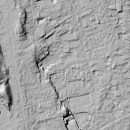
The elevation (above sea level) at the reference point of Okaya (Silk-Reeling Town) is 776.3 m (source: GSI elevation API). Elevation profiles running east-west and north-south through this location are also shown.
Profile positions (vertical green line = north-south / horizontal blue line = east-west)
Elevation is the value at the ground surface (even where a station is underground or elevated, the value is for the ground surface). Elevation is only one factor in disaster preparedness. Check actual risks such as flooding on the Hazard Map Portal Site and the hazard maps published by local governments.
Elevation tiles for the profiles: processed from GSI Tiles
Access by rail
One of the nearest stations to Okaya (Silk-Reeling Town) is Okaya Station, served by the following lines.
- JR East Chuo Line
Source of line information: processed from National Land Numerical Information (Railway Data / Ministry of Land, Infrastructure, Transport and Tourism).
Change seen in the share of built-up area
This compares land use in 1976 and 2021. The share of built-up area within 500 m changed from 100% to 94%. Among the locations on this site, the spread of built-up area here is among the smallest (bottom 20%). The bar below shows where this location falls in the distribution across the locations on this site.
Source: processed from National Land Numerical Information (Land Use Subdivision Mesh / 1976 and 2021 / Ministry of Land, Infrastructure, Transport and Tourism). The texture value (amount of fine detail) of the photographs changed from 15.3 to 33.2. This is a mechanical comparison between photographs and includes differences from the shooting season and from black and white versus color, so treat it only as a rough guide.
Official land prices over time
The official land price (Chika Koji) standard site nearest to this location is "3-5289-1 Tenryu-cho, Okaya, Nagano Prefecture" (about 602 m in a straight line; use: Residential). The official prices per square meter at this standard site from 1998 to 2026 are shown below. The 2026 official price is 39,900 yen.
View as a table
| Year | Official price |
|---|---|
| 1998 | 96,000 yen |
| 1999 | 93,900 yen |
| 2000 | 91,500 yen |
| 2001 | 89,200 yen |
| 2002 | 85,200 yen |
| 2003 | 80,000 yen |
| 2004 | 75,200 yen |
| 2005 | 70,800 yen |
| 2006 | 67,000 yen |
| 2007 | 63,700 yen |
| 2008 | 61,700 yen |
| 2009 | 59,200 yen |
| 2010 | 56,500 yen |
| 2011 | 53,800 yen |
| 2012 | 51,200 yen |
| 2013 | 49,200 yen |
| 2014 | 47,800 yen |
| 2015 | 46,800 yen |
| 2016 | 45,800 yen |
| 2017 | 45,000 yen |
| 2018 | 44,400 yen |
| 2019 | 43,800 yen |
| 2020 | 43,000 yen |
| 2021 | 42,100 yen |
| 2022 | 41,300 yen |
| 2023 | 40,900 yen |
| 2024 | 40,500 yen |
| 2025 | 40,100 yen |
| 2026 | 39,900 yen |
Source: processed from National Land Numerical Information (Land Price Publication Data / Ministry of Land, Infrastructure, Transport and Tourism). Official land prices are values published for standard sites as of January 1 each year and do not show the transaction price of any particular piece of land. The selection and location of standard sites may be reviewed from year to year.
Nearby locations
Sorted by distance from Okaya. Comparing them together shows how the same area has changed over time.
Select a marker on the map to see the location name and a link to it.
Locations with the same origins
Towns in the same category as Okaya (Former factory site), chosen from other regions. You can compare what they share in land use and town layout.
Select a marker on the map to see the location name and a link to it.
Recently viewed towns
This history is saved only on your device and is not sent to any server. Depending on your browser settings, it may be deleted automatically if you do not visit for a while (it is less likely to be deleted if you use the site as an app).
Why not look at how another town has changed?
History of Okaya (Silk-Reeling Town)
On the northwest shore of Lake Suwa, just north of the mouth where the Tenryu River flows out of the lake, the town of Okaya is packed in. On the small flat land surrounded by mountains to the west and north and bounded by the lake and the river to the south, roofs line up without gaps. From the Meiji era to the late 1920s and early 1930s, this town supported the country's exports with the production of raw silk. There are aerial photographs from only two eras, 1961-69 and 1974-78, but if you line up three points in time together with today's photograph, you can read the long-lasting factory roofs northeast of the station and the flow by which their site was replaced by something else.
A town packed onto the north shore of the lake
The lower right of the frame is all Lake Suwa, and from its left edge the Tenryu River flows out thinly and heads west along the bottom edge of the frame. On the north bank of the river a bundle of tracks runs diagonally, and that is the yard of Okaya Station. From the station the townscape spreads north, and the center of the frame is filled with roofs in every era. The left third is mountain slope, covered with the dark shadows of trees, with a few houses and fields entering along the valleys. In the 1961-69 photograph, thin lines of terraces that seem to trace the contour lines overlap on the slope at the upper left, showing that land was cultivated right up to the foot of the mountains. Toward the top on the right another river descends diagonally, and the line of its embankment can be seen clearly. The flat land is limited to a narrow triangle between the lake and the mountains, and the town, the factories and the fields all fit inside it.
According to materials from the City of Okaya, before the Meiji era this land was centered on farming, but because the farmland was small and the winters cold, it was hard to live by farming alone. When trade with other countries began at the end of the Edo period, raw silk became the leading item of Japan's exports, and in the Meiji era many silk reelers appeared here. The Suwa-style reeling machine, improved step by step from imported Western machines, was developed, efforts to make quality uniform also advanced, and Okaya became a major production center. The city writes that when the production of Japan's export raw silk surpassed China's in 1909 and became the largest in the world, it was Okaya that supported it.
Factory roofs in two eras
A corner toward the upper right from the center of the frame catches the eye in the 1961-69 photograph. A group of buildings with many long, narrow roofs lined up in parallel fills the lots with a regularity different from the small rows of houses around it. Just north of it there is also a corner where white rectangular roofs continue with their direction aligned. Along the river in the lower left, long, narrow buildings line up in the same way, showing that factory buildings were placed in groups here and there in the town. In the right half, fields are still wide, and buildings are scattered here and there among surfaces of finely divided lots. Near the lakeshore, east of the mouth where the river flows out, an irregular surface of cloudy white floats on the water.
The parallel roofs of the same corner stand out even more brightly in 1974-78. The number and direction of the roofs are almost unchanged from the previous era, showing that the factory buildings still remained in the same form at this point. The change is in the surroundings: reddish-brown roofs have increased among the fields in the right half, and the rows of houses have become denser toward the right of the frame. On the mountain slope at the upper left, bright surfaces where trees have been cleared have appeared. The station yard keeps the width of its bundle of tracks, and the lake water appears greenish. The line of the lakeshore traces almost the same position as in the previous era, and rows of houses and factory roofs press right up to the water's edge. On the slope on the south bank of the river too, house roofs are climbing little by little among the green of the trees.
From 1961-69 to 1974-78, the center of the town hardly moves, and the factory roofs remain too. In this period, silk reeling was no longer what was changing Okaya. According to the city, during the war the silk mills switched to military production, and after the war, with the decline of silk textiles, the city moved toward being an industrial city of precision machinery. You cannot read from the photographs what was made in the buildings with parallel roofs, but the shape of the long, narrow factories itself remained in the town for some time even after the town's main industry had been replaced.
From a town of thread to a town of machines
The height of silk reeling did not last long. With the Great Depression of 1929 as the trigger, many silk mills were forced to suspend work or go bankrupt. Hirano Village at the time had greatly increased its population thanks to the women working in silk reeling, but with the Depression the population fell sharply. To break through the deadlock and start again as a diversified industrial city, the village skipped becoming a town and adopted city status on April 1, 1936, becoming the City of Okaya. The city hall building built at that time with donations from silk reelers has been preserved as the old city hall.
Places that pass on the memory of silk reeling were also prepared. In October 1964 the municipal Okaya Silk Museum opened, and in August 2014 it moved to the place where a sericulture testing station had been, becoming a museum with a silk mill attached inside. A large number of reeling machines used since the early Meiji era have been collected, and visitors can see the work of reeling thread just as it is. Even after the town's industry moved to machines, its history as a town of thread has been handed down in the form of buildings and machines.
In the corner where parallel roofs lined up in 1961-69 and 1974-78, a large flat white roof and a wide parking lot spread in today's photograph. The long, narrow rows of roofs have disappeared, and only the outline of the lot remains, surrounded by the streets around it. The station's bundle of tracks has narrowed, and in the lower left of the frame an expressway branches off in a large loop, crossing the river and the mountain slope. In the forest at the upper left an elliptical running track has appeared, and on the lakeshore at the lower right several square plazas line up. Most of the fields that were in the right half have been replaced by houses. Even so, the area around the center of the frame remains a gathering of fine roofs through the three points in time, and the way the alleys bend and the direction of the streets cutting through diagonally have not changed much either. Only land gathered into one piece, like the factory site, changed its appearance at once, while the old townscape divided into small lots has kept the same shape while rebuilding its buildings little by little.
If you look at the official land price (Chika Koji) per square meter at the residential standard site in Tenryu-cho 3-chome, up to the 2026 publication the highest is 96,000 yen in 1998 and the lowest is 39,900 yen in 2026. The City of Okaya's hazard map shows how high the water of the lake and the river is expected to rise in heavy rain.