Tsuruga (Port Town and Station) about 60 years ago and today
Then and now
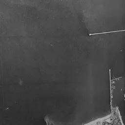
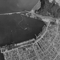
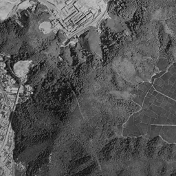
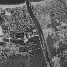
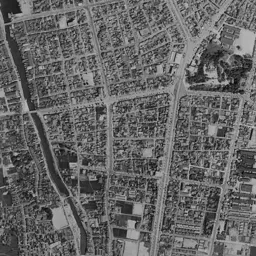
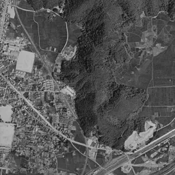
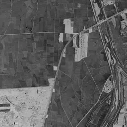
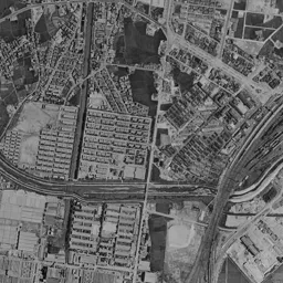
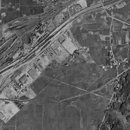
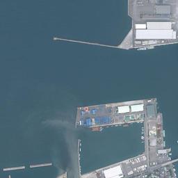
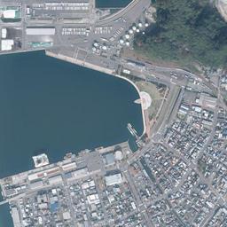
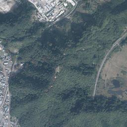
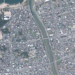
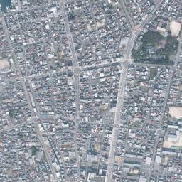
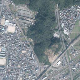
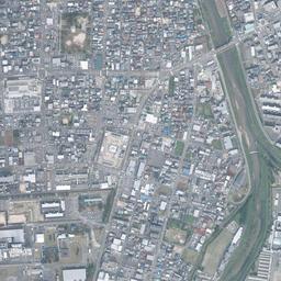
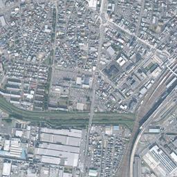
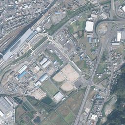
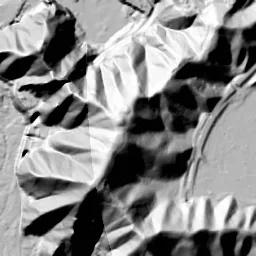


Center photograph taken: 1963-68
What to compare in this era: In the upper left of the frame, a single thin landing pier stands, jutting from the shore out to sea. In 1974-78, a rectangular pier carrying a white warehouse juts out in the same place
Controls: drag to move / right-drag to rotate and tilt / scroll while holding ⌘ or Ctrl to zoomControls: slide with two fingers to move / pinch to zoom / drag two fingers up or down to tilt
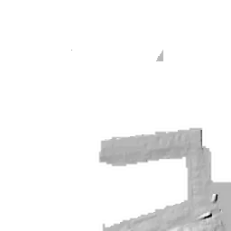
Note: the 3D elevation data is based on current surveys, not on the terrain at the time of the photograph. Elevation tiles: processed from GSI Tiles
The 3D view could not be loaded. Check your connection and try again.
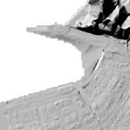
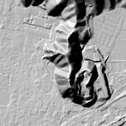
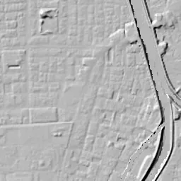
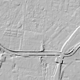
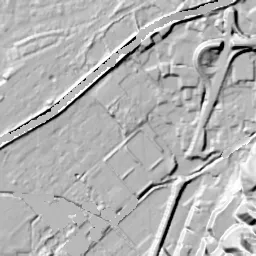
Note: the terrain shading is based on current surveys, not on the terrain at the time of the photograph. Hillshade map: processed from GSI Tiles
Note: the map is today's, not a map from the time of the photograph. Map: © OpenStreetMap contributors
Source: processed from GSI Tiles (aerial photographs by era / latest nationwide photographs / single photographs)
Explore this area on the mapMove the map to compare the surroundings then and now as well.
Overlay and compare the 1961-1969 aerial photograph and today's photograph of the Tsuruga (Port Town and Station) area, Fukui Prefecture. All photographs are published by the Geospatial Information Authority of Japan (GSI).
Eras of photographs for this location
For the Tsuruga (Port Town and Station) area, aerial photographs from the following eras can be compared.
The old photographs of this location cover 2 eras from 1961-1969 to 1974-1978; as of 2026, the newest photograph, 1974-1978, is 51 years ago.There are no photographs of this location from after that until today. The differences between eras are summarized in the guide to aerial photograph eras.
Coverage for each era differs by region. Only the eras that actually have photographs of this location are listed here.
Elevation of this location
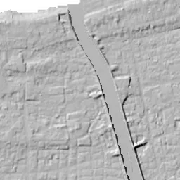
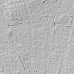
The elevation (above sea level) at the reference point of Tsuruga (Port Town and Station) is 2.2 m (source: GSI elevation API). Elevation profiles running east-west and north-south through this location are also shown.
Profile positions (vertical green line = north-south / horizontal blue line = east-west)
Where the line in a profile breaks off and leaves a gap, no elevation data is available (water surfaces such as the sea or rivers).
Elevation is the value at the ground surface (even where a station is underground or elevated, the value is for the ground surface). Elevation is only one factor in disaster preparedness. Check actual risks such as flooding on the Hazard Map Portal Site and the hazard maps published by local governments.
Elevation tiles for the profiles: processed from GSI Tiles
Access by rail
One of the nearest stations to Tsuruga (Port Town and Station) is Tsuruga Station, served by the following lines.
- JR West Obama Line
- JR West Hokuriku Line
- JR West Hokuriku Shinkansen
- Hapi-Line Fukui Line
Source of line information: processed from National Land Numerical Information (Railway Data / Ministry of Land, Infrastructure, Transport and Tourism).
Change seen in the share of built-up area
This compares land use in 1976 and 2021. The share of built-up area within 500 m changed from 96% to 93%. Among the locations on this site, the spread of built-up area here is among the smallest (bottom 20%). The bar below shows where this location falls in the distribution across the locations on this site.
Source: processed from National Land Numerical Information (Land Use Subdivision Mesh / 1976 and 2021 / Ministry of Land, Infrastructure, Transport and Tourism). The texture value (amount of fine detail) of the photographs changed from 17.6 to 33.3. This is a mechanical comparison between photographs and includes differences from the shooting season and from black and white versus color, so treat it only as a rough guide.
Official land prices over time
The official land price (Chika Koji) standard site nearest to this location is "2-11-8 Shimizu-cho, Tsuruga, Fukui Prefecture" (about 645 m in a straight line; use: Residential). The official prices per square meter at this standard site from 1983 to 2026 are shown below. The 2026 official price is 72,100 yen.
View as a table
| Year | Official price |
|---|---|
| 1983 | 100,000 yen |
| 1984 | 102,000 yen |
| 1985 | 103,000 yen |
| 1986 | 104,000 yen |
| 1987 | 105,000 yen |
| 1988 | 105,000 yen |
| 1989 | 105,000 yen |
| 1990 | 107,000 yen |
| 1991 | 109,000 yen |
| 1992 | 110,000 yen |
| 1993 | 108,000 yen |
| 1994 | 108,000 yen |
| 1995 | 108,000 yen |
| 1996 | 108,000 yen |
| 1997 | 108,000 yen |
| 1998 | 107,000 yen |
| 1999 | 104,000 yen |
| 2000 | 101,000 yen |
| 2001 | 98,000 yen |
| 2002 | 94,800 yen |
| 2003 | 90,300 yen |
| 2004 | 85,500 yen |
| 2005 | 80,000 yen |
| 2006 | 75,800 yen |
| 2007 | 73,700 yen |
| 2008 | 72,200 yen |
| 2009 | 70,200 yen |
| 2010 | 67,900 yen |
| 2011 | 66,300 yen |
| 2012 | 64,900 yen |
| 2013 | 63,400 yen |
| 2014 | 62,500 yen |
| 2015 | 62,300 yen |
| 2016 | 62,300 yen |
| 2017 | 62,300 yen |
| 2018 | 62,800 yen |
| 2019 | 63,500 yen |
| 2020 | 64,600 yen |
| 2021 | 65,200 yen |
| 2022 | 65,800 yen |
| 2023 | 66,800 yen |
| 2024 | 68,100 yen |
| 2025 | 70,100 yen |
| 2026 | 72,100 yen |
Source: processed from National Land Numerical Information (Land Price Publication Data / Ministry of Land, Infrastructure, Transport and Tourism). Official land prices are values published for standard sites as of January 1 each year and do not show the transaction price of any particular piece of land. The selection and location of standard sites may be reviewed from year to year.
Nearby locations
Sorted by distance from Tsuruga. Comparing them together shows how the same area has changed over time.
Select a marker on the map to see the location name and a link to it.
Locations with the same origins
Towns in the same category as Tsuruga (Redevelopment), chosen from other regions. You can compare what they share in land use and town layout.
Select a marker on the map to see the location name and a link to it.
Recently viewed towns
This history is saved only on your device and is not sent to any server. Depending on your browser settings, it may be deleted automatically if you do not visit for a while (it is less likely to be deleted if you use the site as an app).
Why not look at how another town has changed?
History of Tsuruga (Port Town and Station)
The town of Tsuruga spreads over flat land squeezed between the inner end of a bay opening to the north and the railway yard spreading to the southeast. The quays of the port appear at the top of the frame, the station and a bundle of tracks at the lower right, and fine rows of houses fill the space between them. If you switch between the eras, the shape of the bay shore and the form of the yard in the southeast move far more than the framework of the town.
From the capital of the northern provinces to a railway port
Since ancient times Tsuruga has gathered cargo as a harbor at the inner end of the bay. It stood at the entrance to the route that passes by way of Lake Biwa to the capital, and goods sent from Hokuriku and Tohoku to the Kyoto and Osaka region were landed here. According to materials of the City of Tsuruga, in the Edo period kitamaebune trading ships went back and forth to Ezo, and dozens of storehouses holding herring and kelp stood in a row along the sea. When Ihara Saikaku wrote of "the capital of the northern provinces", it was the bustle of this harbor he meant.
The railways of the Meiji era inherited that advantage of location. In 1882 the line between Tsuruga Station and Nagahama Station opened, and the first railway on the Sea of Japan side was linked with the route of the lake boats. When the Hokuriku Line was extended north, the main carrier of cargo shifted to the railway, and after a campaign by local business people and others, Tsuruga Port was designated an open port for foreign trade in 1899. In 1902 a regular route to Vladivostok opened, and in 1907 the port was designated a Class 1 Major Port alongside Yokohama, Kobe and Kanmon. Then in 1912 the Europe-Asia international connecting train began to run from Shimbashi to Kanegasaki Station, on which one could travel to Europe on a single ticket by changing to a ship and the Trans-Siberian Railway. Kanegasaki Station was renamed Tsuruga-ko Station in 1919. An oil company's warehouse completed in 1905 stood on the shore as a building for storing imported oil, and later came to be called the Red Brick Warehouse.
Polish orphans in 1920, and Jewish refugees who crossed from 1940 into the following year holding visas from Sugihara Chiune, also landed at Tsuruga Port by this route, and the city passes on that history as the Port of Humanity.
The port and the yard as two eras show them
The dark water surface of the bay takes up about the top third of the 1961-69 frame. From the foot of the mountain at the upper right, a thin breakwater extends a long way to the left, separating the bay from the open sea. In the upper left of the frame a single thin landing pier stands, jutting from the shore out to sea, and to the left of its base a white sandy beach draws an arc. On the shore in the middle of the top edge, long buildings that look like warehouses line up, and the line of the quays curves gently at the inner end of the bay and continues to the foot of the mountain at the upper right. The mountain is covered with dark woods, and in the upper right corner beyond it a factory corner where square buildings are grouped together can be seen.
The center of the frame is town area densely packed with fine grains of roofs. Toward the upper right of the town there is a forest that alone sinks black among the rows of houses. This is the shrine forest of Kehi Jingu Shrine, regarded as the chief guardian shrine of the Hokurikudo region, and whichever era you switch to, it remains in the same position with the same shape. On the left side of the town a thin waterway runs north-south toward the port, and further left a wide river with levees flows out to the sea.
In the lower right of the frame, a bundle of tracks opens like a fan, and a yard spreads with many lines lying in parallel. On the right of the yard there is a line drawing a large arc, and lots of rice paddies still lie outside it. In the lower center of the frame there is a factory site where long buildings with gabled roofs line up regularly, and in the lower left paddies and whitish prepared land remain. This yard lies at the feet of a station whose station building was burned in the Tsuruga air raid of 1945, and which recovered after the war with a reinforced concrete station building. In 1962, in the middle of this photograph's era, the Hokuriku Tunnel was completed and the line between Tsuruga Station and Fukui Station was electrified. This means that this many tracks lay side by side at a junction of a trunk line that had difficult mountain crossings on either side.
The shape of the port changes in 1974-78. In the position of the thin landing pier at the upper left, a rectangular pier juts out far into the water, carrying one warehouse with a large white roof. The breakwater keeps the same line as in the previous era. On the hill at the right edge of the frame the woods have been cleared, and the brown bare ground is widely exposed. The yard in the southeast keeps its number of lines, while part of the surrounding paddies has begun to be replaced by the roofs of housing and factories. New rows of houses also line up along the levees of the river on the left, and in the lower left of the frame green paddies still continue.
The reclaimed shore and the new station building
In today's photograph, the water surface at the top of the frame has decreased considerably. In the middle of the top edge, the place that in 1974-78 was the bay outside the breakwater (on the open-sea side) has been reclaimed and has become flat land where warehouses with white roofs line up. The breakwater of 1974-78 joins the edge of that reclaimed land, and colorful containers line up on the pier at the upper left. A semicircular plaza juts out on the shore at the inner end of the bay, and the line of the shore itself has been redrawn. The white sandy beach that was in the upper left corner remains only as a thin strip beside the river mouth. The depths of flooding assumed for the low land along the sea and for the reclaimed land are shown on the hazard map published by the City of Tsuruga.
The change on the station side is even larger. On March 16, 2024, the Hokuriku Shinkansen opened between Kanazawa Station and Tsuruga Station, and Tsuruga became the terminal station of the Shinkansen extended from Tokyo. In the position of the yard that opened like a fan, a station building with a long white roof lies parallel to the tracks, and on its east side a station plaza and parking lots have been laid out. Toward the right of the frame, a new straight line has appeared running north-south along the foot of the mountains. The bundle of tracks has become thinner, but its direction is the same as in the 1961-69 photograph.
In the town in the center, even compared with the two old eras, the framework of the streets has hardly moved. The forest of Kehi Jingu Shrine is in the same position, and the wide river on the left, edged with the green of its levees, also runs down to the sea along the same course. In the lower center of the frame, on the factory site where long buildings with gabled roofs lined up in 1961-69, rows of white, long roofs remain facing the same way. A harbor town, the terminus of an international train, a Shinkansen station: the gateway for cargo and people has moved from the bay shore to the yard in the southeast, but the grid of the town connecting both ends remains on the same lines.